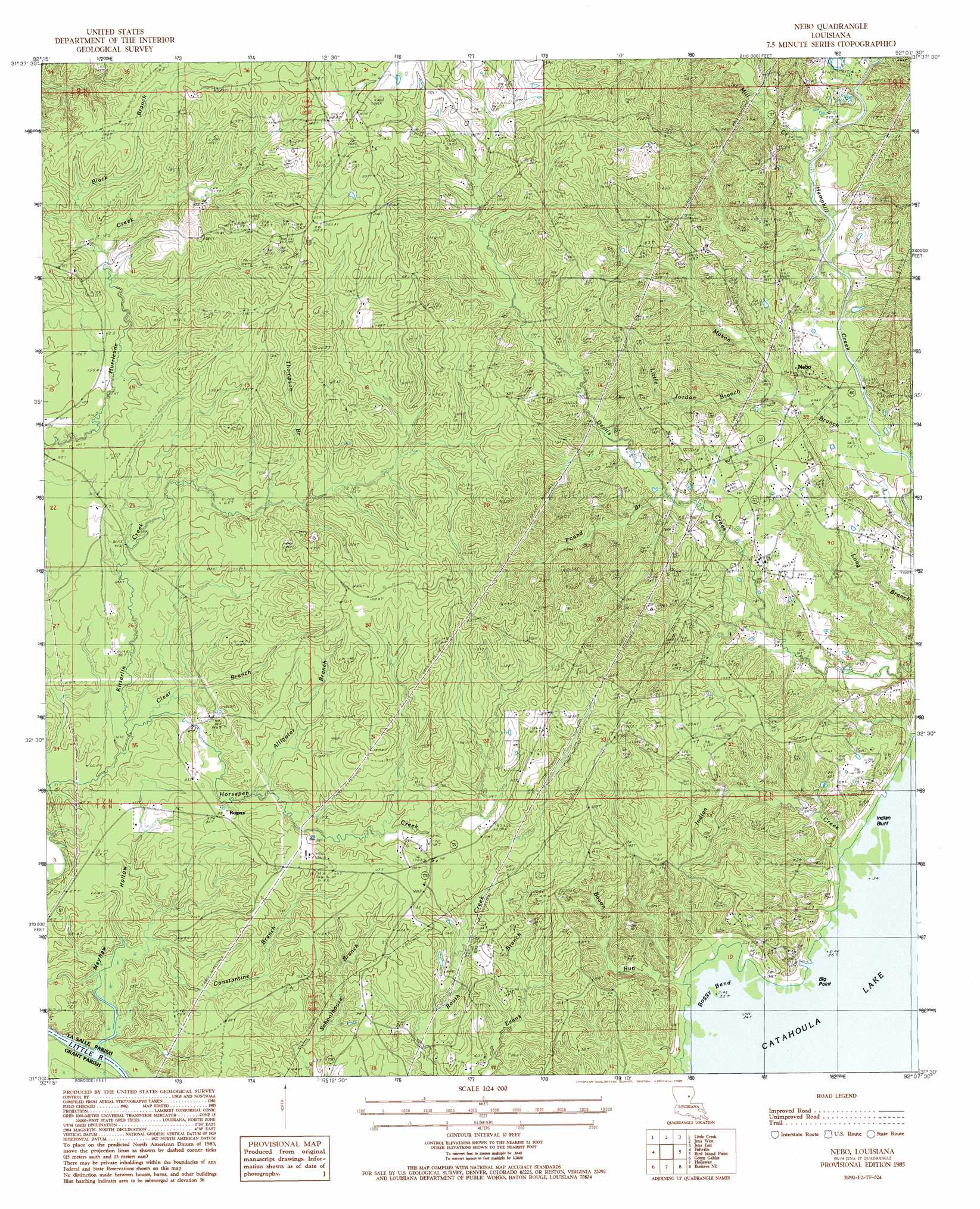
Nebo Topo Map Louisiana
To zoom in, hover over the map of Nebo
USGS Topo Quad 31092e2 - 1:24,000 scale
| Topo Map Name: | Nebo |
| USGS Topo Quad ID: | 31092e2 |
| Print Size: | ca. 21 1/4" wide x 27" high |
| Southeast Coordinates: | 31.5° N latitude / 92.125° W longitude |
| Map Center Coordinates: | 31.5625° N latitude / 92.1875° W longitude |
| U.S. State: | LA |
| Filename: | o31092e2.jpg |
| Download Map JPG Image: | Nebo topo map 1:24,000 scale |
| Map Type: | Topographic |
| Topo Series: | 7.5´ |
| Map Scale: | 1:24,000 |
| Source of Map Images: | United States Geological Survey (USGS) |
| Alternate Map Versions: |
Nebo LA 1985, updated 1985 Download PDF Buy paper map Nebo LA 2012 Download PDF Buy paper map Nebo LA 2015 Download PDF Buy paper map |
1:24,000 Topo Quads surrounding Nebo
Georgetown |
Tullas |
Summerville |
Nickel |
Aimwell |
Mudville |
Little Creek |
Jena West |
Jena East |
Manifest |
Pollock |
Fishville |
Nebo |
Bird Island Point |
Walters |
Ball |
Green Gables |
Holloway |
Buckeye Ne |
Larto Lake North |
Alexandria |
Libuse |
Buckeye |
Powell Point |
Larto Lake South |
> Back to 31092e1 at 1:100,000 scale
> Back to 31092a1 at 1:250,000 scale
> Back to U.S. Topo Maps home
Nebo topo map: Gazetteer
Nebo: Bends
Boggy Bend elevation 11m 36′Nebo: Capes
Big Point elevation 12m 39′Nebo: Cliffs
Indian Bluff elevation 11m 36′Nebo: Oilfields
Nebo-Hemphill Oil Field elevation 47m 154′Rogers Oil Field elevation 30m 98′
West Catahoula Lake Oil Field elevation 33m 108′
Nebo: Populated Places
Magnolia elevation 29m 95′Nebo elevation 31m 101′
Rogers elevation 27m 88′
Nebo: Streams
Alligator Branch elevation 21m 68′Bacon Run elevation 12m 39′
Black Branch elevation 33m 108′
Clear Branch elevation 17m 55′
Constantine Branch elevation 12m 39′
Horsepen Creek elevation 15m 49′
Indian Creek elevation 11m 36′
Little Jordan Branch elevation 18m 59′
Mason Branch elevation 15m 49′
Mill Creek elevation 21m 68′
Pound Branch elevation 24m 78′
Thompson Branch elevation 27m 88′
Whiskey Run elevation 11m 36′
Nebo: Valleys
Mayhew Hollow elevation 12m 39′Nebo digital topo map on disk
Buy this Nebo topo map showing relief, roads, GPS coordinates and other geographical features, as a high-resolution digital map file on DVD: