Jena East Topo Map Louisiana
To zoom in, hover over the map of Jena East
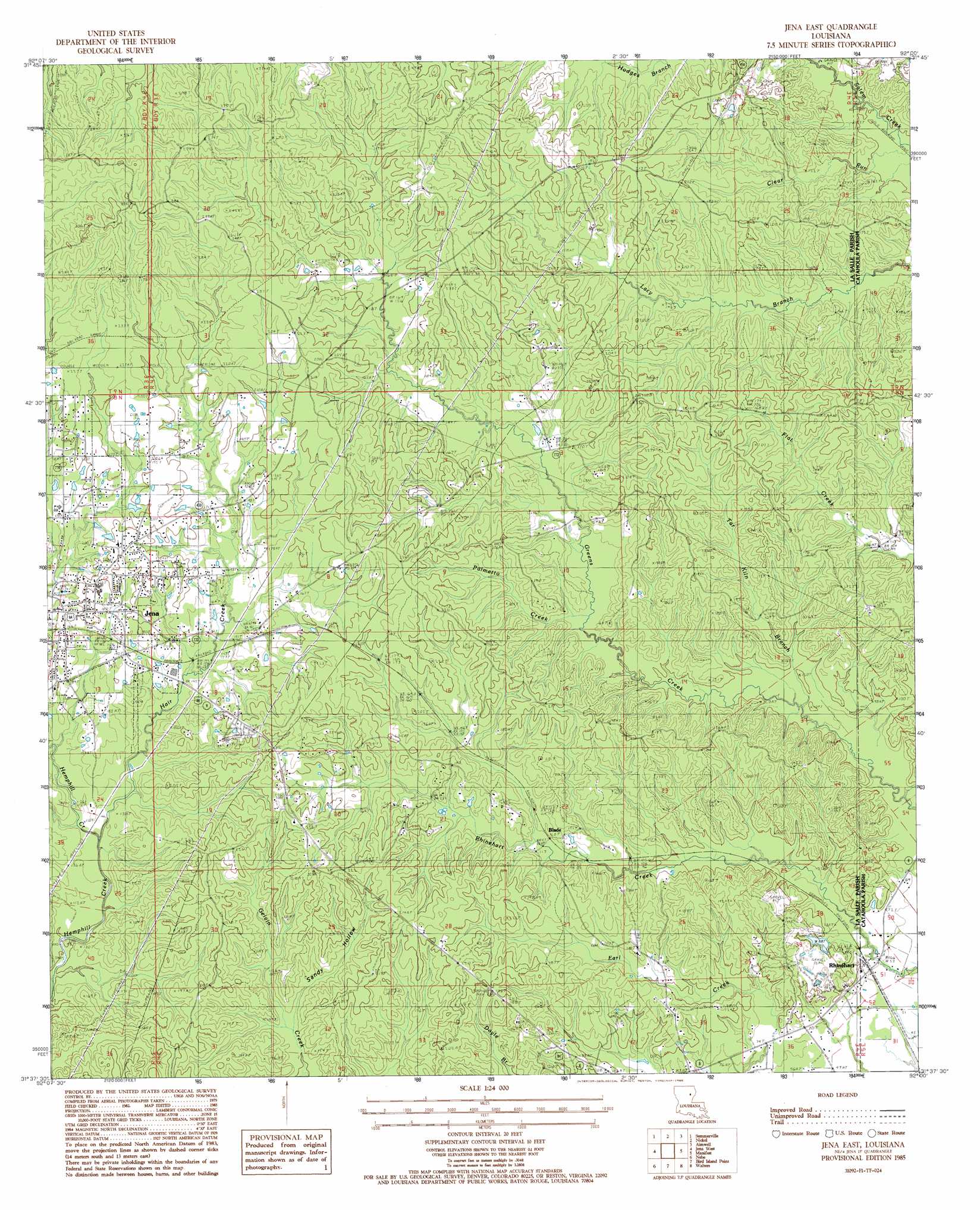
USGS Topo Quad 31092f1 - 1:24,000 scale
| Topo Map Name: | Jena East |
| USGS Topo Quad ID: | 31092f1 |
| Print Size: | ca. 21 1/4" wide x 27" high |
| Southeast Coordinates: | 31.625° N latitude / 92° W longitude |
| Map Center Coordinates: | 31.6875° N latitude / 92.0625° W longitude |
| U.S. State: | LA |
| Filename: | o31092f1.jpg |
| Download Map JPG Image: | Jena East topo map 1:24,000 scale |
| Map Type: | Topographic |
| Topo Series: | 7.5´ |
| Map Scale: | 1:24,000 |
| Source of Map Images: | United States Geological Survey (USGS) |
| Alternate Map Versions: |
Jena East LA 1985, updated 1985 Download PDF Buy paper map Jena East LA 2012 Download PDF Buy paper map Jena East LA 2015 Download PDF Buy paper map |
1:24,000 Topo Quads surrounding Jena East
Fords Creek |
Olla East |
Holum |
Enterprise |
Extension |
Tullas |
Summerville |
Nickel |
Aimwell |
Harrisonburg |
Little Creek |
Jena West |
Jena East |
Manifest |
Jonesville North |
Fishville |
Nebo |
Bird Island Point |
Walters |
Jonesville South |
Green Gables |
Holloway |
Buckeye Ne |
Larto Lake North |
Mayna |
> Back to 31092e1 at 1:100,000 scale
> Back to 31092a1 at 1:250,000 scale
> Back to U.S. Topo Maps home
Jena East topo map: Gazetteer
Jena East: Parks
Jena Town Park elevation 49m 160′Jena East: Populated Places
Blade elevation 37m 121′Cane elevation 42m 137′
Rhinehart elevation 18m 59′
Routon elevation 40m 131′
Jena East: Post Offices
Rhinehart Post Office elevation 24m 78′Jena East: Streams
Ezell Branch elevation 30m 98′Hair Creek elevation 30m 98′
Palmetto Creek elevation 33m 108′
Tar Kiln Branch elevation 24m 78′
Jena East: Valleys
Sandy Hollow elevation 40m 131′Jena East digital topo map on disk
Buy this Jena East topo map showing relief, roads, GPS coordinates and other geographical features, as a high-resolution digital map file on DVD: