Little Creek Topo Map Louisiana
To zoom in, hover over the map of Little Creek
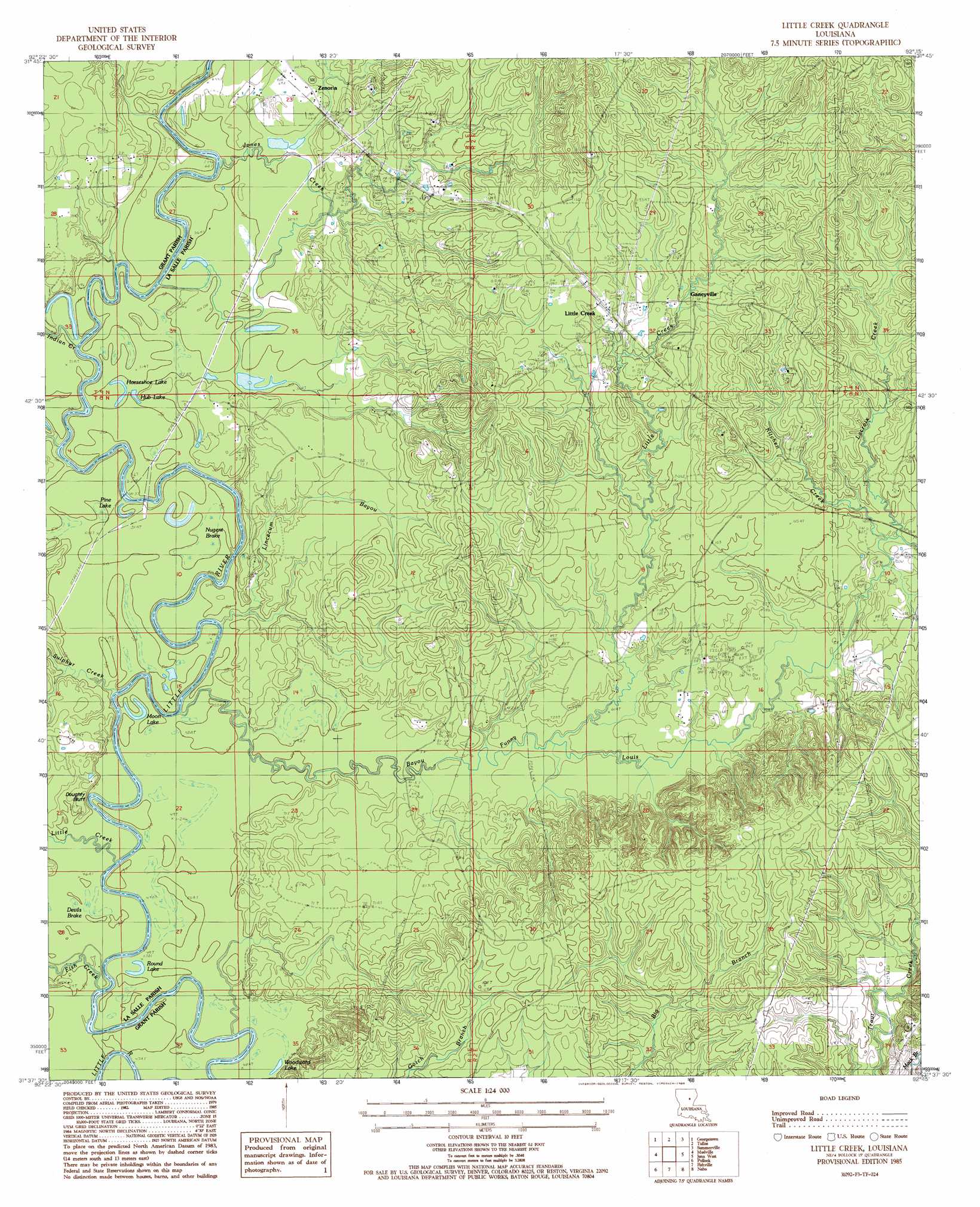
USGS Topo Quad 31092f3 - 1:24,000 scale
| Topo Map Name: | Little Creek |
| USGS Topo Quad ID: | 31092f3 |
| Print Size: | ca. 21 1/4" wide x 27" high |
| Southeast Coordinates: | 31.625° N latitude / 92.25° W longitude |
| Map Center Coordinates: | 31.6875° N latitude / 92.3125° W longitude |
| U.S. State: | LA |
| Filename: | o31092f3.jpg |
| Download Map JPG Image: | Little Creek topo map 1:24,000 scale |
| Map Type: | Topographic |
| Topo Series: | 7.5´ |
| Map Scale: | 1:24,000 |
| Source of Map Images: | United States Geological Survey (USGS) |
| Alternate Map Versions: |
Little Creek LA 1985, updated 1985 Download PDF Buy paper map Little Creek LA 2012 Download PDF Buy paper map Little Creek LA 2015 Download PDF Buy paper map |
1:24,000 Topo Quads surrounding Little Creek
Winnfield East |
Flat Creek |
Fords Creek |
Olla East |
Holum |
Packton |
Georgetown |
Tullas |
Summerville |
Nickel |
Williana |
Mudville |
Little Creek |
Jena West |
Jena East |
Dry Prong |
Pollock |
Fishville |
Nebo |
Bird Island Point |
Rock Hill |
Ball |
Green Gables |
Holloway |
Buckeye Ne |
> Back to 31092e1 at 1:100,000 scale
> Back to 31092a1 at 1:250,000 scale
> Back to U.S. Topo Maps home
Little Creek topo map: Gazetteer
Little Creek: Bends
Big Bend elevation 15m 49′Little Creek: Cliffs
Doughty Bluff elevation 12m 39′Little Creek: Crossings
Campbells Ferry (historical) elevation 11m 36′Rambeaus Ferry (historical) elevation 12m 39′
Little Creek: Lakes
Boston Fool River elevation 12m 39′Horseshoe Lake elevation 15m 49′
Hub Lake elevation 15m 49′
Moon Lake elevation 15m 49′
Pine Lake elevation 15m 49′
Round Lake elevation 14m 45′
Woodward Lake elevation 15m 49′
Little Creek: Oilfields
Little Bayou Oil Field elevation 23m 75′Little Creek Oil Field elevation 32m 104′
North Searcy Gas Field elevation 36m 118′
West Searcy Oil Field elevation 24m 78′
Little Creek: Populated Places
Ganeyville elevation 35m 114′Hester elevation 25m 82′
Little Creek elevation 37m 121′
Zenoria elevation 19m 62′
Little Creek: Streams
Bayou Funny Louis elevation 12m 39′Fish Creek elevation 12m 39′
Indian Creek elevation 12m 39′
Jones Creek elevation 11m 36′
Kitchen Creek elevation 24m 78′
Lacroix Creek elevation 24m 78′
Lincecum Bayou elevation 12m 39′
Little Creek elevation 12m 39′
Little Creek elevation 18m 59′
Sulphur Creek elevation 13m 42′
Little Creek: Swamps
Nugent Brake elevation 15m 49′Little Creek digital topo map on disk
Buy this Little Creek topo map showing relief, roads, GPS coordinates and other geographical features, as a high-resolution digital map file on DVD: