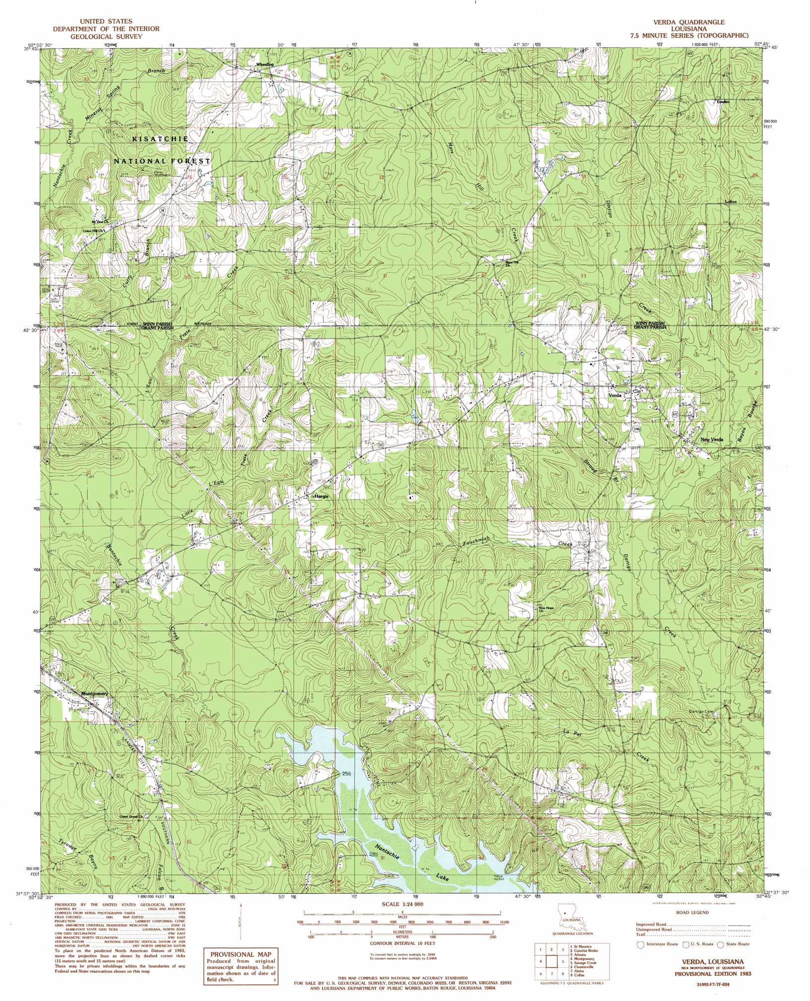
Verda Topo Map Louisiana
To zoom in, hover over the map of Verda
USGS Topo Quad 31092f7 - 1:24,000 scale
| Topo Map Name: | Verda |
| USGS Topo Quad ID: | 31092f7 |
| Print Size: | ca. 21 1/4" wide x 27" high |
| Southeast Coordinates: | 31.625° N latitude / 92.75° W longitude |
| Map Center Coordinates: | 31.6875° N latitude / 92.8125° W longitude |
| U.S. State: | LA |
| Filename: | o31092f7.jpg |
| Download Map JPG Image: | Verda topo map 1:24,000 scale |
| Map Type: | Topographic |
| Topo Series: | 7.5´ |
| Map Scale: | 1:24,000 |
| Source of Map Images: | United States Geological Survey (USGS) |
| Alternate Map Versions: |
Verda LA 1983, updated 1984 Download PDF Buy paper map Verda LA 2012 Download PDF Buy paper map Verda LA 2015 Download PDF Buy paper map |
| FStopo: | US Forest Service topo Verda is available: Download FStopo PDF Download FStopo TIF |
1:24,000 Topo Quads surrounding Verda
Campti |
Coup Point |
Calvin |
Winnfield West |
Winnfield East |
Natchitoches North |
Saint Maurice |
Coochie Brake |
Atlanta |
Packton |
Flora |
Montgomery |
Verda |
Savage Creek |
Williana |
Natchitoches South |
Cloutierville |
Aloha |
Colfax |
Dry Prong |
Bayou Livrogne |
Gorum |
Lena |
Boyce |
Rock Hill |
> Back to 31092e1 at 1:100,000 scale
> Back to 31092a1 at 1:250,000 scale
> Back to U.S. Topo Maps home
Verda topo map: Gazetteer
Verda: Dams
Louisiana Noname 84 Dam elevation 60m 196′Verda: Lakes
Nantachie Lake elevation 29m 95′Verda: Populated Places
Emden elevation 73m 239′Hargis elevation 66m 216′
Lofton elevation 71m 232′
Mars Hill elevation 60m 196′
Mount Zion elevation 68m 223′
New Verda elevation 49m 160′
Verda elevation 63m 206′
Wetzlar elevation 47m 154′
Wheeling elevation 72m 236′
Verda: Post Offices
Verda Post Office elevation 64m 209′Verda: Streams
Bayou Bourbe elevation 43m 141′Curry Branch elevation 32m 104′
Fouchmiah Creek elevation 38m 124′
L'Eau Frete Creek elevation 32m 104′
Little L'Eau Frete Creek elevation 34m 111′
Mars Hill Creek elevation 48m 157′
Mineral Spring Branch elevation 42m 137′
Stroud Branch elevation 39m 127′
Verda digital topo map on disk
Buy this Verda topo map showing relief, roads, GPS coordinates and other geographical features, as a high-resolution digital map file on DVD: