Summerville Topo Map Louisiana
To zoom in, hover over the map of Summerville
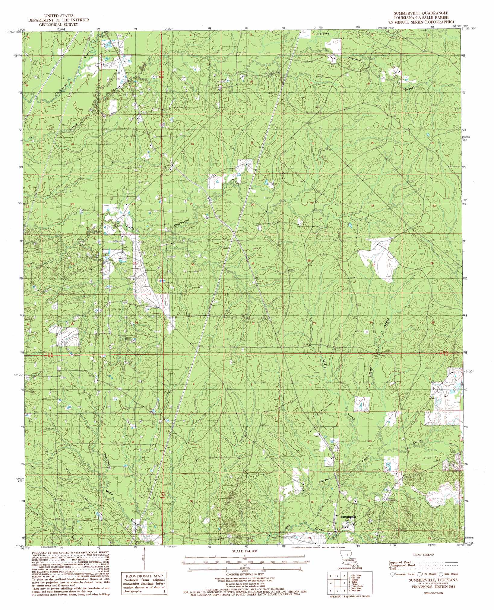
USGS Topo Quad 31092g2 - 1:24,000 scale
| Topo Map Name: | Summerville |
| USGS Topo Quad ID: | 31092g2 |
| Print Size: | ca. 21 1/4" wide x 27" high |
| Southeast Coordinates: | 31.75° N latitude / 92.125° W longitude |
| Map Center Coordinates: | 31.8125° N latitude / 92.1875° W longitude |
| U.S. State: | LA |
| Filename: | o31092g2.jpg |
| Download Map JPG Image: | Summerville topo map 1:24,000 scale |
| Map Type: | Topographic |
| Topo Series: | 7.5´ |
| Map Scale: | 1:24,000 |
| Source of Map Images: | United States Geological Survey (USGS) |
| Alternate Map Versions: |
Summerville LA 1984, updated 1985 Download PDF Buy paper map Summerville LA 2012 Download PDF Buy paper map Summerville LA 2015 Download PDF Buy paper map |
1:24,000 Topo Quads surrounding Summerville
Sikes |
Cotton Plant |
Clark |
Columbia |
Mason |
Flat Creek |
Fords Creek |
Olla East |
Holum |
Enterprise |
Georgetown |
Tullas |
Summerville |
Nickel |
Aimwell |
Mudville |
Little Creek |
Jena West |
Jena East |
Manifest |
Pollock |
Fishville |
Nebo |
Bird Island Point |
Walters |
> Back to 31092e1 at 1:100,000 scale
> Back to 31092a1 at 1:250,000 scale
> Back to U.S. Topo Maps home
Summerville topo map: Gazetteer
Summerville: Oilfields
Olla Oil Field elevation 39m 127′Summerville: Populated Places
Chickasaw elevation 46m 150′Summerville elevation 46m 150′
Summerville: Streams
Adams Creek elevation 40m 131′Delaney Branch elevation 39m 127′
Franklin Branch elevation 40m 131′
Mill Creek elevation 37m 121′
Safety Creek elevation 37m 121′
Summerville digital topo map on disk
Buy this Summerville topo map showing relief, roads, GPS coordinates and other geographical features, as a high-resolution digital map file on DVD: