Coochie Brake Topo Map Louisiana
To zoom in, hover over the map of Coochie Brake
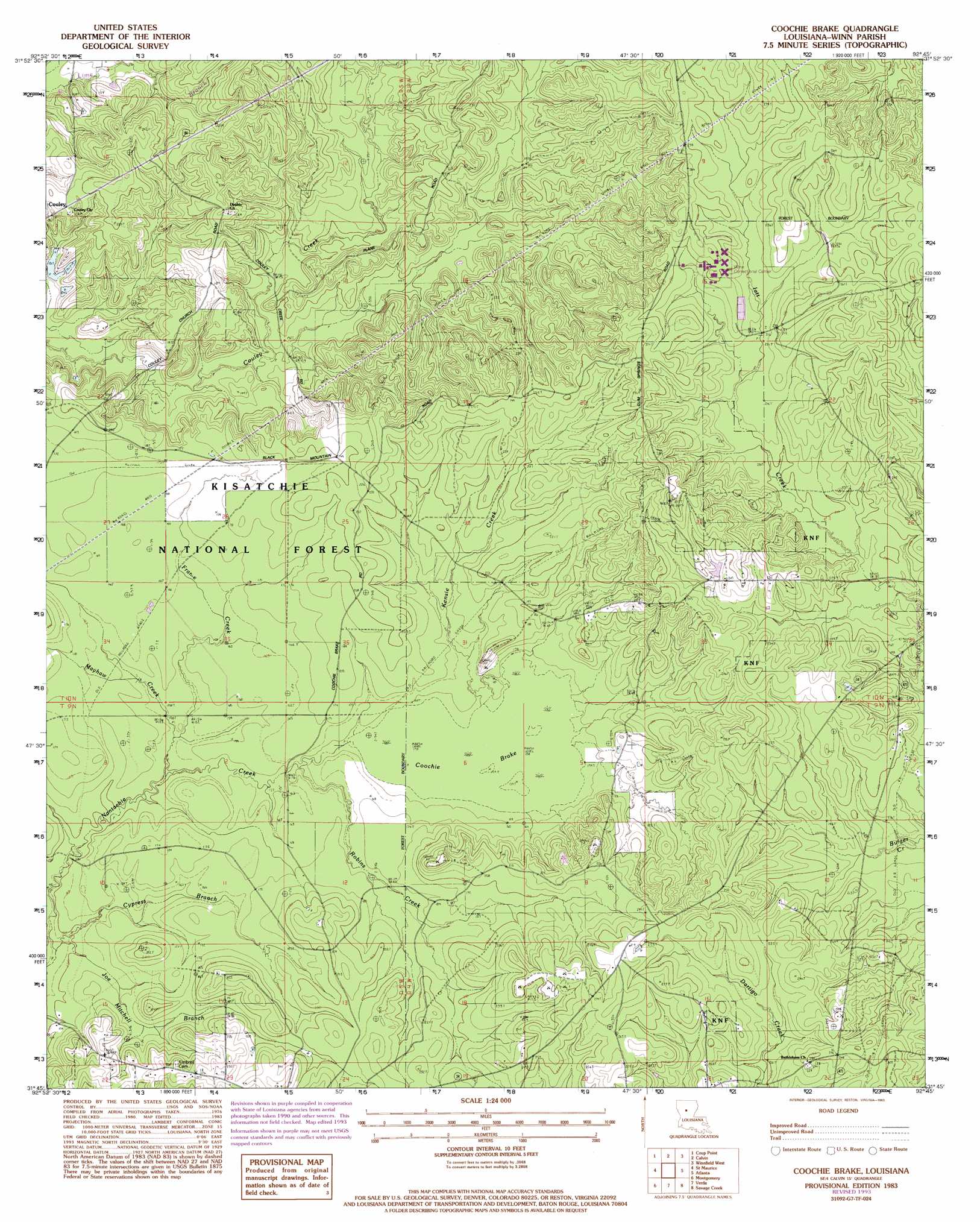
USGS Topo Quad 31092g7 - 1:24,000 scale
| Topo Map Name: | Coochie Brake |
| USGS Topo Quad ID: | 31092g7 |
| Print Size: | ca. 21 1/4" wide x 27" high |
| Southeast Coordinates: | 31.75° N latitude / 92.75° W longitude |
| Map Center Coordinates: | 31.8125° N latitude / 92.8125° W longitude |
| U.S. State: | LA |
| Filename: | o31092g7.jpg |
| Download Map JPG Image: | Coochie Brake topo map 1:24,000 scale |
| Map Type: | Topographic |
| Topo Series: | 7.5´ |
| Map Scale: | 1:24,000 |
| Source of Map Images: | United States Geological Survey (USGS) |
| Alternate Map Versions: |
Coochie Brake LA 1983 Download PDF Buy paper map Coochie Brake LA 1983, updated 1984 Download PDF Buy paper map Coochie Brake LA 2003, updated 2005 Download PDF Buy paper map Coochie Brake LA 2012 Download PDF Buy paper map Coochie Brake LA 2015 Download PDF Buy paper map |
| FStopo: | US Forest Service topo Coochie Brake is available: Download FStopo PDF Download FStopo TIF |
1:24,000 Topo Quads surrounding Coochie Brake
Chestnut |
Goldonna |
Iron Branch |
Dodson |
Hudson |
Campti |
Coup Point |
Calvin |
Winnfield West |
Winnfield East |
Natchitoches North |
Saint Maurice |
Coochie Brake |
Atlanta |
Packton |
Flora |
Montgomery |
Verda |
Savage Creek |
Williana |
Natchitoches South |
Cloutierville |
Aloha |
Colfax |
Dry Prong |
> Back to 31092e1 at 1:100,000 scale
> Back to 31092a1 at 1:250,000 scale
> Back to U.S. Topo Maps home
Coochie Brake topo map: Gazetteer
Coochie Brake: Populated Places
Couley elevation 59m 193′Coochie Brake: Streams
Cypress Branch elevation 45m 147′Frame Creek elevation 47m 154′
Gravel Creek elevation 55m 180′
Joe Mitchell Branch elevation 44m 144′
Kensie Creek elevation 50m 164′
Mayhaw Creek elevation 46m 150′
Robins Creek elevation 48m 157′
Coochie Brake: Swamps
Coochie Brake elevation 48m 157′Coochie Brake digital topo map on disk
Buy this Coochie Brake topo map showing relief, roads, GPS coordinates and other geographical features, as a high-resolution digital map file on DVD: