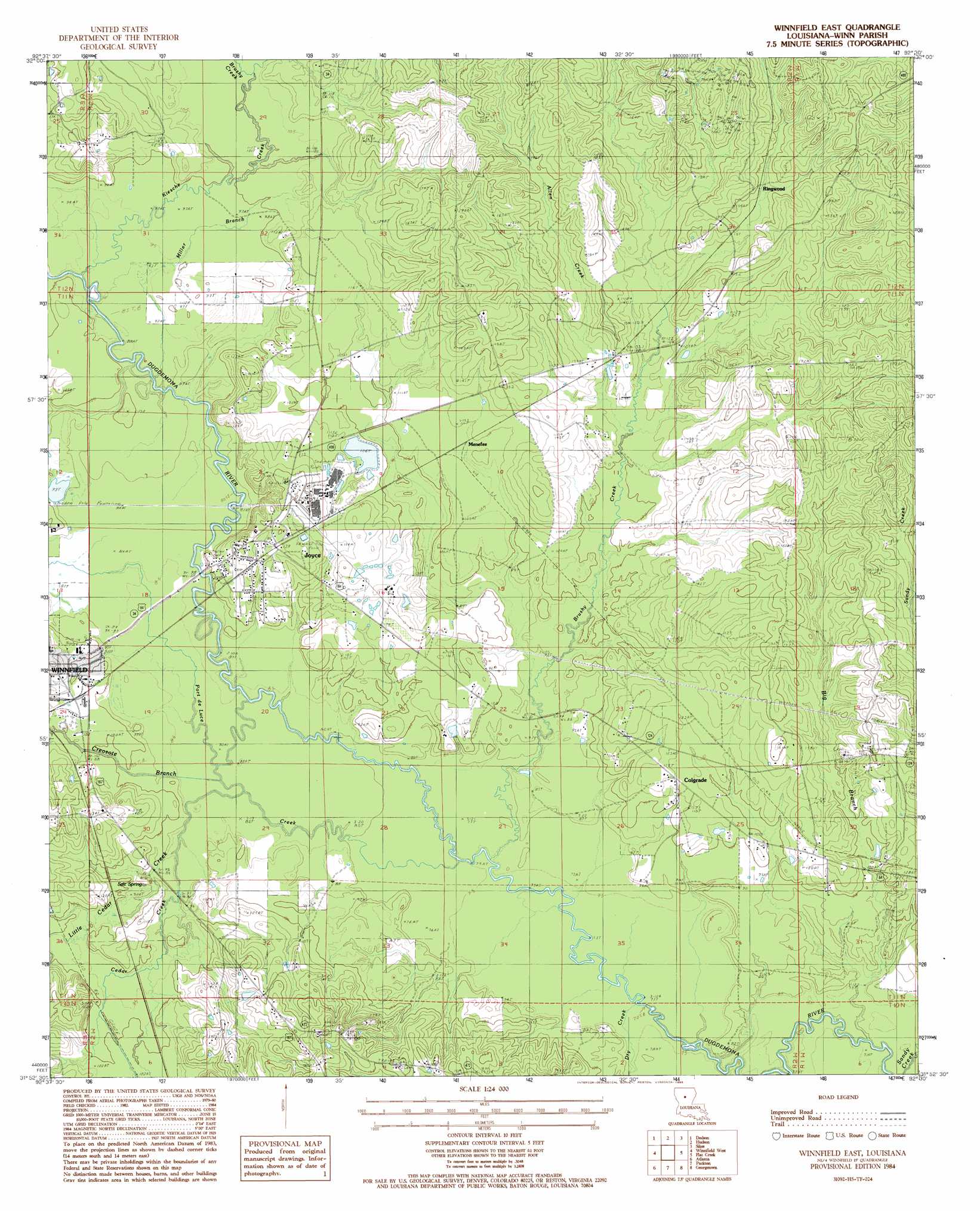
Winnfield East Topo Map Louisiana
To zoom in, hover over the map of Winnfield East
USGS Topo Quad 31092h5 - 1:24,000 scale
| Topo Map Name: | Winnfield East |
| USGS Topo Quad ID: | 31092h5 |
| Print Size: | ca. 21 1/4" wide x 27" high |
| Southeast Coordinates: | 31.875° N latitude / 92.5° W longitude |
| Map Center Coordinates: | 31.9375° N latitude / 92.5625° W longitude |
| U.S. State: | LA |
| Filename: | o31092h5.jpg |
| Download Map JPG Image: | Winnfield East topo map 1:24,000 scale |
| Map Type: | Topographic |
| Topo Series: | 7.5´ |
| Map Scale: | 1:24,000 |
| Source of Map Images: | United States Geological Survey (USGS) |
| Alternate Map Versions: |
Winnfield East LA 1984, updated 1985 Download PDF Buy paper map Winnfield East LA 2012 Download PDF Buy paper map Winnfield East LA 2015 Download PDF Buy paper map |
1:24,000 Topo Quads surrounding Winnfield East
Danville |
Jonesboro South |
Weston |
Womack |
Vixen |
Iron Branch |
Dodson |
Hudson |
Sikes |
Cotton Plant |
Calvin |
Winnfield West |
Winnfield East |
Flat Creek |
Fords Creek |
Coochie Brake |
Atlanta |
Packton |
Georgetown |
Tullas |
Verda |
Savage Creek |
Williana |
Mudville |
Little Creek |
> Back to 31092e1 at 1:100,000 scale
> Back to 31092a1 at 1:250,000 scale
> Back to U.S. Topo Maps home
Winnfield East topo map: Gazetteer
Winnfield East: Dams
Tremont Pond Dam elevation 30m 98′Winnfield East: Parks
Winnfield Mini Park elevation 31m 101′Winnfield East: Populated Places
Colgrade elevation 35m 114′Joyce elevation 39m 127′
Menefee elevation 33m 108′
Ringwood elevation 47m 154′
Winnfield East: Post Offices
Joyce Post Office (historical) elevation 43m 141′Winnfield East: Springs
Salt Spring elevation 30m 98′Winnfield East: Streams
Allen Creek elevation 32m 104′Big Branch elevation 21m 68′
Brushy Creek elevation 31m 101′
Brushy Creek elevation 24m 78′
Cedar Creek elevation 25m 82′
Creosote Branch elevation 26m 85′
Dry Creek elevation 21m 68′
Kiesche Creek elevation 27m 88′
Little Cedar Creek elevation 30m 98′
Miller Branch elevation 27m 88′
Port de Luce Creek elevation 24m 78′
Sandy Creek elevation 21m 68′
Winnfield East digital topo map on disk
Buy this Winnfield East topo map showing relief, roads, GPS coordinates and other geographical features, as a high-resolution digital map file on DVD: