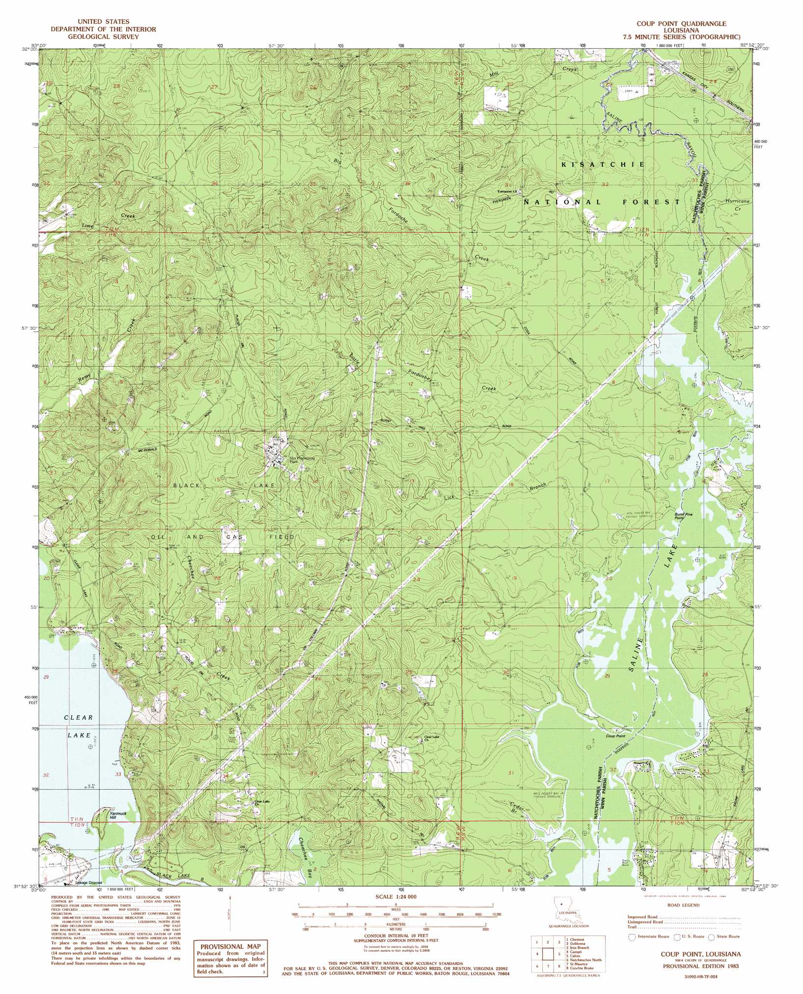
Coup Point Topo Map Louisiana
To zoom in, hover over the map of Coup Point
USGS Topo Quad 31092h8 - 1:24,000 scale
| Topo Map Name: | Coup Point |
| USGS Topo Quad ID: | 31092h8 |
| Print Size: | ca. 21 1/4" wide x 27" high |
| Southeast Coordinates: | 31.875° N latitude / 92.875° W longitude |
| Map Center Coordinates: | 31.9375° N latitude / 92.9375° W longitude |
| U.S. State: | LA |
| Filename: | o31092h8.jpg |
| Download Map JPG Image: | Coup Point topo map 1:24,000 scale |
| Map Type: | Topographic |
| Topo Series: | 7.5´ |
| Map Scale: | 1:24,000 |
| Source of Map Images: | United States Geological Survey (USGS) |
| Alternate Map Versions: |
Coup Point LA 1983, updated 1984 Download PDF Buy paper map Coup Point LA 2003, updated 2005 Download PDF Buy paper map Coup Point LA 2012 Download PDF Buy paper map Coup Point LA 2015 Download PDF Buy paper map |
| FStopo: | US Forest Service topo Coup Point is available: Download FStopo PDF Download FStopo TIF |
1:24,000 Topo Quads surrounding Coup Point
Troy |
Ashland |
Saline |
Danville |
Jonesboro South |
Martin |
Chestnut |
Goldonna |
Iron Branch |
Dodson |
Messick |
Campti |
Coup Point |
Calvin |
Winnfield West |
Powhatan |
Natchitoches North |
Saint Maurice |
Coochie Brake |
Atlanta |
Provencal |
Flora |
Montgomery |
Verda |
Savage Creek |
> Back to 31092e1 at 1:100,000 scale
> Back to 31092a1 at 1:250,000 scale
> Back to U.S. Topo Maps home
Coup Point topo map: Gazetteer
Coup Point: Capes
Burnt Pine Point elevation 31m 101′Burnt Pine Point elevation 31m 101′
Coup Point elevation 31m 101′
Coup Point: Islands
Yarmuck Hill elevation 34m 111′Coup Point: Oilfields
Black Lake Oil and Gas Field elevation 74m 242′Black Lake Oil and Gas Field elevation 65m 213′
Coup Point: Populated Places
Clear Lake (historical) elevation 44m 144′Coup Point: Streams
Big Fordoche Creek elevation 31m 101′Cedar Branch elevation 31m 101′
Cedar Branch elevation 31m 101′
Cheechee Creek elevation 31m 101′
Hurricane Creek elevation 32m 104′
Lick Branch elevation 31m 101′
Little Fordoche Creek elevation 31m 101′
Mill Creek elevation 33m 108′
Range Creek elevation 31m 101′
Spring Branch elevation 33m 108′
Coup Point: Summits
Yarmuck Hill elevation 36m 118′Coup Point digital topo map on disk
Buy this Coup Point topo map showing relief, roads, GPS coordinates and other geographical features, as a high-resolution digital map file on DVD: