Little Sandy Creek Topo Map Louisiana
To zoom in, hover over the map of Little Sandy Creek
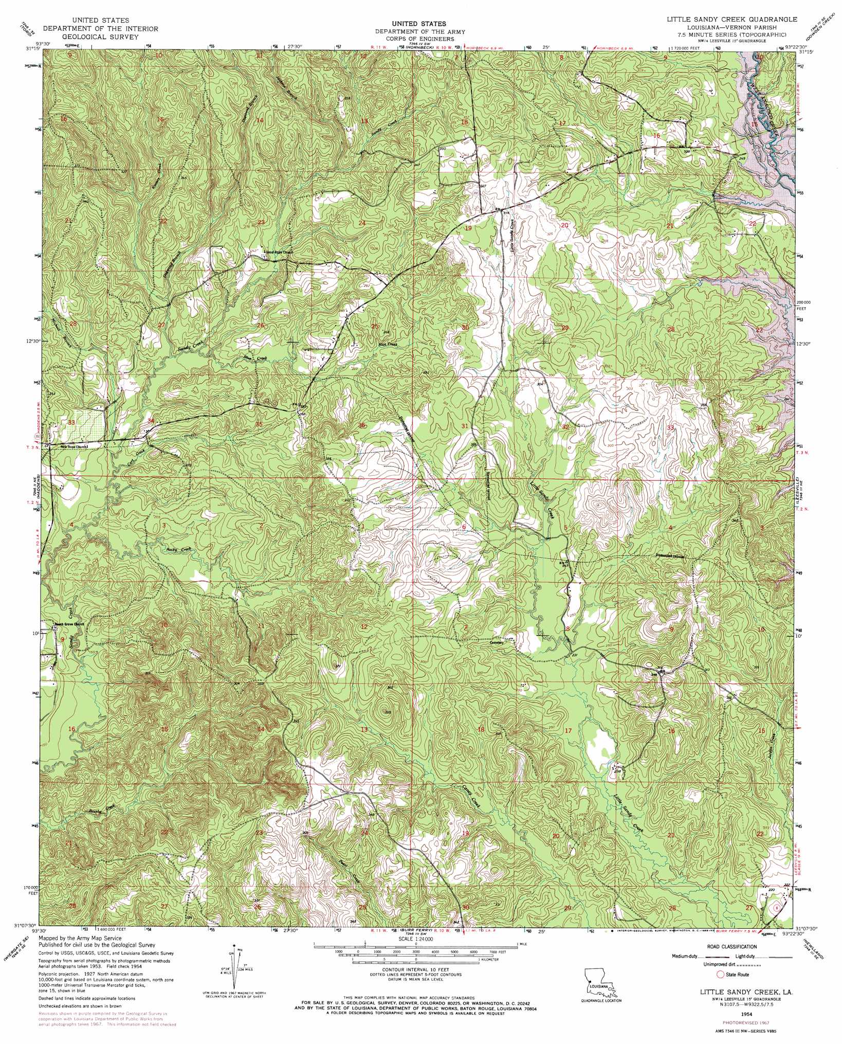
USGS Topo Quad 31093b4 - 1:24,000 scale
| Topo Map Name: | Little Sandy Creek |
| USGS Topo Quad ID: | 31093b4 |
| Print Size: | ca. 21 1/4" wide x 27" high |
| Southeast Coordinates: | 31.125° N latitude / 93.375° W longitude |
| Map Center Coordinates: | 31.1875° N latitude / 93.4375° W longitude |
| U.S. State: | LA |
| Filename: | o31093b4.jpg |
| Download Map JPG Image: | Little Sandy Creek topo map 1:24,000 scale |
| Map Type: | Topographic |
| Topo Series: | 7.5´ |
| Map Scale: | 1:24,000 |
| Source of Map Images: | United States Geological Survey (USGS) |
| Alternate Map Versions: |
Little Sandy Creek LA 1954, updated 1958 Download PDF Buy paper map Little Sandy Creek LA 1954, updated 1968 Download PDF Buy paper map Little Sandy Creek LA 2012 Download PDF Buy paper map Little Sandy Creek LA 2015 Download PDF Buy paper map |
1:24,000 Topo Quads surrounding Little Sandy Creek
Salter Creek |
Negreet |
Florien |
Peason |
Kisatchie |
Negreet Sw |
Toro |
Hornbeck |
Dowden Creek |
Kurthwood |
Fairmount |
Haddens |
Little Sandy Creek |
Leesville |
Slagle |
Wiergate |
Wiergate Se |
Burr Ferry |
Newllano |
Fort Polk |
Shankleville |
Evans |
Knight |
Rose Pine |
Hurricane Branch |
> Back to 31093a1 at 1:100,000 scale
> Back to 31092a1 at 1:250,000 scale
> Back to U.S. Topo Maps home
Little Sandy Creek topo map: Gazetteer
Little Sandy Creek: Streams
Blue Creek elevation 58m 190′Cart Creek elevation 54m 177′
Dogwood Branch elevation 59m 193′
Jackson Branch elevation 76m 249′
Koonce Creek elevation 63m 206′
Michael Branch elevation 52m 170′
Rocky Creek elevation 50m 164′
Little Sandy Creek digital topo map on disk
Buy this Little Sandy Creek topo map showing relief, roads, GPS coordinates and other geographical features, as a high-resolution digital map file on DVD: