Florien Topo Map Louisiana
To zoom in, hover over the map of Florien
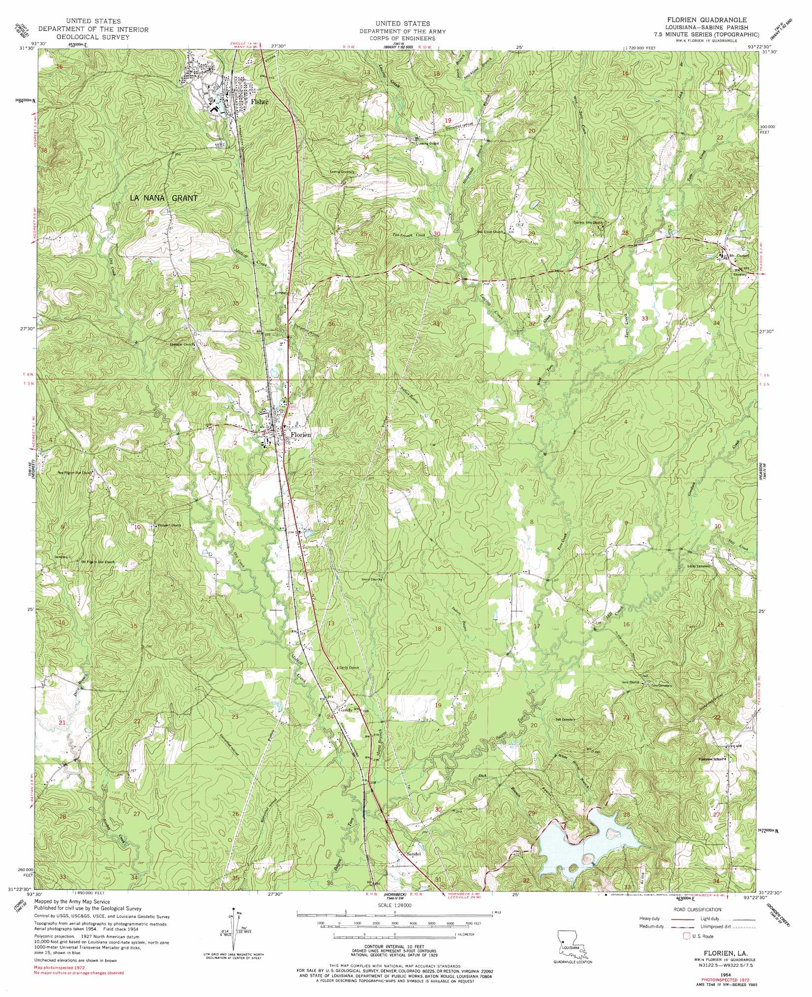
USGS Topo Quad 31093d4 - 1:24,000 scale
| Topo Map Name: | Florien |
| USGS Topo Quad ID: | 31093d4 |
| Print Size: | ca. 21 1/4" wide x 27" high |
| Southeast Coordinates: | 31.375° N latitude / 93.375° W longitude |
| Map Center Coordinates: | 31.4375° N latitude / 93.4375° W longitude |
| U.S. State: | LA |
| Filename: | o31093d4.jpg |
| Download Map JPG Image: | Florien topo map 1:24,000 scale |
| Map Type: | Topographic |
| Topo Series: | 7.5´ |
| Map Scale: | 1:24,000 |
| Source of Map Images: | United States Geological Survey (USGS) |
| Alternate Map Versions: |
Florien LA 1954, updated 1958 Download PDF Buy paper map Florien LA 1954, updated 1977 Download PDF Buy paper map Florien LA 1997, updated 1997 Download PDF Buy paper map Florien LA 2012 Download PDF Buy paper map Florien LA 2015 Download PDF Buy paper map |
1:24,000 Topo Quads surrounding Florien
Zwolle |
Belmont |
Marthaville |
Robeline |
Provencal |
Beech Bayou |
Loring |
Many |
Vowells Mill |
Bellwood |
Salter Creek |
Negreet |
Florien |
Peason |
Kisatchie |
Negreet Sw |
Toro |
Hornbeck |
Dowden Creek |
Kurthwood |
Fairmount |
Haddens |
Little Sandy Creek |
Leesville |
Slagle |
> Back to 31093a1 at 1:100,000 scale
> Back to 31092a1 at 1:250,000 scale
> Back to U.S. Topo Maps home
Florien topo map: Gazetteer
Florien: Airports
Cook Airport elevation 83m 272′Hodges Airfield (historical) elevation 127m 416′
Florien: Dams
Hodges Garden Dam elevation 88m 288′Florien: Islands
Bear Island elevation 96m 314′House Island elevation 97m 318′
Nandina Island elevation 107m 351′
Florien: Parks
Fisher Historic District elevation 105m 344′Florien: Populated Places
Fisher elevation 105m 344′Florien elevation 83m 272′
Gandy elevation 70m 229′
Mount Carmel elevation 99m 324′
Sandel elevation 67m 219′
Florien: Post Offices
Florien Post Office elevation 80m 262′Florien: Streams
Devil Branch elevation 63m 206′Dick Branch elevation 61m 200′
Dry Creek elevation 64m 209′
Goodson Creek elevation 66m 216′
Hildbrandt Branch elevation 76m 249′
Indian Bayou elevation 61m 200′
Lick Branch elevation 77m 252′
Many Branch elevation 60m 196′
Midkiff Creek elevation 57m 187′
Mill Creek elevation 63m 206′
Nash Creek elevation 57m 187′
Steve Branch elevation 84m 275′
Strickland Branch elevation 84m 275′
Tan Trough Creek elevation 74m 242′
Toro Creek elevation 61m 200′
West Toro Creek elevation 67m 219′
White House Branch elevation 61m 200′
Florien digital topo map on disk
Buy this Florien topo map showing relief, roads, GPS coordinates and other geographical features, as a high-resolution digital map file on DVD: