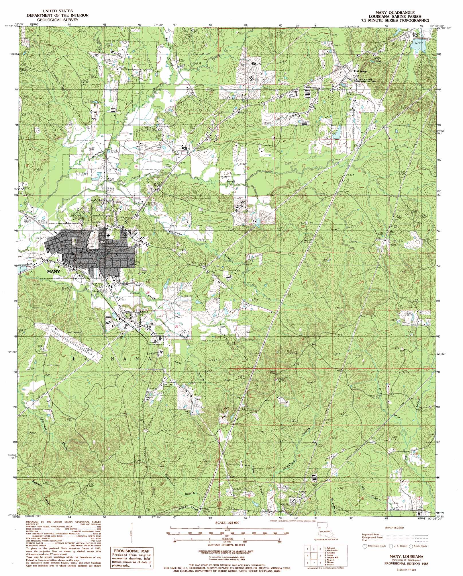
Many Topo Map Louisiana
To zoom in, hover over the map of Many
USGS Topo Quad 31093e4 - 1:24,000 scale
| Topo Map Name: | Many |
| USGS Topo Quad ID: | 31093e4 |
| Print Size: | ca. 21 1/4" wide x 27" high |
| Southeast Coordinates: | 31.5° N latitude / 93.375° W longitude |
| Map Center Coordinates: | 31.5625° N latitude / 93.4375° W longitude |
| U.S. State: | LA |
| Filename: | o31093e4.jpg |
| Download Map JPG Image: | Many topo map 1:24,000 scale |
| Map Type: | Topographic |
| Topo Series: | 7.5´ |
| Map Scale: | 1:24,000 |
| Source of Map Images: | United States Geological Survey (USGS) |
| Alternate Map Versions: |
Many LA 1988, updated 1988 Download PDF Buy paper map Many LA 1994, updated 1997 Download PDF Buy paper map Many LA 2012 Download PDF Buy paper map Many LA 2015 Download PDF Buy paper map |
1:24,000 Topo Quads surrounding Many
Converse |
Pleasant Hill |
Hollis Creek |
Allen |
Powhatan |
Zwolle |
Belmont |
Marthaville |
Robeline |
Provencal |
Beech Bayou |
Loring |
Many |
Vowells Mill |
Bellwood |
Salter Creek |
Negreet |
Florien |
Peason |
Kisatchie |
Negreet Sw |
Toro |
Hornbeck |
Dowden Creek |
Kurthwood |
> Back to 31093e1 at 1:100,000 scale
> Back to 31092a1 at 1:250,000 scale
> Back to U.S. Topo Maps home
Many topo map: Gazetteer
Many: Airports
Hart Airport elevation 93m 305′Many: Dams
Bayou Dupont Number 10 Dam elevation 69m 226′Many: Lakes
Miller Pond elevation 88m 288′Many: Oilfields
Fort Jesup Oil Field elevation 106m 347′Pendleton-Many Oil and Gas Field elevation 80m 262′
Many: Parks
Fort Jesup State Historic Site elevation 127m 416′Many: Populated Places
Alford Heights elevation 89m 291′Blakes Addition elevation 71m 232′
Cobbs Addition elevation 84m 275′
Fort Jesup elevation 111m 364′
Many elevation 84m 275′
Many: Post Offices
Many Post Office elevation 88m 288′Many: Streams
Blackwell Creek elevation 67m 219′Clear Branch elevation 71m 232′
Harpoon Branch elevation 76m 249′
Hurricane Branch elevation 92m 301′
Klondike Creek elevation 74m 242′
Lewing Creek elevation 88m 288′
Turpentine Branch elevation 89m 291′
Many digital topo map on disk
Buy this Many topo map showing relief, roads, GPS coordinates and other geographical features, as a high-resolution digital map file on DVD: