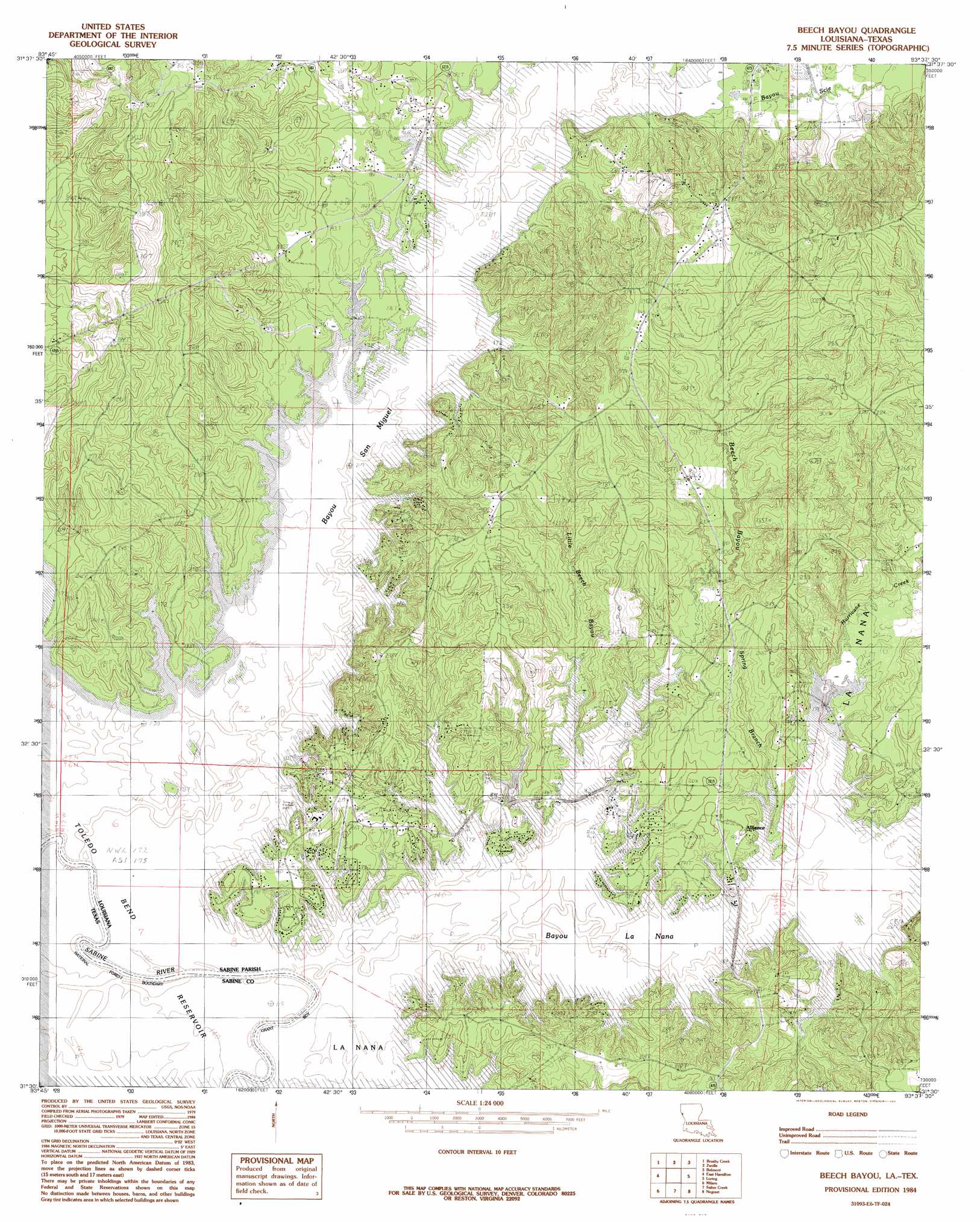
Beech Bayou Topo Map Louisiana
To zoom in, hover over the map of Beech Bayou
USGS Topo Quad 31093e6 - 1:24,000 scale
| Topo Map Name: | Beech Bayou |
| USGS Topo Quad ID: | 31093e6 |
| Print Size: | ca. 21 1/4" wide x 27" high |
| Southeast Coordinates: | 31.5° N latitude / 93.625° W longitude |
| Map Center Coordinates: | 31.5625° N latitude / 93.6875° W longitude |
| U.S. States: | LA, TX |
| Filename: | o31093e6.jpg |
| Download Map JPG Image: | Beech Bayou topo map 1:24,000 scale |
| Map Type: | Topographic |
| Topo Series: | 7.5´ |
| Map Scale: | 1:24,000 |
| Source of Map Images: | United States Geological Survey (USGS) |
| Alternate Map Versions: |
Beech Bayou LA 1984, updated 1984 Download PDF Buy paper map Beech Bayou LA 2003, updated 2004 Download PDF Buy paper map Beech Bayou LA 2010 Download PDF Buy paper map Beech Bayou LA 2015 Download PDF Buy paper map |
| FStopo: | US Forest Service topo Beech Bayou is available: Download FStopo PDF Download FStopo TIF |
1:24,000 Topo Quads surrounding Beech Bayou
Huxley |
Union Springs |
Converse |
Pleasant Hill |
Hollis Creek |
Patroon North |
Brushy Creek |
Zwolle |
Belmont |
Marthaville |
Patroon South |
East Hamilton |
Beech Bayou |
Loring |
Many |
Geneva |
Milam |
Salter Creek |
Negreet |
Florien |
Pineland North |
Hemphill |
Negreet Sw |
Toro |
Hornbeck |
> Back to 31093e1 at 1:100,000 scale
> Back to 31092a1 at 1:250,000 scale
> Back to U.S. Topo Maps home
Beech Bayou topo map: Gazetteer
Beech Bayou: Airports
Ammons Airport elevation 58m 190′Beech Bayou: Crossings
Carters Ferry (historical) elevation 52m 170′Beech Bayou: Populated Places
Alliance elevation 61m 200′Beech Bayou: Streams
Bayou La Nana elevation 52m 170′Bayou San Miguel elevation 52m 170′
Bayou Scie elevation 52m 170′
Beech Bayou elevation 57m 187′
Choctaw Branch elevation 52m 170′
Funks Bayou elevation 52m 170′
Hurricane Creek elevation 52m 170′
Little Beech Bayou elevation 53m 173′
Spring Branch elevation 52m 170′
Beech Bayou digital topo map on disk
Buy this Beech Bayou topo map showing relief, roads, GPS coordinates and other geographical features, as a high-resolution digital map file on DVD: