East Hamilton Topo Map Texas
To zoom in, hover over the map of East Hamilton
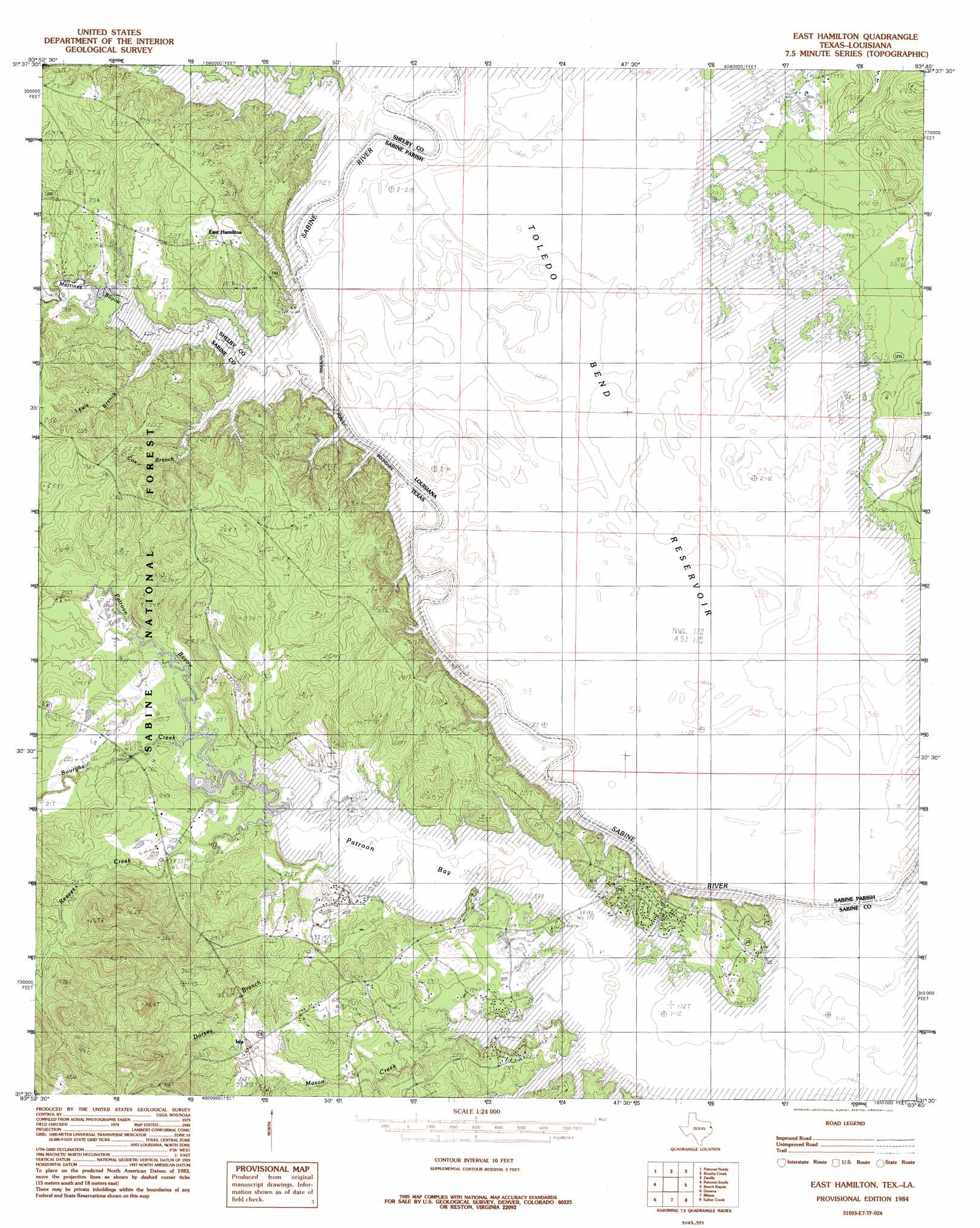
USGS Topo Quad 31093e7 - 1:24,000 scale
| Topo Map Name: | East Hamilton |
| USGS Topo Quad ID: | 31093e7 |
| Print Size: | ca. 21 1/4" wide x 27" high |
| Southeast Coordinates: | 31.5° N latitude / 93.75° W longitude |
| Map Center Coordinates: | 31.5625° N latitude / 93.8125° W longitude |
| U.S. States: | TX, LA |
| Filename: | o31093e7.jpg |
| Download Map JPG Image: | East Hamilton topo map 1:24,000 scale |
| Map Type: | Topographic |
| Topo Series: | 7.5´ |
| Map Scale: | 1:24,000 |
| Source of Map Images: | United States Geological Survey (USGS) |
| Alternate Map Versions: |
East Hamilton TX 1984, updated 1984 Download PDF Buy paper map East Hamilton TX 2003, updated 2004 Download PDF Buy paper map East Hamilton TX 2010 Download PDF Buy paper map East Hamilton TX 2012 Download PDF Buy paper map East Hamilton TX 2016 Download PDF Buy paper map |
| FStopo: | US Forest Service topo East Hamilton is available: Download FStopo PDF Download FStopo TIF |
1:24,000 Topo Quads surrounding East Hamilton
Shelbyville |
Huxley |
Union Springs |
Converse |
Pleasant Hill |
Hurstown |
Patroon North |
Brushy Creek |
Zwolle |
Belmont |
San Augustine East |
Patroon South |
East Hamilton |
Beech Bayou |
Loring |
Chinquapin |
Geneva |
Milam |
Salter Creek |
Negreet |
Bronson |
Pineland North |
Hemphill |
Negreet Sw |
Toro |
> Back to 31093e1 at 1:100,000 scale
> Back to 31092a1 at 1:250,000 scale
> Back to U.S. Topo Maps home
East Hamilton topo map: Gazetteer
East Hamilton: Crossings
Chamber Ferry (historical) elevation 52m 170′Darnell Ferry (historical) elevation 52m 170′
East Hamilton: Guts
Sandy Slough elevation 52m 170′East Hamilton: Islands
Ball Island elevation 52m 170′East Hamilton: Lakes
Black Lake elevation 52m 170′Brushy Lake elevation 52m 170′
Buzzard Lake elevation 52m 170′
Donnell Lake elevation 52m 170′
Holmes River Lake elevation 52m 170′
Horseshoe Lake elevation 52m 170′
Round Pond elevation 52m 170′
Saltworks Lake elevation 52m 170′
Vines Old River Lake elevation 52m 170′
Webb Lake elevation 52m 170′
East Hamilton: Populated Places
East Hamilton elevation 62m 203′Isla elevation 77m 252′
East Hamilton: Ridges
Bone Ridge elevation 52m 170′East Hamilton: Streams
Bayou San Patricio elevation 52m 170′Bourghs Creek elevation 53m 173′
Brittain Creek elevation 52m 170′
Cox Branch elevation 52m 170′
Dorsey Branch elevation 52m 170′
Lewis Branch elevation 52m 170′
Martinez Bayou elevation 53m 173′
Mason Creek elevation 52m 170′
Reeves Creek elevation 52m 170′
Wilson Creek elevation 52m 170′
East Hamilton digital topo map on disk
Buy this East Hamilton topo map showing relief, roads, GPS coordinates and other geographical features, as a high-resolution digital map file on DVD: