Marthaville Topo Map Louisiana
To zoom in, hover over the map of Marthaville
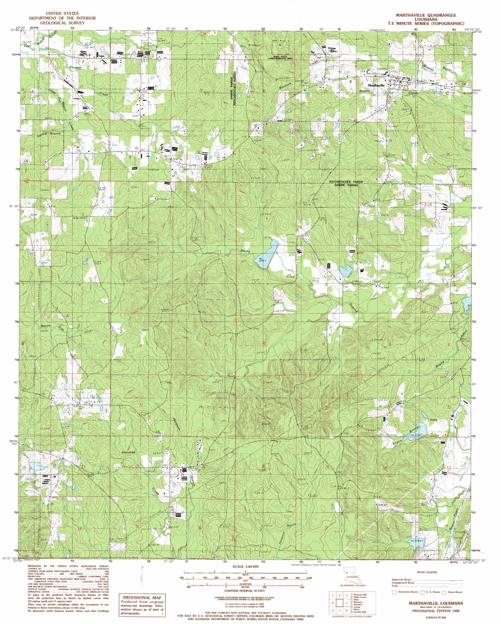
USGS Topo Quad 31093f4 - 1:24,000 scale
| Topo Map Name: | Marthaville |
| USGS Topo Quad ID: | 31093f4 |
| Print Size: | ca. 21 1/4" wide x 27" high |
| Southeast Coordinates: | 31.625° N latitude / 93.375° W longitude |
| Map Center Coordinates: | 31.6875° N latitude / 93.4375° W longitude |
| U.S. State: | LA |
| Filename: | o31093f4.jpg |
| Download Map JPG Image: | Marthaville topo map 1:24,000 scale |
| Map Type: | Topographic |
| Topo Series: | 7.5´ |
| Map Scale: | 1:24,000 |
| Source of Map Images: | United States Geological Survey (USGS) |
| Alternate Map Versions: |
Marthaville LA 1988, updated 1988 Download PDF Buy paper map Marthaville LA 2012 Download PDF Buy paper map Marthaville LA 2015 Download PDF Buy paper map |
1:24,000 Topo Quads surrounding Marthaville
Trenton |
Pelican |
Evelyn |
Hanna |
Messick |
Converse |
Pleasant Hill |
Hollis Creek |
Allen |
Powhatan |
Zwolle |
Belmont |
Marthaville |
Robeline |
Provencal |
Beech Bayou |
Loring |
Many |
Vowells Mill |
Bellwood |
Salter Creek |
Negreet |
Florien |
Peason |
Kisatchie |
> Back to 31093e1 at 1:100,000 scale
> Back to 31092a1 at 1:250,000 scale
> Back to U.S. Topo Maps home
Marthaville topo map: Gazetteer
Marthaville: Dams
Bayou Dupont Number 11 Dam elevation 71m 232′Bayou Dupont Number 12 Dam elevation 70m 229′
Bayou Dupont Number Four Dam elevation 64m 209′
Bayou Dupont Number Two Dam elevation 67m 219′
Marthaville: Oilfields
Klondike Oil Field elevation 103m 337′Marthaville: Parks
Rebel State Historic Site elevation 99m 324′Marthaville: Populated Places
Marthaville elevation 75m 246′Marthaville: Post Offices
Marthaville Post Office elevation 79m 259′Marthaville: Streams
Bayou of the Three Prairies elevation 59m 193′Spring Branch elevation 87m 285′
Thomas Creek elevation 81m 265′
Whitlock Creek elevation 72m 236′
Marthaville digital topo map on disk
Buy this Marthaville topo map showing relief, roads, GPS coordinates and other geographical features, as a high-resolution digital map file on DVD: