Pleasant Hill Topo Map Louisiana
To zoom in, hover over the map of Pleasant Hill
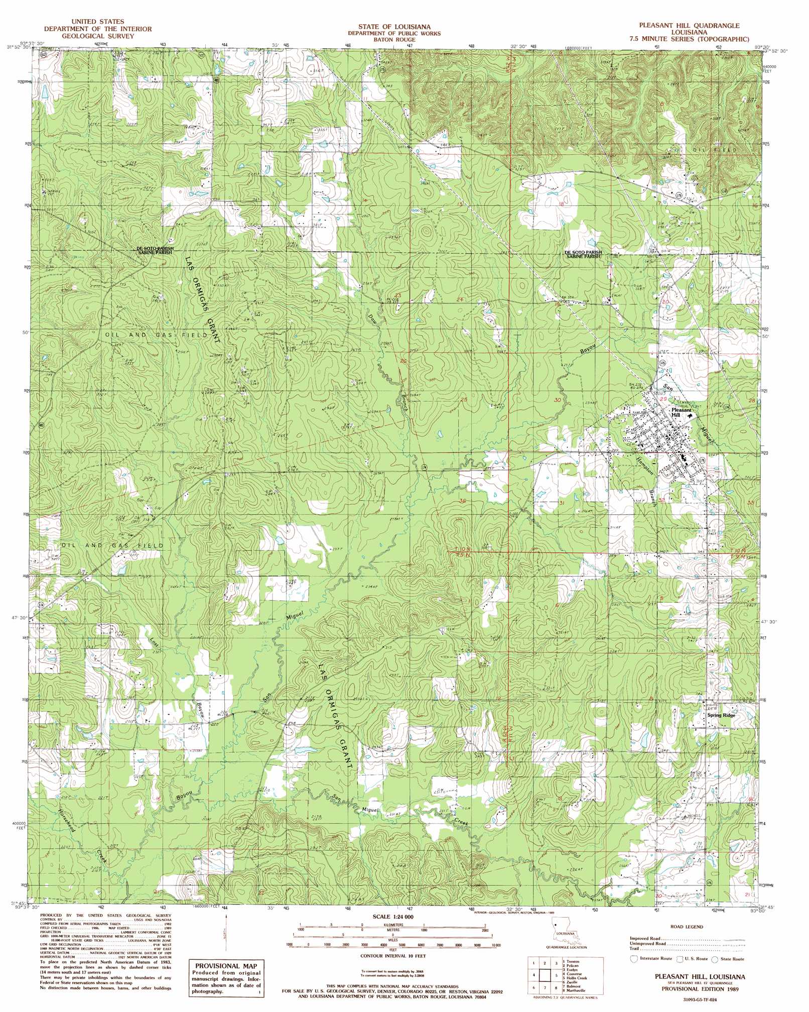
USGS Topo Quad 31093g5 - 1:24,000 scale
| Topo Map Name: | Pleasant Hill |
| USGS Topo Quad ID: | 31093g5 |
| Print Size: | ca. 21 1/4" wide x 27" high |
| Southeast Coordinates: | 31.75° N latitude / 93.5° W longitude |
| Map Center Coordinates: | 31.8125° N latitude / 93.5625° W longitude |
| U.S. State: | LA |
| Filename: | o31093g5.jpg |
| Download Map JPG Image: | Pleasant Hill topo map 1:24,000 scale |
| Map Type: | Topographic |
| Topo Series: | 7.5´ |
| Map Scale: | 1:24,000 |
| Source of Map Images: | United States Geological Survey (USGS) |
| Alternate Map Versions: |
Pleasant Hill LA 1989, updated 1989 Download PDF Buy paper map Pleasant Hill LA 2012 Download PDF Buy paper map Pleasant Hill LA 2015 Download PDF Buy paper map |
1:24,000 Topo Quads surrounding Pleasant Hill
Grand Cane |
Mansfield |
Bayou Pierre Lake |
Harmon |
Coushatta |
Hunter |
Trenton |
Pelican |
Evelyn |
Hanna |
Union Springs |
Converse |
Pleasant Hill |
Hollis Creek |
Allen |
Brushy Creek |
Zwolle |
Belmont |
Marthaville |
Robeline |
East Hamilton |
Beech Bayou |
Loring |
Many |
Vowells Mill |
> Back to 31093e1 at 1:100,000 scale
> Back to 31092a1 at 1:250,000 scale
> Back to U.S. Topo Maps home
Pleasant Hill topo map: Gazetteer
Pleasant Hill: Oilfields
San Miquel Bayou Oil and Gas Field elevation 73m 239′Spring Ridge Gas Field elevation 96m 314′
Pleasant Hill: Populated Places
Old Pleasant Hill elevation 99m 324′Pleasant Hill elevation 87m 285′
Spring Ridge elevation 111m 364′
Pleasant Hill: Post Offices
Pleasant Hill Post Office elevation 88m 288′Pleasant Hill: Streams
Daw Branch elevation 72m 236′Hampton Branch elevation 76m 249′
Horsehead Creek elevation 63m 206′
Lost Bayou elevation 64m 209′
North Fork Little Bayou San Miguel elevation 76m 249′
San Miguel Creek elevation 64m 209′
Pleasant Hill digital topo map on disk
Buy this Pleasant Hill topo map showing relief, roads, GPS coordinates and other geographical features, as a high-resolution digital map file on DVD: