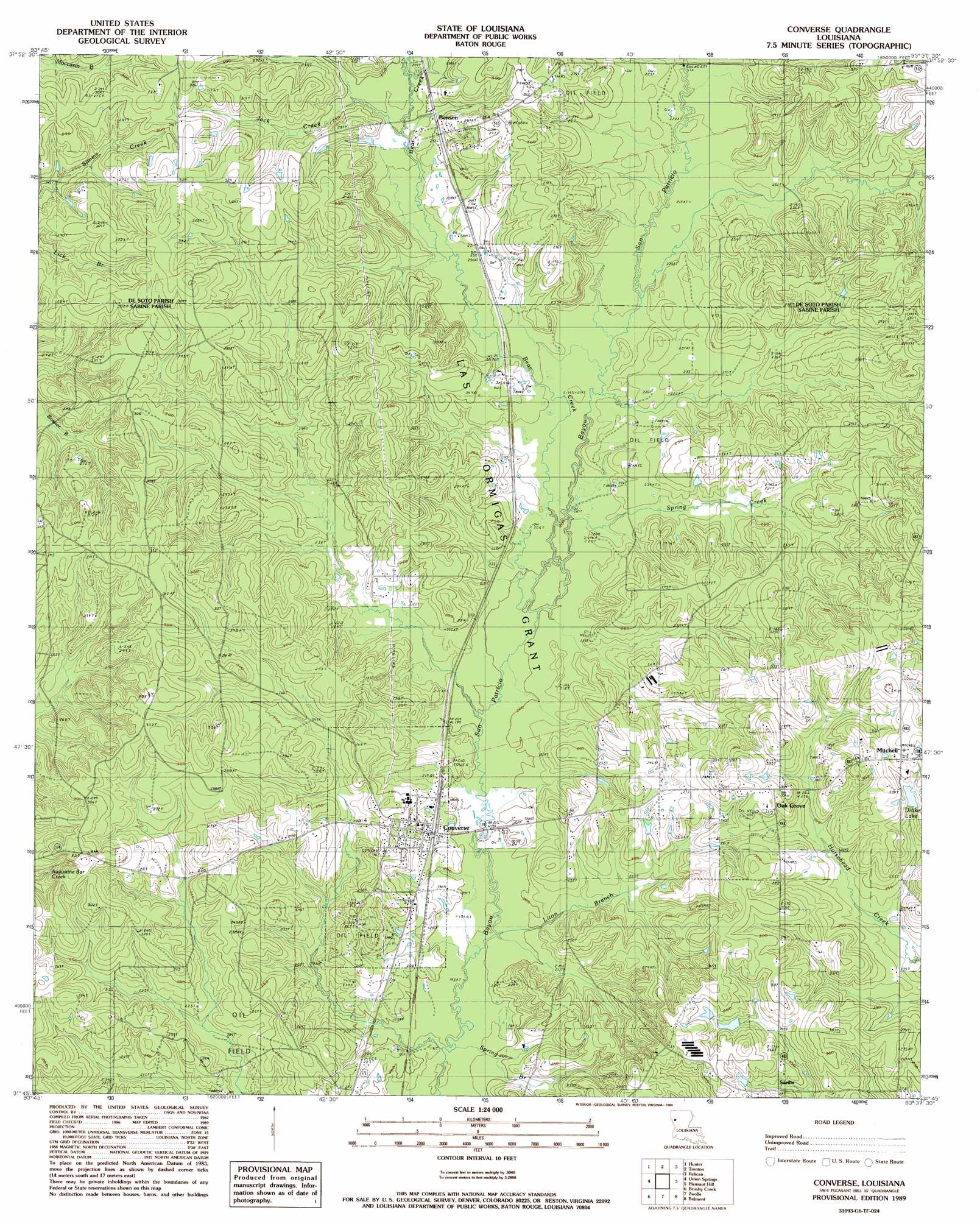
Converse Topo Map Louisiana
To zoom in, hover over the map of Converse
USGS Topo Quad 31093g6 - 1:24,000 scale
| Topo Map Name: | Converse |
| USGS Topo Quad ID: | 31093g6 |
| Print Size: | ca. 21 1/4" wide x 27" high |
| Southeast Coordinates: | 31.75° N latitude / 93.625° W longitude |
| Map Center Coordinates: | 31.8125° N latitude / 93.6875° W longitude |
| U.S. State: | LA |
| Filename: | o31093g6.jpg |
| Download Map JPG Image: | Converse topo map 1:24,000 scale |
| Map Type: | Topographic |
| Topo Series: | 7.5´ |
| Map Scale: | 1:24,000 |
| Source of Map Images: | United States Geological Survey (USGS) |
| Alternate Map Versions: |
Converse LA 1989, updated 1989 Download PDF Buy paper map Converse LA 1994, updated 1996 Download PDF Buy paper map Converse LA 2012 Download PDF Buy paper map Converse LA 2015 Download PDF Buy paper map |
1:24,000 Topo Quads surrounding Converse
Longstreet |
Grand Cane |
Mansfield |
Bayou Pierre Lake |
Harmon |
Logansport East |
Hunter |
Trenton |
Pelican |
Evelyn |
Huxley |
Union Springs |
Converse |
Pleasant Hill |
Hollis Creek |
Patroon North |
Brushy Creek |
Zwolle |
Belmont |
Marthaville |
Patroon South |
East Hamilton |
Beech Bayou |
Loring |
Many |
> Back to 31093e1 at 1:100,000 scale
> Back to 31092a1 at 1:250,000 scale
> Back to U.S. Topo Maps home
Converse topo map: Gazetteer
Converse: Oilfields
Benson Oil and Gas Field elevation 72m 236′Converse Oil and Gas Field elevation 65m 213′
Pleasant Hill Oil and Gas Field elevation 70m 229′
Converse: Populated Places
Benson elevation 77m 252′Converse elevation 65m 213′
Mitchell elevation 98m 321′
Oak Grove elevation 92m 301′
Sardis elevation 78m 255′
Converse: Post Offices
Converse Post Office elevation 68m 223′Converse: Reservoirs
Drake Lake elevation 83m 272′Converse: Streams
Bear Creek elevation 61m 200′Choctaw Bayou elevation 61m 200′
Estes Bayou elevation 58m 190′
Jack Creek elevation 70m 229′
Liton Branch elevation 58m 190′
Spring Branch elevation 58m 190′
Spring Creek elevation 61m 200′
Converse digital topo map on disk
Buy this Converse topo map showing relief, roads, GPS coordinates and other geographical features, as a high-resolution digital map file on DVD: