Pelican Topo Map Louisiana
To zoom in, hover over the map of Pelican
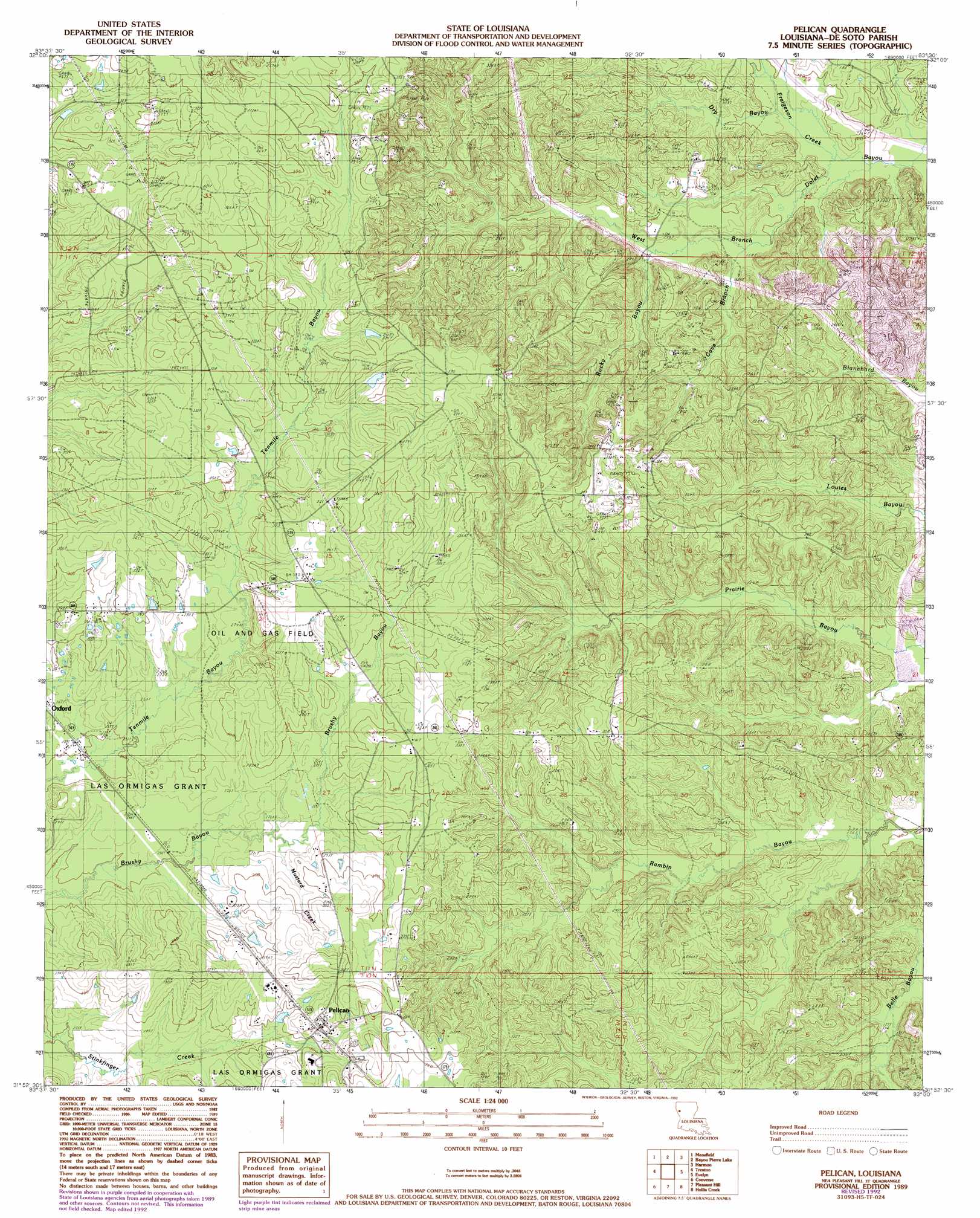
USGS Topo Quad 31093h5 - 1:24,000 scale
| Topo Map Name: | Pelican |
| USGS Topo Quad ID: | 31093h5 |
| Print Size: | ca. 21 1/4" wide x 27" high |
| Southeast Coordinates: | 31.875° N latitude / 93.5° W longitude |
| Map Center Coordinates: | 31.9375° N latitude / 93.5625° W longitude |
| U.S. State: | LA |
| Filename: | o31093h5.jpg |
| Download Map JPG Image: | Pelican topo map 1:24,000 scale |
| Map Type: | Topographic |
| Topo Series: | 7.5´ |
| Map Scale: | 1:24,000 |
| Source of Map Images: | United States Geological Survey (USGS) |
| Alternate Map Versions: |
Pelican LA 1989 Download PDF Buy paper map Pelican LA 1989, updated 1992 Download PDF Buy paper map Pelican LA 2012 Download PDF Buy paper map Pelican LA 2015 Download PDF Buy paper map |
1:24,000 Topo Quads surrounding Pelican
Gloster |
Holly |
Clear Lake |
East Point |
Hall Summit |
Grand Cane |
Mansfield |
Bayou Pierre Lake |
Harmon |
Coushatta |
Hunter |
Trenton |
Pelican |
Evelyn |
Hanna |
Union Springs |
Converse |
Pleasant Hill |
Hollis Creek |
Allen |
Brushy Creek |
Zwolle |
Belmont |
Marthaville |
Robeline |
> Back to 31093e1 at 1:100,000 scale
> Back to 31092a1 at 1:250,000 scale
> Back to U.S. Topo Maps home
Pelican topo map: Gazetteer
Pelican: Oilfields
East Trenton Oil Field elevation 98m 321′Oxford Gas Field elevation 99m 324′
Ten Mile Bayou Oil and Gas Field elevation 107m 351′
Pelican: Populated Places
Dolette (historical) elevation 88m 288′Grove Hill elevation 112m 367′
Pelican elevation 97m 318′
Pelican: Post Offices
Pelican Post Office elevation 95m 311′Pelican: Ranges
Dolette Hills elevation 86m 282′Pelican: Streams
Cave Branch elevation 48m 157′Dry Bayou elevation 42m 137′
Fraigeson Creek elevation 42m 137′
Mustard Creek elevation 79m 259′
Rocky Bayou elevation 52m 170′
Pelican digital topo map on disk
Buy this Pelican topo map showing relief, roads, GPS coordinates and other geographical features, as a high-resolution digital map file on DVD: