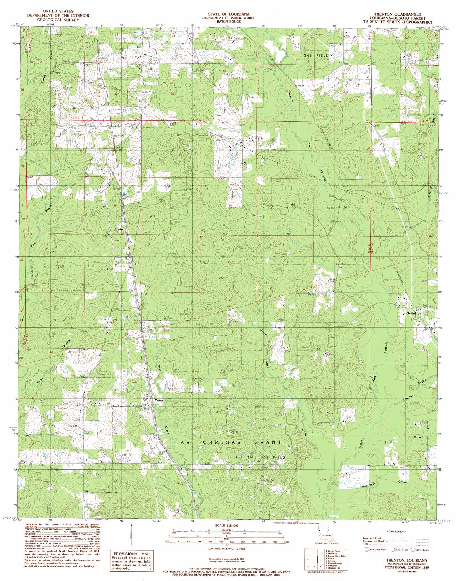
Trenton Topo Map Louisiana
To zoom in, hover over the map of Trenton
USGS Topo Quad 31093h6 - 1:24,000 scale
| Topo Map Name: | Trenton |
| USGS Topo Quad ID: | 31093h6 |
| Print Size: | ca. 21 1/4" wide x 27" high |
| Southeast Coordinates: | 31.875° N latitude / 93.625° W longitude |
| Map Center Coordinates: | 31.9375° N latitude / 93.6875° W longitude |
| U.S. State: | LA |
| Filename: | o31093h6.jpg |
| Download Map JPG Image: | Trenton topo map 1:24,000 scale |
| Map Type: | Topographic |
| Topo Series: | 7.5´ |
| Map Scale: | 1:24,000 |
| Source of Map Images: | United States Geological Survey (USGS) |
| Alternate Map Versions: |
Trenton LA 1989, updated 1989 Download PDF Buy paper map Trenton LA 1995, updated 1997 Download PDF Buy paper map Trenton LA 2012 Download PDF Buy paper map Trenton LA 2015 Download PDF Buy paper map |
1:24,000 Topo Quads surrounding Trenton
Keatchie |
Gloster |
Holly |
Clear Lake |
East Point |
Longstreet |
Grand Cane |
Mansfield |
Bayou Pierre Lake |
Harmon |
Logansport East |
Hunter |
Trenton |
Pelican |
Evelyn |
Huxley |
Union Springs |
Converse |
Pleasant Hill |
Hollis Creek |
Patroon North |
Brushy Creek |
Zwolle |
Belmont |
Marthaville |
> Back to 31093e1 at 1:100,000 scale
> Back to 31092a1 at 1:250,000 scale
> Back to U.S. Topo Maps home
Trenton topo map: Gazetteer
Trenton: Oilfields
Chatman Bayou Oil and Gas Field elevation 97m 318′East Spider Gas Field elevation 105m 344′
Trenton Gas Field elevation 100m 328′
Trenton: Populated Places
Catuna elevation 85m 278′Coker elevation 106m 347′
Eudora (historical) elevation 85m 278′
Halcyon (historical) elevation 102m 334′
Oxford elevation 81m 265′
Trenton elevation 105m 344′
Trenton: Post Offices
Oxford Post Office elevation 81m 265′Trenton: Streams
Brushy Bayou elevation 67m 219′Chatman Bayou elevation 76m 249′
Green Cane Bayou elevation 67m 219′
Stinkfinger Creek elevation 67m 219′
Tenmile Bayou elevation 69m 226′
Trenton digital topo map on disk
Buy this Trenton topo map showing relief, roads, GPS coordinates and other geographical features, as a high-resolution digital map file on DVD: