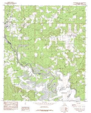
Logansport East Topo Map Louisiana
To zoom in, hover over the map of Logansport East
USGS Topo Quad 31093h8 - 1:24,000 scale
| Topo Map Name: | Logansport East |
| USGS Topo Quad ID: | 31093h8 |
| Print Size: | ca. 21 1/4" wide x 27" high |
| Southeast Coordinates: | 31.875° N latitude / 93.875° W longitude |
| Map Center Coordinates: | 31.9375° N latitude / 93.9375° W longitude |
| U.S. States: | LA, TX |
| Filename: | o31093h8.jpg |
| Download Map JPG Image: | Logansport East topo map 1:24,000 scale |
| Map Type: | Topographic |
| Topo Series: | 7.5´ |
| Map Scale: | 1:24,000 |
| Source of Map Images: | United States Geological Survey (USGS) |
| Alternate Map Versions: |
Logansport East LA 1984, updated 1984 Download PDF Buy paper map Logansport East LA 2003, updated 2004 Download PDF Buy paper map Logansport East LA 2010 Download PDF Buy paper map Logansport East LA 2015 Download PDF Buy paper map |
| FStopo: | US Forest Service topo Logansport East is available: Download FStopo PDF Download FStopo TIF |
1:24,000 Topo Quads surrounding Logansport East
> Back to 31093e1 at 1:100,000 scale
> Back to 31092a1 at 1:250,000 scale
> Back to U.S. Topo Maps home
Logansport East topo map: Gazetteer
Logansport East: Guts
Big Slough elevation 53m 173′Logansport East: Islands
Pine Island elevation 53m 173′Logansport East: Lakes
Ashton Lake elevation 53m 173′Cawthorn Lake elevation 56m 183′
Gum Pond elevation 52m 170′
Horseshoe Lake elevation 53m 173′
Logansport East: Oilfields
Cypress Branch Gas Field elevation 75m 246′Logansport Gas Field elevation 60m 196′
Logansport East: Parks
North Toledo Bend Wildlife Mangement Area elevation 54m 177′Logansport East: Populated Places
Logansport elevation 65m 213′Paragon (historical) elevation 84m 275′
Stanley elevation 95m 311′
Logansport East: Streams
Bayou Castor elevation 52m 170′Bayou Grand Cane elevation 54m 177′
Big Branch elevation 52m 170′
Canadian Bayou elevation 58m 190′
Clark Branch elevation 57m 187′
Clemar Creek elevation 55m 180′
Cypress Branch elevation 52m 170′
Petty Creek elevation 52m 170′
Roberts Branch elevation 52m 170′
Rocky Branch elevation 52m 170′
Styles Creek elevation 52m 170′
Yellow Branch elevation 52m 170′
Logansport East digital topo map on disk
Buy this Logansport East topo map showing relief, roads, GPS coordinates and other geographical features, as a high-resolution digital map file on DVD:


