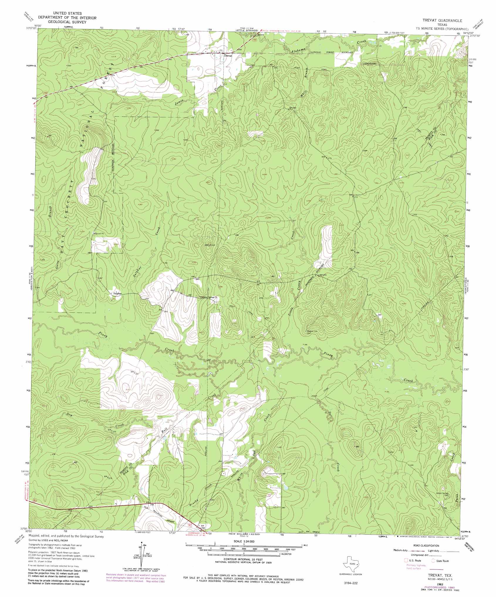
Trevat Topo Map Texas
To zoom in, hover over the map of Trevat
USGS Topo Quad 31094a8 - 1:24,000 scale
| Topo Map Name: | Trevat |
| USGS Topo Quad ID: | 31094a8 |
| Print Size: | ca. 21 1/4" wide x 27" high |
| Southeast Coordinates: | 31° N latitude / 94.875° W longitude |
| Map Center Coordinates: | 31.0625° N latitude / 94.9375° W longitude |
| U.S. State: | TX |
| Filename: | o31094a8.jpg |
| Download Map JPG Image: | Trevat topo map 1:24,000 scale |
| Map Type: | Topographic |
| Topo Series: | 7.5´ |
| Map Scale: | 1:24,000 |
| Source of Map Images: | United States Geological Survey (USGS) |
| Alternate Map Versions: |
Trevat TX 1963, updated 1966 Download PDF Buy paper map Trevat TX 1963, updated 1980 Download PDF Buy paper map Trevat TX 1963, updated 1984 Download PDF Buy paper map Trevat TX 2004, updated 2006 Download PDF Buy paper map Trevat TX 2010 Download PDF Buy paper map Trevat TX 2013 Download PDF Buy paper map Trevat TX 2016 Download PDF Buy paper map |
| FStopo: | US Forest Service topo Trevat is available: Download FStopo PDF Download FStopo TIF |
1:24,000 Topo Quads surrounding Trevat
Kennard |
Centralia |
Wells Sw |
Keltys |
Lufkin |
Pennington |
Crecy |
Apple Springs |
Diboll |
Bald Hill |
Groveton West |
Groveton East |
Trevat |
Wakefield |
Pluck |
Chita |
Colita |
Carmona |
Corrigan |
Camden |
Carlisle |
Onalaska |
New Willard |
Leggett |
Hortense |
> Back to 31094a1 at 1:100,000 scale
> Back to 31094a1 at 1:250,000 scale
> Back to U.S. Topo Maps home
Trevat topo map: Gazetteer
Trevat: Populated Places
Sulphur elevation 73m 239′Trevat elevation 70m 229′
Trevat: Reservoirs
Dry Lake elevation 67m 219′Trevat: Streams
Adams Spring Branch elevation 63m 206′Brushy Creek elevation 67m 219′
Brushy Creek elevation 66m 216′
Bull Creek elevation 61m 200′
Dry Creek elevation 64m 209′
James Creek elevation 57m 187′
James Creek elevation 58m 190′
Little Caney Creek elevation 58m 190′
Little Caney Creek elevation 57m 187′
North Creek elevation 58m 190′
North Creek elevation 58m 190′
Salt Creek elevation 58m 190′
Salt Creek elevation 57m 187′
Sulphur Creek elevation 61m 200′
White Branch elevation 55m 180′
White Branch elevation 54m 177′
White Oak Creek elevation 57m 187′
White Oak Creek elevation 58m 190′
Trevat digital topo map on disk
Buy this Trevat topo map showing relief, roads, GPS coordinates and other geographical features, as a high-resolution digital map file on DVD: