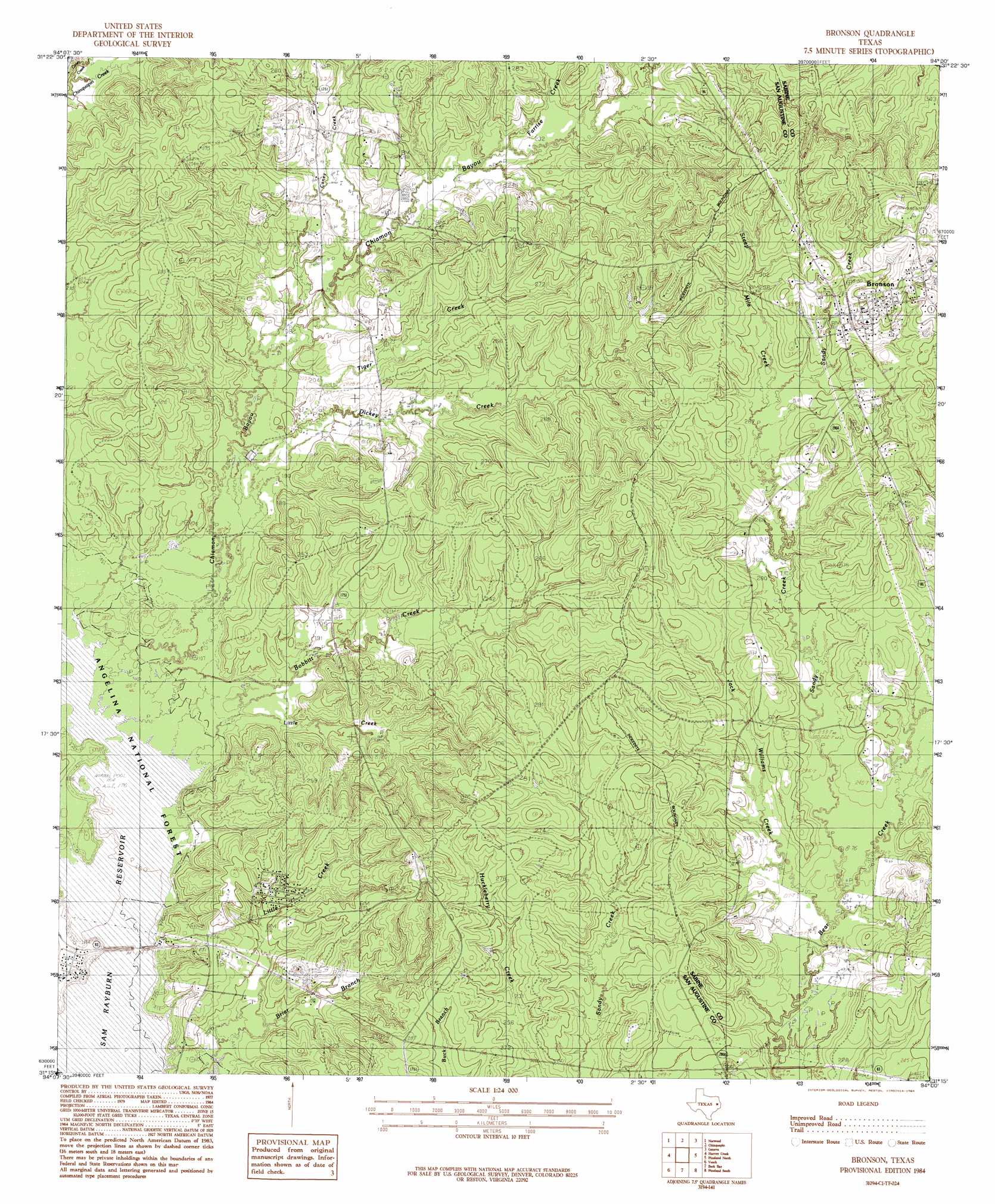
Bronson Topo Map Texas
To zoom in, hover over the map of Bronson
USGS Topo Quad 31094c1 - 1:24,000 scale
| Topo Map Name: | Bronson |
| USGS Topo Quad ID: | 31094c1 |
| Print Size: | ca. 21 1/4" wide x 27" high |
| Southeast Coordinates: | 31.25° N latitude / 94° W longitude |
| Map Center Coordinates: | 31.3125° N latitude / 94.0625° W longitude |
| U.S. State: | TX |
| Filename: | o31094c1.jpg |
| Download Map JPG Image: | Bronson topo map 1:24,000 scale |
| Map Type: | Topographic |
| Topo Series: | 7.5´ |
| Map Scale: | 1:24,000 |
| Source of Map Images: | United States Geological Survey (USGS) |
| Alternate Map Versions: |
Bronson TX 1984, updated 1984 Download PDF Buy paper map Bronson TX 2010 Download PDF Buy paper map Bronson TX 2013 Download PDF Buy paper map Bronson TX 2016 Download PDF Buy paper map |
| FStopo: | US Forest Service topo Bronson is available: Download FStopo PDF Download FStopo TIF |
1:24,000 Topo Quads surrounding Bronson
Chireno North |
San Augustine West |
San Augustine East |
Patroon South |
East Hamilton |
Chireno South |
Norwood |
Chinquapin |
Geneva |
Milam |
Broaddus |
Harvey Creek |
Bronson |
Pineland North |
Hemphill |
Cassells-Boykin Park |
Veach |
Buck Bay |
Pineland South |
Hurricane Creek |
Boykin Spring |
Ebenezer |
Mcgee Bend |
Harrisburg |
Weeks Settlement |
> Back to 31094a1 at 1:100,000 scale
> Back to 31094a1 at 1:250,000 scale
> Back to U.S. Topo Maps home
Bronson topo map: Gazetteer
Bronson: Populated Places
Anthony Harbor elevation 57m 187′Blue Springs elevation 99m 324′
Bronson elevation 97m 318′
Glen Oaks elevation 62m 203′
Bronson: Streams
Bobbitt Creek elevation 52m 170′Caney Creek elevation 61m 200′
Caney Creek elevation 61m 200′
Chiamon Bayou elevation 50m 164′
Copelle Creek elevation 50m 164′
Dickey Creek elevation 57m 187′
Farrise Creek elevation 67m 219′
Goose Branch elevation 50m 164′
Jack Williams Creek elevation 64m 209′
Little Creek elevation 54m 177′
Little Creek elevation 56m 183′
Sandy Creek elevation 64m 209′
Sandy Creek elevation 51m 167′
Steep Mile Creek elevation 83m 272′
Tiger Creek elevation 58m 190′
Tilde Creek elevation 50m 164′
Bronson digital topo map on disk
Buy this Bronson topo map showing relief, roads, GPS coordinates and other geographical features, as a high-resolution digital map file on DVD: