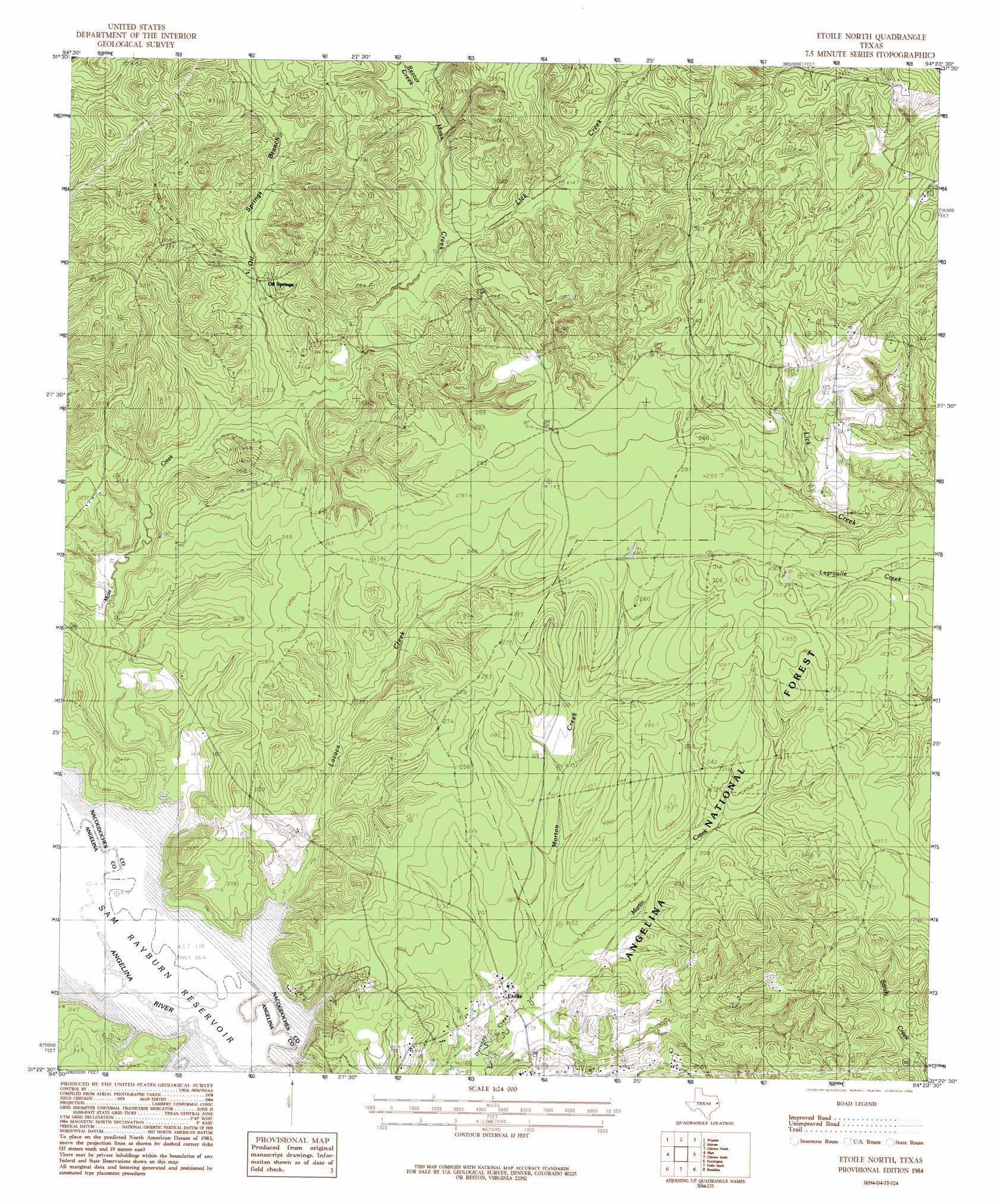
Etoile North Topo Map Texas
To zoom in, hover over the map of Etoile North
USGS Topo Quad 31094d4 - 1:24,000 scale
| Topo Map Name: | Etoile North |
| USGS Topo Quad ID: | 31094d4 |
| Print Size: | ca. 21 1/4" wide x 27" high |
| Southeast Coordinates: | 31.375° N latitude / 94.375° W longitude |
| Map Center Coordinates: | 31.4375° N latitude / 94.4375° W longitude |
| U.S. State: | TX |
| Filename: | o31094d4.jpg |
| Download Map JPG Image: | Etoile North topo map 1:24,000 scale |
| Map Type: | Topographic |
| Topo Series: | 7.5´ |
| Map Scale: | 1:24,000 |
| Source of Map Images: | United States Geological Survey (USGS) |
| Alternate Map Versions: |
Etoile North TX 1984, updated 1984 Download PDF Buy paper map Etoile North TX 2010 Download PDF Buy paper map Etoile North TX 2013 Download PDF Buy paper map Etoile North TX 2016 Download PDF Buy paper map |
| FStopo: | US Forest Service topo Etoile North is available: Download FStopo PDF Download FStopo TIF |
1:24,000 Topo Quads surrounding Etoile North
Nacogdoches North |
Appleby |
Martinsville |
Mount Herman |
Neuville |
Nacogdoches South |
Woden |
Melrose |
Chireno North |
San Augustine West |
Redland |
Platt |
Etoile North |
Chireno South |
Norwood |
Lufkin |
Huntington |
Etoile South |
Broaddus |
Harvey Creek |
Bald Hill |
Manning |
Zavalla |
Cassells-Boykin Park |
Veach |
> Back to 31094a1 at 1:100,000 scale
> Back to 31094a1 at 1:250,000 scale
> Back to U.S. Topo Maps home
Etoile North topo map: Gazetteer
Etoile North: Guts
Marion Slough elevation 50m 164′Walker Slough elevation 50m 164′
Etoile North: Islands
Big Island elevation 50m 164′Etoile North: Parks
Etoile Park elevation 64m 209′Etoile North: Populated Places
Clear Springs elevation 110m 360′Etoile elevation 58m 190′
La Cerda elevation 89m 291′
Suttons Mill elevation 73m 239′
Etoile North: Streams
Lavaca Creek elevation 50m 164′Lick Creek elevation 65m 213′
Martin Creek elevation 54m 177′
Morton Creek elevation 54m 177′
Moss Creek elevation 50m 164′
Oil Springs Branch elevation 58m 190′
Rector Creek elevation 69m 226′
Terrapin Creek elevation 94m 308′
Etoile North: Wells
Oil Springs Oil Field Discovery Well elevation 76m 249′Etoile North digital topo map on disk
Buy this Etoile North topo map showing relief, roads, GPS coordinates and other geographical features, as a high-resolution digital map file on DVD: