San Augustine West Topo Map Texas
To zoom in, hover over the map of San Augustine West
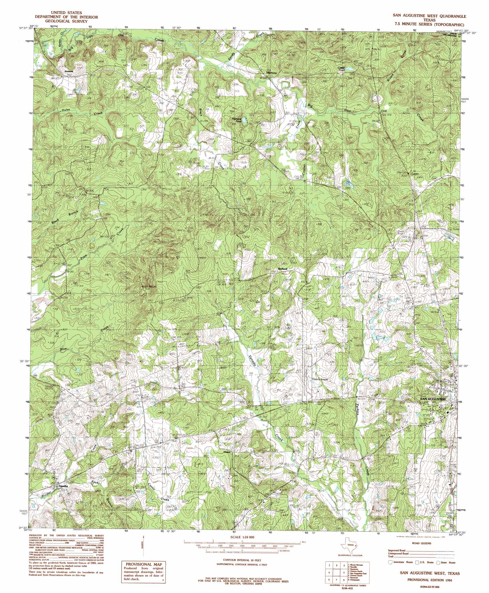
USGS Topo Quad 31094e2 - 1:24,000 scale
| Topo Map Name: | San Augustine West |
| USGS Topo Quad ID: | 31094e2 |
| Print Size: | ca. 21 1/4" wide x 27" high |
| Southeast Coordinates: | 31.5° N latitude / 94.125° W longitude |
| Map Center Coordinates: | 31.5625° N latitude / 94.1875° W longitude |
| U.S. State: | TX |
| Filename: | o31094e2.jpg |
| Download Map JPG Image: | San Augustine West topo map 1:24,000 scale |
| Map Type: | Topographic |
| Topo Series: | 7.5´ |
| Map Scale: | 1:24,000 |
| Source of Map Images: | United States Geological Survey (USGS) |
| Alternate Map Versions: |
San Augustine West TX 1984, updated 1985 Download PDF Buy paper map San Augustine West TX 2010 Download PDF Buy paper map San Augustine West TX 2013 Download PDF Buy paper map San Augustine West TX 2016 Download PDF Buy paper map |
1:24,000 Topo Quads surrounding San Augustine West
Garrison East |
Arcadia |
Center |
Shelbyville |
Huxley |
Martinsville |
Mount Herman |
Neuville |
Hurstown |
Patroon North |
Melrose |
Chireno North |
San Augustine West |
San Augustine East |
Patroon South |
Etoile North |
Chireno South |
Norwood |
Chinquapin |
Geneva |
Etoile South |
Broaddus |
Harvey Creek |
Bronson |
Pineland North |
> Back to 31094e1 at 1:100,000 scale
> Back to 31094a1 at 1:250,000 scale
> Back to U.S. Topo Maps home
San Augustine West topo map: Gazetteer
San Augustine West: Airports
San Augustine County Airport elevation 129m 423′San Augustine West: Lakes
Cattail Pond elevation 108m 354′Highland Pond elevation 96m 314′
San Augustine West: Parks
Blount Park elevation 119m 390′San Augustine West: Populated Places
Denning elevation 93m 305′Harmony elevation 103m 337′
Ironosa elevation 101m 331′
Redland elevation 157m 515′
Union elevation 123m 403′
San Augustine West: Streams
Couller Creek elevation 90m 295′McKeever Creek elevation 78m 255′
Odell Creek elevation 73m 239′
Rivers Creek elevation 91m 298′
Rocky Branch elevation 76m 249′
Sandy Creek elevation 82m 269′
San Augustine West digital topo map on disk
Buy this San Augustine West topo map showing relief, roads, GPS coordinates and other geographical features, as a high-resolution digital map file on DVD: