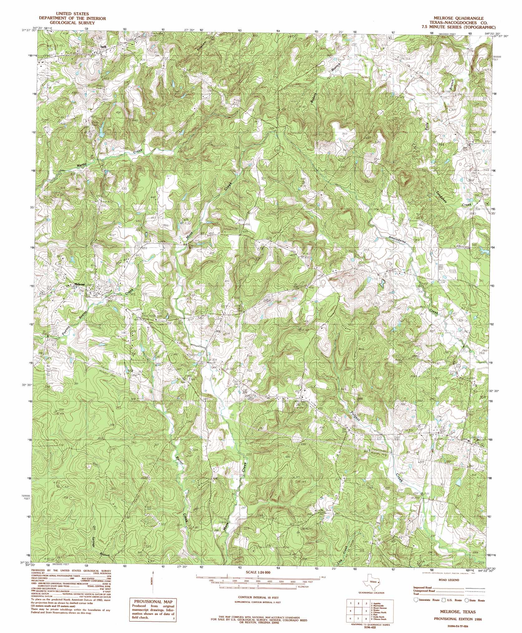
Melrose Topo Map Texas
To zoom in, hover over the map of Melrose
USGS Topo Quad 31094e4 - 1:24,000 scale
| Topo Map Name: | Melrose |
| USGS Topo Quad ID: | 31094e4 |
| Print Size: | ca. 21 1/4" wide x 27" high |
| Southeast Coordinates: | 31.5° N latitude / 94.375° W longitude |
| Map Center Coordinates: | 31.5625° N latitude / 94.4375° W longitude |
| U.S. State: | TX |
| Filename: | o31094e4.jpg |
| Download Map JPG Image: | Melrose topo map 1:24,000 scale |
| Map Type: | Topographic |
| Topo Series: | 7.5´ |
| Map Scale: | 1:24,000 |
| Source of Map Images: | United States Geological Survey (USGS) |
| Alternate Map Versions: |
Melrose TX 1984, updated 1985 Download PDF Buy paper map Melrose TX 2010 Download PDF Buy paper map Melrose TX 2013 Download PDF Buy paper map Melrose TX 2016 Download PDF Buy paper map |
1:24,000 Topo Quads surrounding Melrose
Trawick |
Garrison West |
Garrison East |
Arcadia |
Center |
Nacogdoches North |
Appleby |
Martinsville |
Mount Herman |
Neuville |
Nacogdoches South |
Woden |
Melrose |
Chireno North |
San Augustine West |
Redland |
Platt |
Etoile North |
Chireno South |
Norwood |
Lufkin |
Huntington |
Etoile South |
Broaddus |
Harvey Creek |
> Back to 31094e1 at 1:100,000 scale
> Back to 31094a1 at 1:250,000 scale
> Back to U.S. Topo Maps home
Melrose digital topo map on disk
Buy this Melrose topo map showing relief, roads, GPS coordinates and other geographical features, as a high-resolution digital map file on DVD: