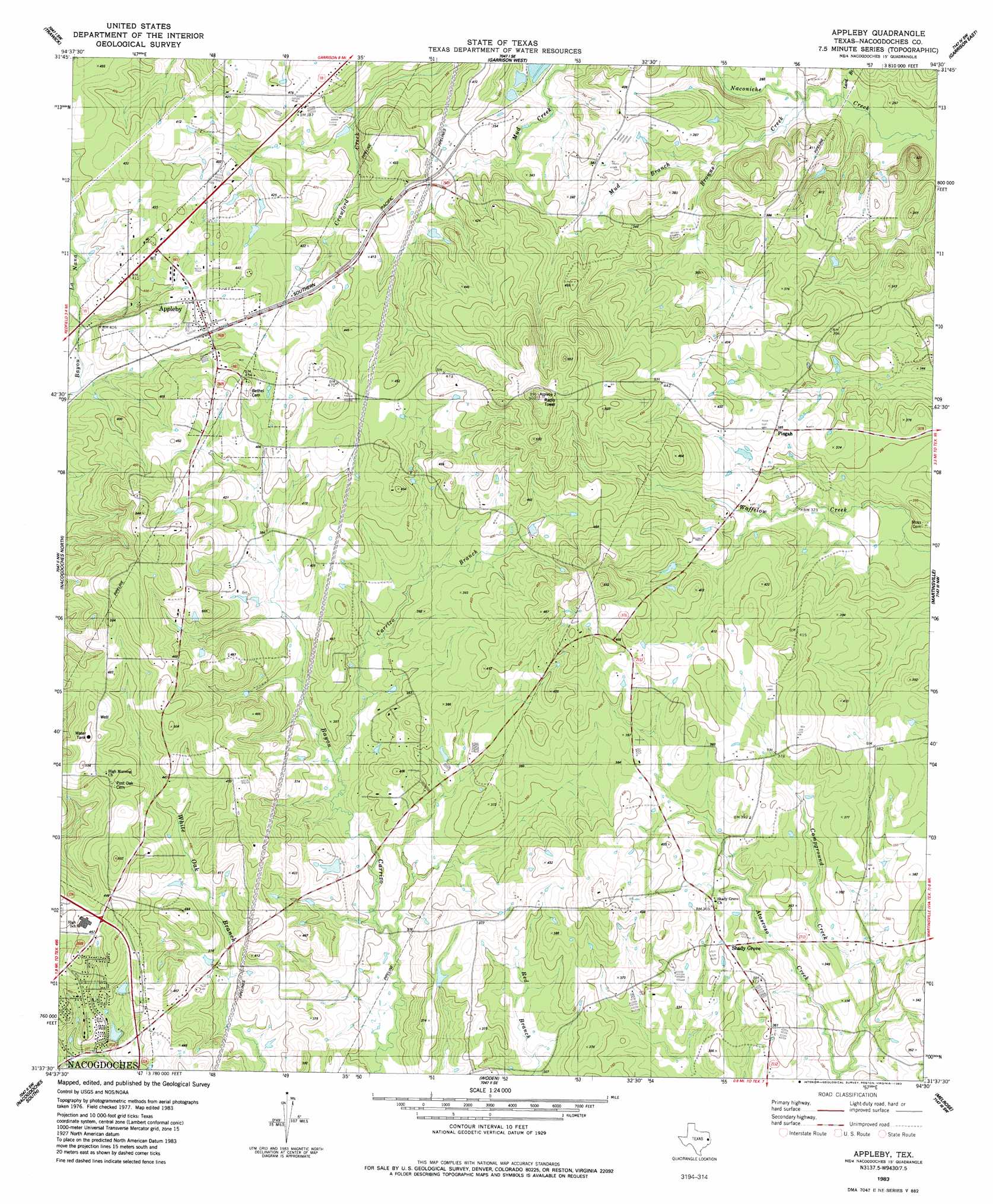
Appleby Topo Map Texas
To zoom in, hover over the map of Appleby
USGS Topo Quad 31094f5 - 1:24,000 scale
| Topo Map Name: | Appleby |
| USGS Topo Quad ID: | 31094f5 |
| Print Size: | ca. 21 1/4" wide x 27" high |
| Southeast Coordinates: | 31.625° N latitude / 94.5° W longitude |
| Map Center Coordinates: | 31.6875° N latitude / 94.5625° W longitude |
| U.S. State: | TX |
| Filename: | o31094f5.jpg |
| Download Map JPG Image: | Appleby topo map 1:24,000 scale |
| Map Type: | Topographic |
| Topo Series: | 7.5´ |
| Map Scale: | 1:24,000 |
| Source of Map Images: | United States Geological Survey (USGS) |
| Alternate Map Versions: |
Appleby TX 1983, updated 1983 Download PDF Buy paper map Appleby TX 2010 Download PDF Buy paper map Appleby TX 2013 Download PDF Buy paper map Appleby TX 2016 Download PDF Buy paper map |
1:24,000 Topo Quads surrounding Appleby
Laneville |
Mount Enterprise |
Caledonia |
Timpson |
Tenaha West |
Cushing |
Trawick |
Garrison West |
Garrison East |
Arcadia |
Lake Nacogdoches North |
Nacogdoches North |
Appleby |
Martinsville |
Mount Herman |
Lake Nacogdoches South |
Nacogdoches South |
Woden |
Melrose |
Chireno North |
Clawson |
Redland |
Platt |
Etoile North |
Chireno South |
> Back to 31094e1 at 1:100,000 scale
> Back to 31094a1 at 1:250,000 scale
> Back to U.S. Topo Maps home
Appleby topo map: Gazetteer
Appleby: Dams
Soil Conservation Service Site 21 Dam elevation 87m 285′Appleby: Populated Places
Appleby elevation 125m 410′Pisgah elevation 118m 387′
Shady Grove elevation 108m 354′
Appleby: Reservoirs
Soil Conservation Service Site 21 Reservoir elevation 87m 285′Appleby: Streams
Browns Creek elevation 85m 278′Campground Creek elevation 88m 288′
Carrizo Branch elevation 95m 311′
Lard Branch elevation 84m 275′
Mud Branch elevation 91m 298′
Peterson Branch elevation 88m 288′
Red Branch elevation 116m 380′
Appleby digital topo map on disk
Buy this Appleby topo map showing relief, roads, GPS coordinates and other geographical features, as a high-resolution digital map file on DVD: