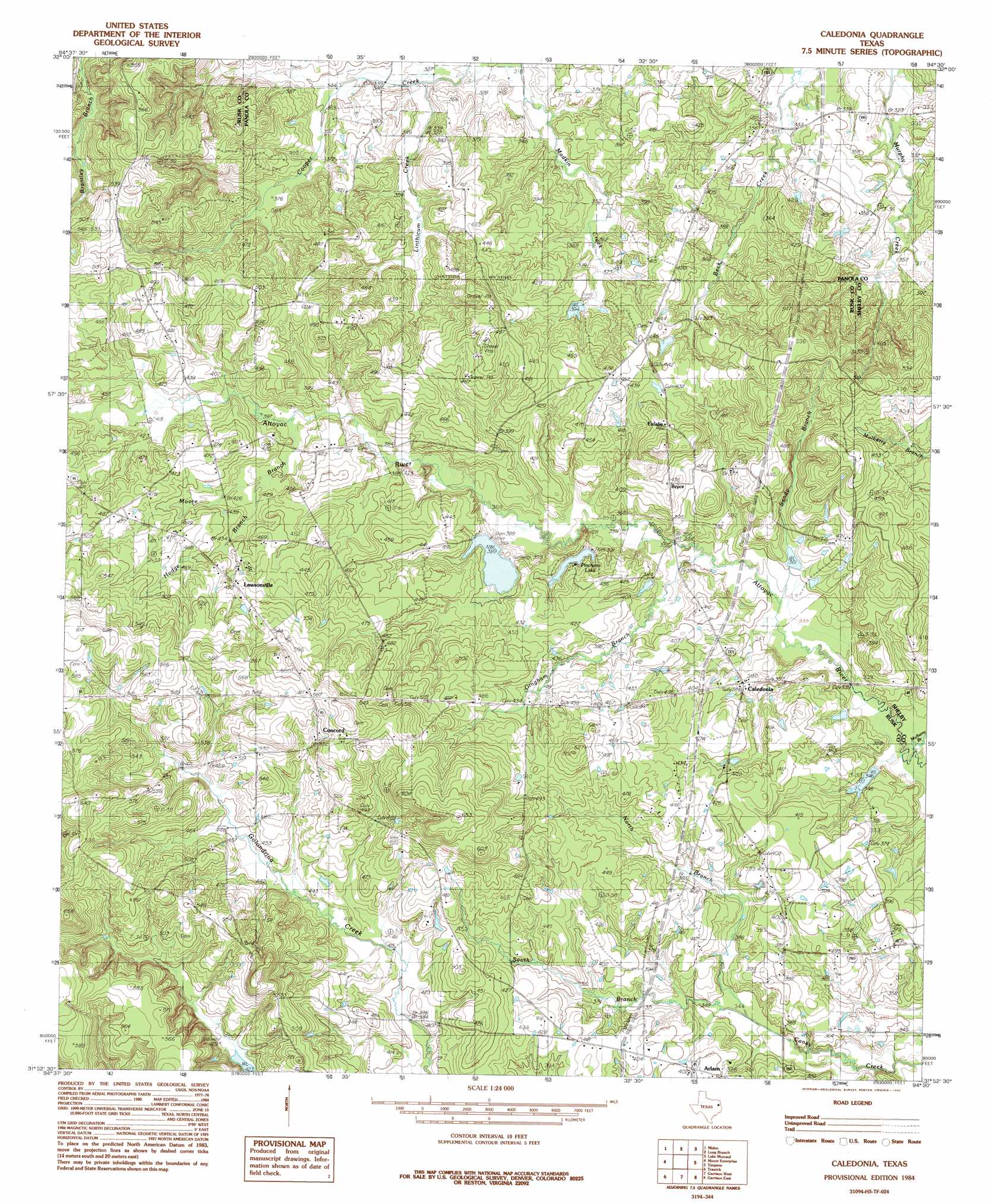
Caledonia Topo Map Texas
To zoom in, hover over the map of Caledonia
USGS Topo Quad 31094h5 - 1:24,000 scale
| Topo Map Name: | Caledonia |
| USGS Topo Quad ID: | 31094h5 |
| Print Size: | ca. 21 1/4" wide x 27" high |
| Southeast Coordinates: | 31.875° N latitude / 94.5° W longitude |
| Map Center Coordinates: | 31.9375° N latitude / 94.5625° W longitude |
| U.S. State: | TX |
| Filename: | o31094h5.jpg |
| Download Map JPG Image: | Caledonia topo map 1:24,000 scale |
| Map Type: | Topographic |
| Topo Series: | 7.5´ |
| Map Scale: | 1:24,000 |
| Source of Map Images: | United States Geological Survey (USGS) |
| Alternate Map Versions: |
Caledonia TX 1984, updated 1985 Download PDF Buy paper map Caledonia TX 2010 Download PDF Buy paper map Caledonia TX 2013 Download PDF Buy paper map Caledonia TX 2016 Download PDF Buy paper map |
1:24,000 Topo Quads surrounding Caledonia
Henderson |
Church Hill |
Fair Play |
Beckville |
Carthage |
Berryhill Creek |
Minden |
Long Branch |
Lake Murvaul |
Gary |
Laneville |
Mount Enterprise |
Caledonia |
Timpson |
Tenaha West |
Cushing |
Trawick |
Garrison West |
Garrison East |
Arcadia |
Lake Nacogdoches North |
Nacogdoches North |
Appleby |
Martinsville |
Mount Herman |
> Back to 31094e1 at 1:100,000 scale
> Back to 31094a1 at 1:250,000 scale
> Back to U.S. Topo Maps home
Caledonia topo map: Gazetteer
Caledonia: Dams
Soil Conservation Service Site 2 Dam elevation 117m 383′Soil Conservation Service Site 5 Dam elevation 106m 347′
Caledonia: Populated Places
Arlam elevation 122m 400′Bryce elevation 136m 446′
Caledonia elevation 119m 390′
Concord elevation 159m 521′
Lawsonville elevation 143m 469′
Caledonia: Reservoirs
Soil Conservation Service Site 2 Reservoir elevation 117m 383′Soil Conservation Service Site 5 Reservoir elevation 106m 347′
Caledonia: Streams
Gingham Branch elevation 105m 344′Hodge Branch elevation 123m 403′
Linthicum Creek elevation 96m 314′
Moore Branch elevation 120m 393′
Mulberry Branch elevation 100m 328′
North Branch Caney Creek elevation 104m 341′
Sandy Branch elevation 103m 337′
South Branch Caney Creek elevation 104m 341′
Caledonia digital topo map on disk
Buy this Caledonia topo map showing relief, roads, GPS coordinates and other geographical features, as a high-resolution digital map file on DVD: