Pennington Topo Map Texas
To zoom in, hover over the map of Pennington
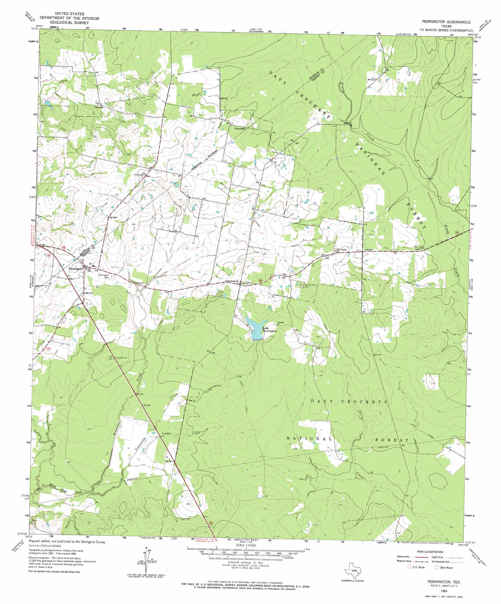
USGS Topo Quad 31095b2 - 1:24,000 scale
| Topo Map Name: | Pennington |
| USGS Topo Quad ID: | 31095b2 |
| Print Size: | ca. 21 1/4" wide x 27" high |
| Southeast Coordinates: | 31.125° N latitude / 95.125° W longitude |
| Map Center Coordinates: | 31.1875° N latitude / 95.1875° W longitude |
| U.S. State: | TX |
| Filename: | o31095b2.jpg |
| Download Map JPG Image: | Pennington topo map 1:24,000 scale |
| Map Type: | Topographic |
| Topo Series: | 7.5´ |
| Map Scale: | 1:24,000 |
| Source of Map Images: | United States Geological Survey (USGS) |
| Alternate Map Versions: |
Pennington TX 1963, updated 1964 Download PDF Buy paper map Pennington TX 1963, updated 1968 Download PDF Buy paper map Pennington TX 2011 Download PDF Buy paper map Pennington TX 2013 Download PDF Buy paper map Pennington TX 2016 Download PDF Buy paper map |
| FStopo: | US Forest Service topo Pennington is available: Download FStopo PDF Download FStopo TIF |
1:24,000 Topo Quads surrounding Pennington
Grapeland |
Crockett Ne |
Ratcliff |
Kennard Ne |
Wells |
Crockett |
Berea |
Kennard |
Centralia |
Wells Sw |
Lovelady North |
Fodice |
Pennington |
Crecy |
Apple Springs |
Lovelady South |
Glendale |
Groveton West |
Groveton East |
Trevat |
Trinity West |
Trinity East |
Chita |
Colita |
Carmona |
> Back to 31095a1 at 1:100,000 scale
> Back to 31094a1 at 1:250,000 scale
> Back to U.S. Topo Maps home
Pennington topo map: Gazetteer
Pennington: Dams
Lake Pennington Dam elevation 102m 334′Westbrook Lake Dam elevation 106m 347′
Pennington: Populated Places
Friendship elevation 108m 354′Pennington elevation 105m 344′
Pennington: Reservoirs
Lake Pennington elevation 107m 351′Westbrook Lake elevation 106m 347′
Pennington: Streams
Brownlee Creek elevation 73m 239′Copper Creek elevation 81m 265′
Louisville Creek elevation 74m 242′
Pennington digital topo map on disk
Buy this Pennington topo map showing relief, roads, GPS coordinates and other geographical features, as a high-resolution digital map file on DVD: