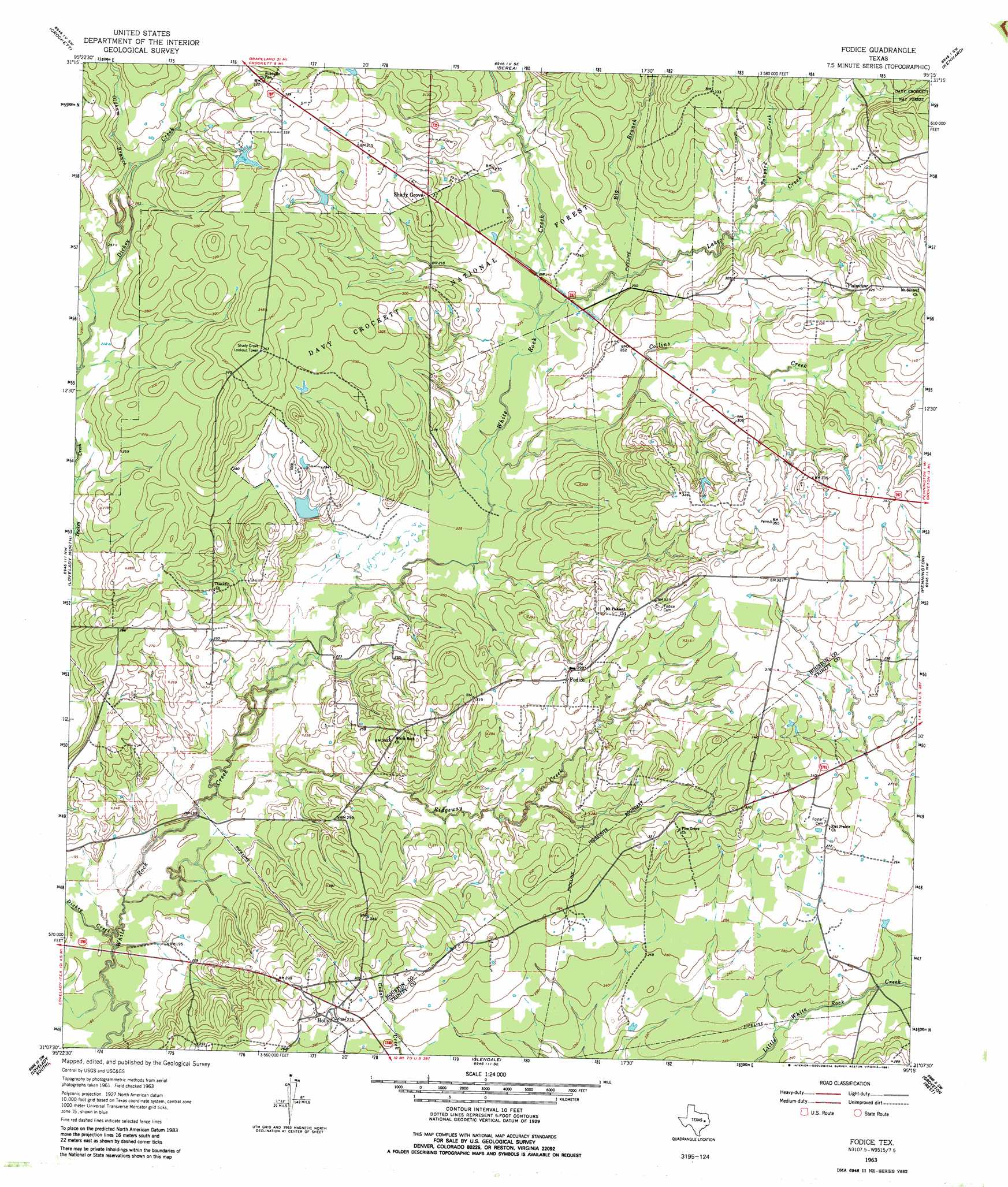
Fodice Topo Map Texas
To zoom in, hover over the map of Fodice
USGS Topo Quad 31095b3 - 1:24,000 scale
| Topo Map Name: | Fodice |
| USGS Topo Quad ID: | 31095b3 |
| Print Size: | ca. 21 1/4" wide x 27" high |
| Southeast Coordinates: | 31.125° N latitude / 95.25° W longitude |
| Map Center Coordinates: | 31.1875° N latitude / 95.3125° W longitude |
| U.S. State: | TX |
| Filename: | o31095b3.jpg |
| Download Map JPG Image: | Fodice topo map 1:24,000 scale |
| Map Type: | Topographic |
| Topo Series: | 7.5´ |
| Map Scale: | 1:24,000 |
| Source of Map Images: | United States Geological Survey (USGS) |
| Alternate Map Versions: |
Fodice TX 1963, updated 1965 Download PDF Buy paper map Fodice TX 1963, updated 1981 Download PDF Buy paper map Fodice TX 2004, updated 2006 Download PDF Buy paper map Fodice TX 2011 Download PDF Buy paper map Fodice TX 2013 Download PDF Buy paper map Fodice TX 2016 Download PDF Buy paper map |
| FStopo: | US Forest Service topo Fodice is available: Download FStopo PDF Download FStopo TIF |
1:24,000 Topo Quads surrounding Fodice
Hays Spring |
Grapeland |
Crockett Ne |
Ratcliff |
Kennard Ne |
Porter Springs |
Crockett |
Berea |
Kennard |
Centralia |
Pearsons Chapel |
Lovelady North |
Fodice |
Pennington |
Crecy |
Weldon |
Lovelady South |
Glendale |
Groveton West |
Groveton East |
Wyser Bottom |
Trinity West |
Trinity East |
Chita |
Colita |
> Back to 31095a1 at 1:100,000 scale
> Back to 31094a1 at 1:250,000 scale
> Back to U.S. Topo Maps home
Fodice topo map: Gazetteer
Fodice: Dams
Frazier Lake Dam elevation 80m 262′Fodice: Parks
Fodice Marker elevation 91m 298′Fodice: Populated Places
Fodice elevation 91m 298′Holly elevation 85m 278′
Plainview elevation 94m 308′
Shady Grove elevation 94m 308′
Fodice: Reservoirs
Bob Shrivers Tank elevation 80m 262′Frazier Lake elevation 80m 262′
Fodice: Streams
Big Branch elevation 76m 249′Collins Creek elevation 69m 226′
Dickey Creek elevation 55m 180′
East Fork White Rock Creek elevation 71m 232′
Lake Creek elevation 87m 285′
Oldham Branch elevation 78m 255′
Ridgeway Creek elevation 59m 193′
Spring Branch elevation 63m 206′
Tanyard Creek elevation 79m 259′
Fodice digital topo map on disk
Buy this Fodice topo map showing relief, roads, GPS coordinates and other geographical features, as a high-resolution digital map file on DVD: