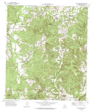
Pryor Mountain Topo Map Texas
To zoom in, hover over the map of Pryor Mountain
USGS Topo Quad 31095f2 - 1:24,000 scale
| Topo Map Name: | Pryor Mountain |
| USGS Topo Quad ID: | 31095f2 |
| Print Size: | ca. 21 1/4" wide x 27" high |
| Southeast Coordinates: | 31.625° N latitude / 95.125° W longitude |
| Map Center Coordinates: | 31.6875° N latitude / 95.1875° W longitude |
| U.S. State: | TX |
| Filename: | o31095f2.jpg |
| Download Map JPG Image: | Pryor Mountain topo map 1:24,000 scale |
| Map Type: | Topographic |
| Topo Series: | 7.5´ |
| Map Scale: | 1:24,000 |
| Source of Map Images: | United States Geological Survey (USGS) |
| Alternate Map Versions: |
Pryor Mountain TX 1973, updated 1976 Download PDF Buy paper map Pryor Mountain TX 2010 Download PDF Buy paper map Pryor Mountain TX 2013 Download PDF Buy paper map Pryor Mountain TX 2016 Download PDF Buy paper map |
1:24,000 Topo Quads surrounding Pryor Mountain
> Back to 31095e1 at 1:100,000 scale
> Back to 31094a1 at 1:250,000 scale
> Back to U.S. Topo Maps home
Pryor Mountain topo map: Gazetteer
Pryor Mountain: Dams
Decker Lake Dam elevation 94m 308′Pryor Mountain: Oilfields
William Wise Oil Field elevation 123m 403′Pryor Mountain: Populated Places
Bulah elevation 104m 341′Hudson Chapel elevation 142m 465′
Lone Oak elevation 144m 472′
Pryor Mountain: Reservoirs
Decker Lake elevation 90m 295′Parks Lake elevation 113m 370′
Pryor Lake elevation 123m 403′
Pryor Mountain: Springs
McCann Spring elevation 119m 390′Pryor Mountain: Streams
Black Branch elevation 109m 357′Collins Branch elevation 80m 262′
Fain Branch elevation 116m 380′
Hall Branch elevation 91m 298′
Hendon Branch elevation 116m 380′
Holliday Branch elevation 85m 278′
Jones Branch elevation 110m 360′
Lewis Branch elevation 95m 311′
Manson Branch elevation 108m 354′
McCann Creek elevation 110m 360′
Merideth Creek elevation 82m 269′
Miller Branch elevation 75m 246′
Newton Branch elevation 91m 298′
Sand Branch elevation 91m 298′
Stevens Branch elevation 91m 298′
Thompson Branch elevation 103m 337′
Walnut Branch elevation 91m 298′
Woodall Branch elevation 110m 360′
Pryor Mountain: Summits
Big Hill elevation 140m 459′Collins Mountain elevation 181m 593′
Fowler Hill elevation 131m 429′
Gibson Mountain elevation 199m 652′
Henry White Mountain elevation 178m 583′
Jones Mountain elevation 199m 652′
Pryor Mountain elevation 210m 688′
Reagan Mountain elevation 199m 652′
Round Mountain elevation 191m 626′
Smith Mountain elevation 184m 603′
Sunshine Mountain elevation 183m 600′
Pryor Mountain: Valleys
Bird Hollow elevation 78m 255′Pryor Mountain digital topo map on disk
Buy this Pryor Mountain topo map showing relief, roads, GPS coordinates and other geographical features, as a high-resolution digital map file on DVD:


