Slocum Topo Map Texas
To zoom in, hover over the map of Slocum
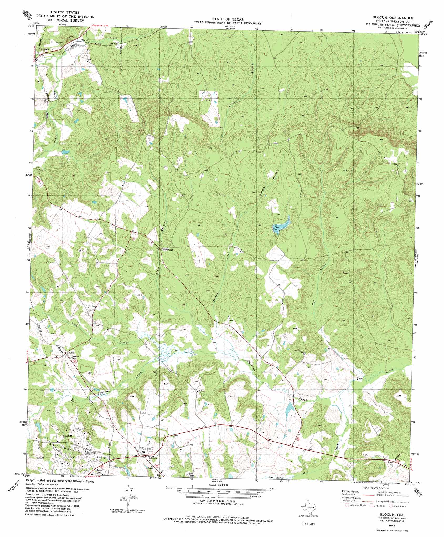
USGS Topo Quad 31095f4 - 1:24,000 scale
| Topo Map Name: | Slocum |
| USGS Topo Quad ID: | 31095f4 |
| Print Size: | ca. 21 1/4" wide x 27" high |
| Southeast Coordinates: | 31.625° N latitude / 95.375° W longitude |
| Map Center Coordinates: | 31.6875° N latitude / 95.4375° W longitude |
| U.S. State: | TX |
| Filename: | o31095f4.jpg |
| Download Map JPG Image: | Slocum topo map 1:24,000 scale |
| Map Type: | Topographic |
| Topo Series: | 7.5´ |
| Map Scale: | 1:24,000 |
| Source of Map Images: | United States Geological Survey (USGS) |
| Alternate Map Versions: |
Slocum TX 1982, updated 1982 Download PDF Buy paper map Slocum TX 1982, updated 1982 Download PDF Buy paper map Slocum TX 2010 Download PDF Buy paper map Slocum TX 2013 Download PDF Buy paper map Slocum TX 2016 Download PDF Buy paper map |
1:24,000 Topo Quads surrounding Slocum
Wilkerson Mountain |
Pert |
Todd City |
Jacksonville West |
Jacksonville East |
Northwest Palestine |
Northeast Palestine |
Neches |
Maydelle |
Rusk |
Southwest Palestine |
Southeast Palestine |
Slocum |
Denson Springs |
Pryor Mountain |
Indian Lake |
Elkhart Creek |
Percilla |
Augusta |
Weches |
Stanmire Lake |
Hays Spring |
Grapeland |
Crockett Ne |
Ratcliff |
> Back to 31095e1 at 1:100,000 scale
> Back to 31094a1 at 1:250,000 scale
> Back to U.S. Topo Maps home
Slocum topo map: Gazetteer
Slocum: Dams
Mays Lake Dam elevation 102m 334′Slocum: Oilfields
Solcum Oil Field elevation 131m 429′Slocum: Populated Places
Alderbranch elevation 112m 367′Kossuth elevation 98m 321′
Slocum elevation 150m 492′
Slocum: Reservoirs
Mays Lake elevation 102m 334′Slocum: Streams
Alder Branch elevation 92m 301′Gal Creek elevation 84m 275′
Snake Creek elevation 94m 308′
Spring Branch elevation 109m 357′
Squirrel Creek elevation 90m 295′
Turkey Creek elevation 90m 295′
Yellow Branch elevation 106m 347′
Slocum: Swamps
Ioni Marsh elevation 98m 321′Slocum digital topo map on disk
Buy this Slocum topo map showing relief, roads, GPS coordinates and other geographical features, as a high-resolution digital map file on DVD: