Blackfoot Topo Map Texas
To zoom in, hover over the map of Blackfoot
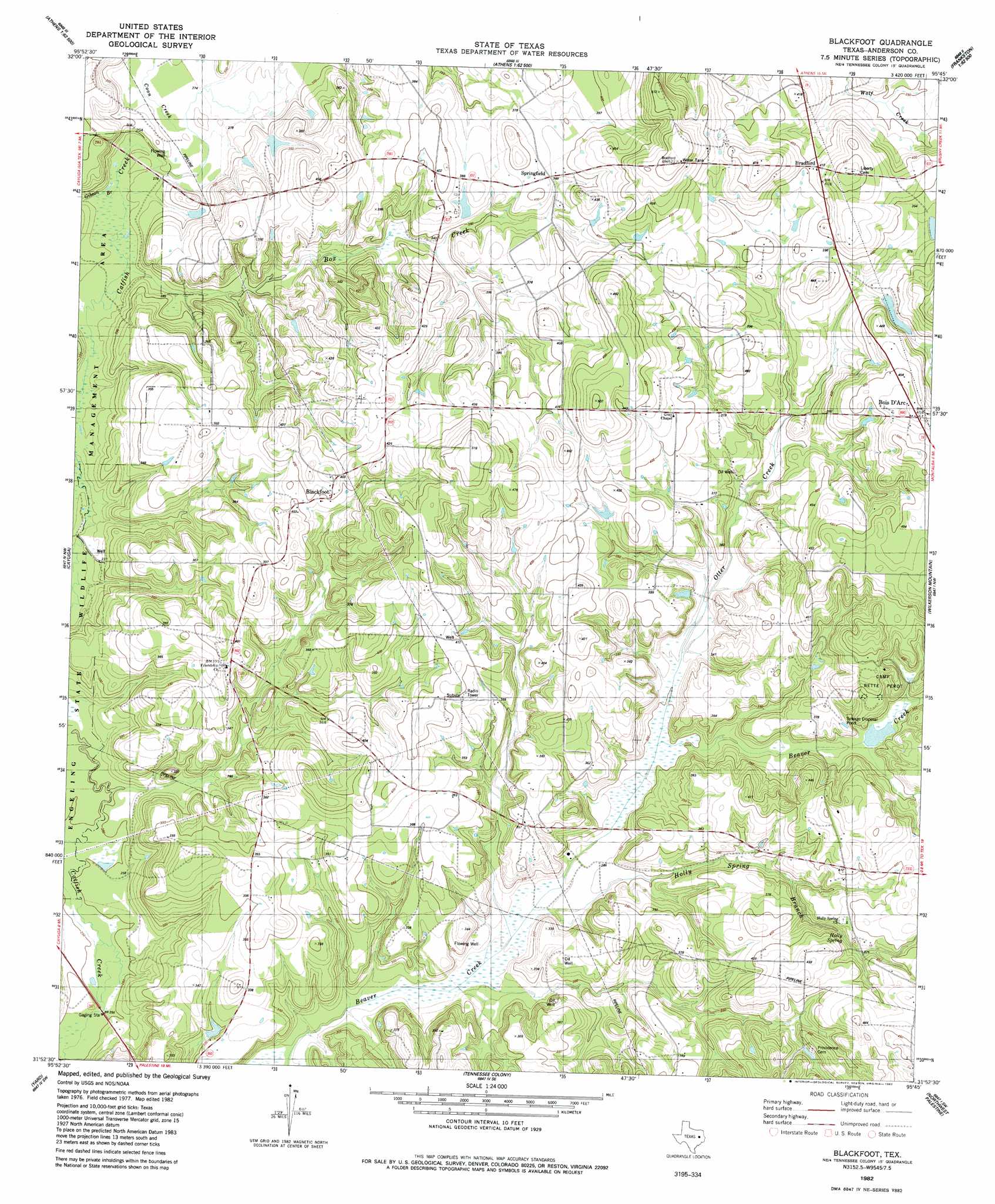
USGS Topo Quad 31095h7 - 1:24,000 scale
| Topo Map Name: | Blackfoot |
| USGS Topo Quad ID: | 31095h7 |
| Print Size: | ca. 21 1/4" wide x 27" high |
| Southeast Coordinates: | 31.875° N latitude / 95.75° W longitude |
| Map Center Coordinates: | 31.9375° N latitude / 95.8125° W longitude |
| U.S. State: | TX |
| Filename: | o31095h7.jpg |
| Download Map JPG Image: | Blackfoot topo map 1:24,000 scale |
| Map Type: | Topographic |
| Topo Series: | 7.5´ |
| Map Scale: | 1:24,000 |
| Source of Map Images: | United States Geological Survey (USGS) |
| Alternate Map Versions: |
Blackfoot TX 1982, updated 1982 Download PDF Buy paper map Blackfoot TX 2010 Download PDF Buy paper map Blackfoot TX 2013 Download PDF Buy paper map Blackfoot TX 2016 Download PDF Buy paper map |
1:24,000 Topo Quads surrounding Blackfoot
Malakoff |
Mallard Hill |
Athens |
Leagueville |
Moore Station |
Creslenn Ranch |
Cross Roads |
Coon Creek Lake |
La Rue |
Poynor |
Roustabout Camp |
Cayuga |
Blackfoot |
Wilkerson Mountain |
Pert |
Young |
Yard |
Tennessee Colony |
Northwest Palestine |
Northeast Palestine |
Turlington |
Butler |
Long Lake |
Southwest Palestine |
Southeast Palestine |
> Back to 31095e1 at 1:100,000 scale
> Back to 31094a1 at 1:250,000 scale
> Back to U.S. Topo Maps home
Blackfoot topo map: Gazetteer
Blackfoot: Dams
Bomer Lake Dam elevation 115m 377′Blackfoot: Oilfields
Blackfoot Oil Field elevation 109m 357′Blackfoot: Populated Places
Blackfoot elevation 119m 390′Bois d'Arc elevation 140m 459′
Bradford elevation 129m 423′
Springfield elevation 119m 390′
Ward elevation 110m 360′
Blackfoot: Reservoirs
Bomer Lake elevation 115m 377′Blackfoot: Springs
Holly Spring elevation 116m 380′Blackfoot: Streams
Coon Creek elevation 85m 278′Gibson Branch elevation 81m 265′
Holly Spring Branch elevation 86m 282′
Otter Creek elevation 91m 298′
Blackfoot digital topo map on disk
Buy this Blackfoot topo map showing relief, roads, GPS coordinates and other geographical features, as a high-resolution digital map file on DVD: