Cayuga Topo Map Texas
To zoom in, hover over the map of Cayuga
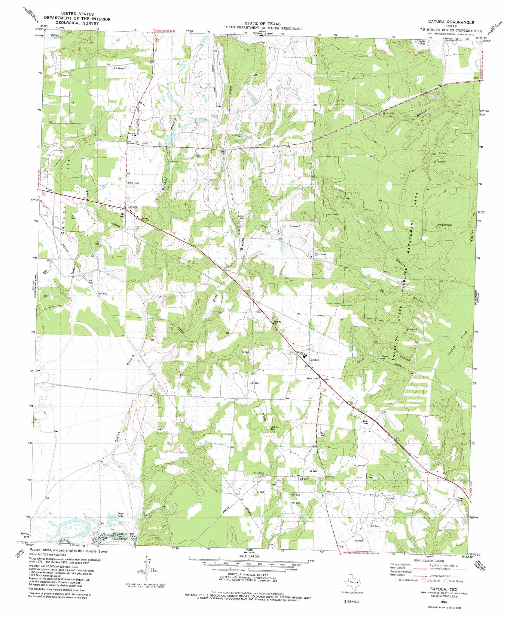
USGS Topo Quad 31095h8 - 1:24,000 scale
| Topo Map Name: | Cayuga |
| USGS Topo Quad ID: | 31095h8 |
| Print Size: | ca. 21 1/4" wide x 27" high |
| Southeast Coordinates: | 31.875° N latitude / 95.875° W longitude |
| Map Center Coordinates: | 31.9375° N latitude / 95.9375° W longitude |
| U.S. State: | TX |
| Filename: | o31095h8.jpg |
| Download Map JPG Image: | Cayuga topo map 1:24,000 scale |
| Map Type: | Topographic |
| Topo Series: | 7.5´ |
| Map Scale: | 1:24,000 |
| Source of Map Images: | United States Geological Survey (USGS) |
| Alternate Map Versions: |
Cayuga TX 1982, updated 1982 Download PDF Buy paper map Cayuga TX 2010 Download PDF Buy paper map Cayuga TX 2013 Download PDF Buy paper map Cayuga TX 2016 Download PDF Buy paper map |
1:24,000 Topo Quads surrounding Cayuga
Kerens |
Malakoff |
Mallard Hill |
Athens |
Leagueville |
Goodlow Park |
Creslenn Ranch |
Cross Roads |
Coon Creek Lake |
La Rue |
Winkler |
Roustabout Camp |
Cayuga |
Blackfoot |
Wilkerson Mountain |
Stewards Mill |
Young |
Yard |
Tennessee Colony |
Northwest Palestine |
Fairfield |
Turlington |
Butler |
Long Lake |
Southwest Palestine |
> Back to 31095e1 at 1:100,000 scale
> Back to 31094a1 at 1:250,000 scale
> Back to U.S. Topo Maps home
Cayuga topo map: Gazetteer
Cayuga: Airports
Lochridge Ranch Airport elevation 116m 380′Cayuga: Dams
Cox Lake Dam elevation 92m 301′Cayuga: Lakes
Duck Lake elevation 72m 236′Cayuga: Parks
Gus Engeling Wildlife Management Area elevation 97m 318′Cayuga: Populated Places
Bethel elevation 113m 370′Cayuga elevation 94m 308′
Cayuga: Reservoirs
Cox Lake elevation 92m 301′Cayuga: Springs
DD Spring elevation 94m 308′Kidd Spring elevation 92m 301′
Cayuga: Streams
Bee Branch elevation 98m 321′Crawford Branch elevation 79m 259′
Hall Branch elevation 73m 239′
Long Branch elevation 77m 252′
Mitchell Branch elevation 73m 239′
Saline Branch elevation 77m 252′
Shore Branch elevation 82m 269′
Short Branch elevation 78m 255′
Skeet Branch elevation 79m 259′
Cayuga digital topo map on disk
Buy this Cayuga topo map showing relief, roads, GPS coordinates and other geographical features, as a high-resolution digital map file on DVD: