Owensville Topo Map Texas
To zoom in, hover over the map of Owensville
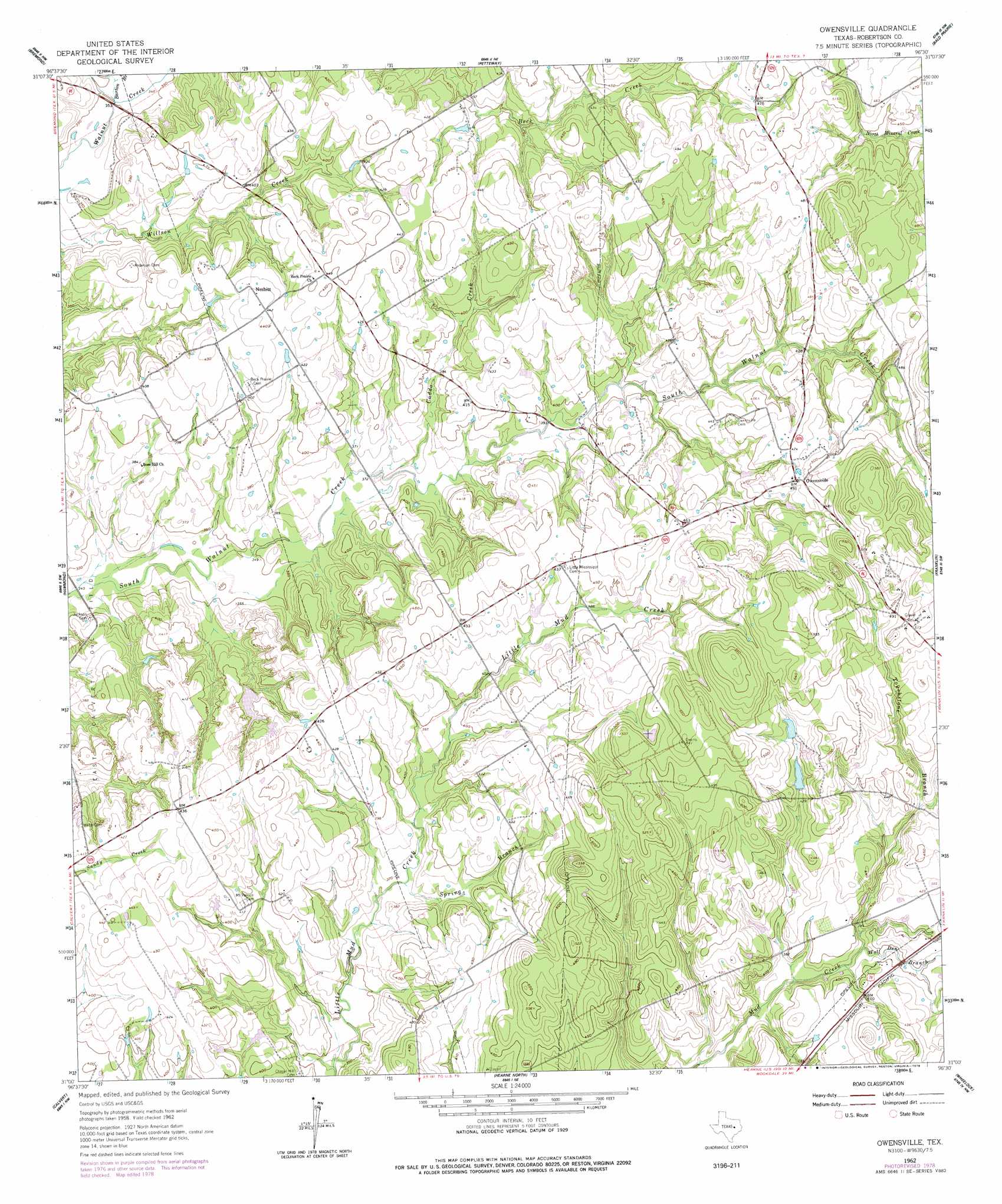
USGS Topo Quad 31096a5 - 1:24,000 scale
| Topo Map Name: | Owensville |
| USGS Topo Quad ID: | 31096a5 |
| Print Size: | ca. 21 1/4" wide x 27" high |
| Southeast Coordinates: | 31° N latitude / 96.5° W longitude |
| Map Center Coordinates: | 31.0625° N latitude / 96.5625° W longitude |
| U.S. State: | TX |
| Filename: | o31096a5.jpg |
| Download Map JPG Image: | Owensville topo map 1:24,000 scale |
| Map Type: | Topographic |
| Topo Series: | 7.5´ |
| Map Scale: | 1:24,000 |
| Source of Map Images: | United States Geological Survey (USGS) |
| Alternate Map Versions: |
Owensville TX 1962, updated 1964 Download PDF Buy paper map Owensville TX 1962, updated 1978 Download PDF Buy paper map Owensville TX 2010 Download PDF Buy paper map Owensville TX 2013 Download PDF Buy paper map Owensville TX 2016 Download PDF Buy paper map |
1:24,000 Topo Quads surrounding Owensville
Mcclanahan |
Kosse West |
Kosse East |
Oletha |
Round Prairie |
Reagan |
Bremond |
Petteway |
Bald Prairie |
Marquez |
Baileyville |
Hammond |
Owensville |
Franklin |
Camp Creek Lake |
Maysfield |
Calvert |
Hearne North |
Wheelock |
Edge |
Hanover |
Gause |
Hearne South |
Dunn Creek |
Kurten |
> Back to 31096a1 at 1:100,000 scale
> Back to 31096a1 at 1:250,000 scale
> Back to U.S. Topo Maps home
Owensville topo map: Gazetteer
Owensville: Airports
Sandbur Ranches Airport elevation 137m 449′Owensville: Dams
Lutz Lake Dam elevation 116m 380′Owensville: Oilfields
East Calvert Oil Field elevation 118m 387′Owensville: Parks
Franklin Lions Stadium elevation 132m 433′Owensville: Populated Places
Nesbitt elevation 134m 439′Owensville elevation 149m 488′
Owensville: Reservoirs
Lutz Lake elevation 116m 380′Owensville: Streams
Barton Branch elevation 107m 351′Caddo Creek elevation 113m 370′
Red Bank Creek elevation 107m 351′
Spring Branch elevation 112m 367′
Touchstone Branch elevation 116m 380′
Wolf Den Branch elevation 116m 380′
Owensville digital topo map on disk
Buy this Owensville topo map showing relief, roads, GPS coordinates and other geographical features, as a high-resolution digital map file on DVD: