Hammond Topo Map Texas
To zoom in, hover over the map of Hammond
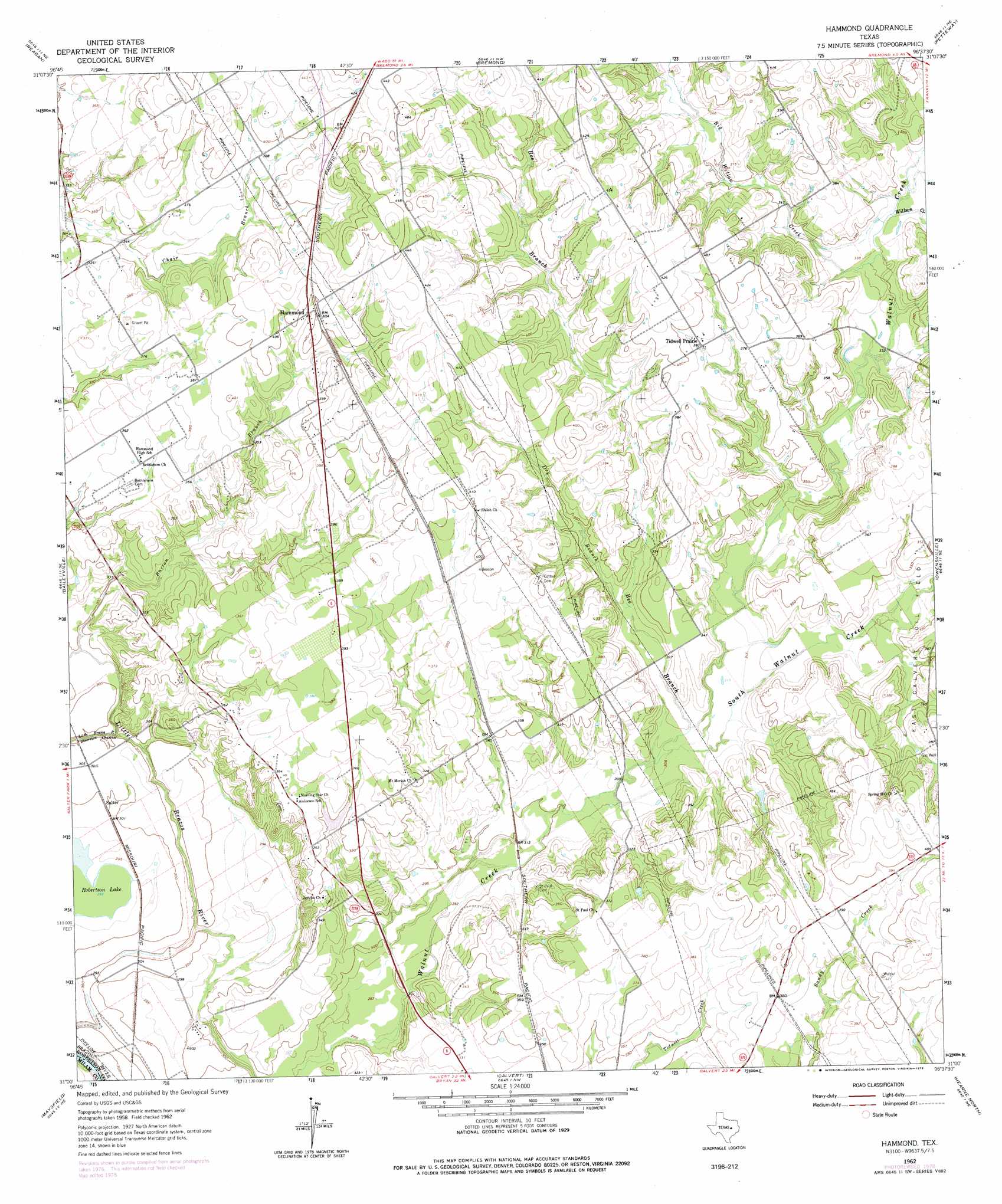
USGS Topo Quad 31096a6 - 1:24,000 scale
| Topo Map Name: | Hammond |
| USGS Topo Quad ID: | 31096a6 |
| Print Size: | ca. 21 1/4" wide x 27" high |
| Southeast Coordinates: | 31° N latitude / 96.625° W longitude |
| Map Center Coordinates: | 31.0625° N latitude / 96.6875° W longitude |
| U.S. State: | TX |
| Filename: | o31096a6.jpg |
| Download Map JPG Image: | Hammond topo map 1:24,000 scale |
| Map Type: | Topographic |
| Topo Series: | 7.5´ |
| Map Scale: | 1:24,000 |
| Source of Map Images: | United States Geological Survey (USGS) |
| Alternate Map Versions: |
Hammond TX 1962, updated 1964 Download PDF Buy paper map Hammond TX 1962, updated 1978 Download PDF Buy paper map Hammond TX 1962, updated 1978 Download PDF Buy paper map Hammond TX 2010 Download PDF Buy paper map Hammond TX 2013 Download PDF Buy paper map Hammond TX 2016 Download PDF Buy paper map |
1:24,000 Topo Quads surrounding Hammond
Marlin |
Mcclanahan |
Kosse West |
Kosse East |
Oletha |
Cedar Springs |
Reagan |
Bremond |
Petteway |
Bald Prairie |
Rosebud |
Baileyville |
Hammond |
Owensville |
Franklin |
Ben Arnold |
Maysfield |
Calvert |
Hearne North |
Wheelock |
Cameron |
Hanover |
Gause |
Hearne South |
Dunn Creek |
> Back to 31096a1 at 1:100,000 scale
> Back to 31096a1 at 1:250,000 scale
> Back to U.S. Topo Maps home
Hammond topo map: Gazetteer
Hammond: Dams
Hall Dam elevation 103m 337′Hammond: Lakes
Robertson Lake elevation 89m 291′Hammond: Populated Places
Hammond elevation 121m 396′Salter elevation 91m 298′
Tidwell Prairie elevation 117m 383′
Hammond: Reservoirs
Hall Lake elevation 103m 337′Hammond: Streams
Barton Branch elevation 89m 291′Bee Branch elevation 100m 328′
Big Willow Creek elevation 101m 331′
Dry Branch elevation 101m 331′
South Walnut Creek elevation 93m 305′
Willson Creek elevation 102m 334′
Hammond digital topo map on disk
Buy this Hammond topo map showing relief, roads, GPS coordinates and other geographical features, as a high-resolution digital map file on DVD: