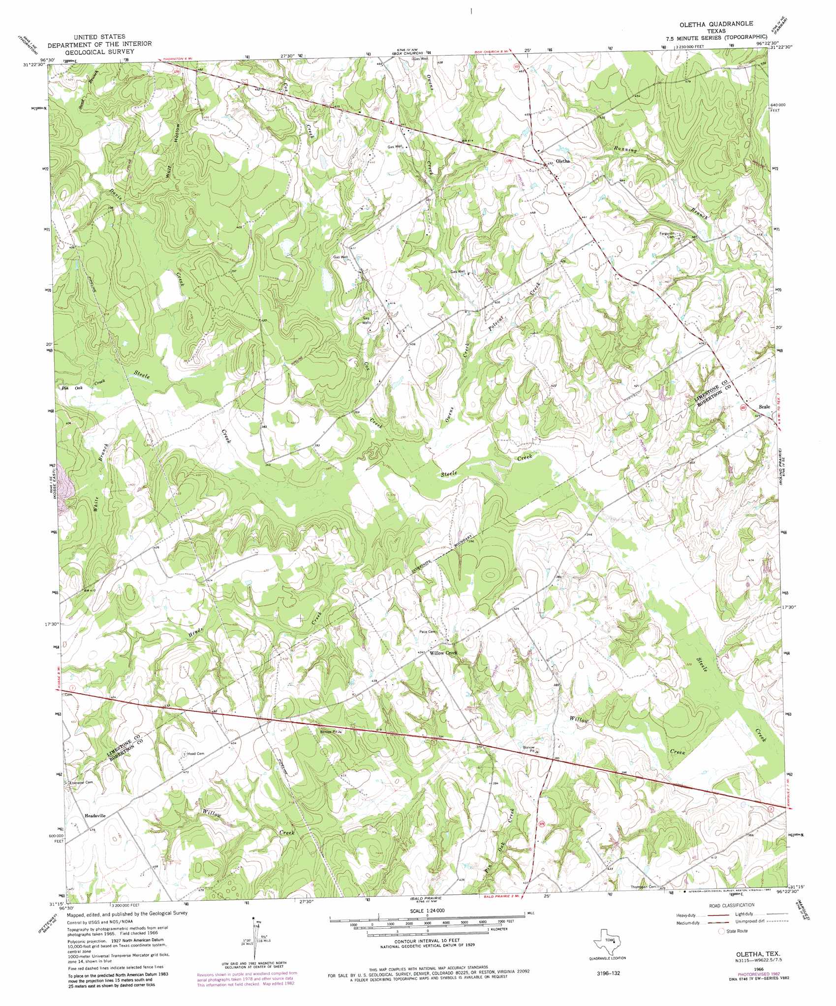
Oletha Topo Map Texas
To zoom in, hover over the map of Oletha
USGS Topo Quad 31096c4 - 1:24,000 scale
| Topo Map Name: | Oletha |
| USGS Topo Quad ID: | 31096c4 |
| Print Size: | ca. 21 1/4" wide x 27" high |
| Southeast Coordinates: | 31.25° N latitude / 96.375° W longitude |
| Map Center Coordinates: | 31.3125° N latitude / 96.4375° W longitude |
| U.S. State: | TX |
| Filename: | o31096c4.jpg |
| Download Map JPG Image: | Oletha topo map 1:24,000 scale |
| Map Type: | Topographic |
| Topo Series: | 7.5´ |
| Map Scale: | 1:24,000 |
| Source of Map Images: | United States Geological Survey (USGS) |
| Alternate Map Versions: |
Oletha TX 1966, updated 1970 Download PDF Buy paper map Oletha TX 1966, updated 1983 Download PDF Buy paper map Oletha TX 2010 Download PDF Buy paper map Oletha TX 2013 Download PDF Buy paper map Oletha TX 2016 Download PDF Buy paper map |
1:24,000 Topo Quads surrounding Oletha
Ben Hur |
Groesbeck |
Fallon |
Teague South |
Dew |
Odds |
Thornton |
Box Church |
Farrar |
Donie |
Kosse West |
Kosse East |
Oletha |
Round Prairie |
Jewett |
Bremond |
Petteway |
Bald Prairie |
Marquez |
Margie |
Hammond |
Owensville |
Franklin |
Camp Creek Lake |
Hilltop Lakes |
> Back to 31096a1 at 1:100,000 scale
> Back to 31096a1 at 1:250,000 scale
> Back to U.S. Topo Maps home
Oletha topo map: Gazetteer
Oletha: Populated Places
Headsville elevation 146m 479′Oletha elevation 144m 472′
Willow Creek elevation 131m 429′
Oletha: Streams
Cox Creek elevation 107m 351′Davis Creek elevation 110m 360′
Heads Creek elevation 109m 357′
Owens Creek elevation 107m 351′
Pin Oak Creek elevation 112m 367′
Pin Oak Creek elevation 110m 360′
Polecat Creek elevation 112m 367′
Sand Branch elevation 119m 390′
White Branch elevation 111m 364′
Willow Creek elevation 100m 328′
Oletha: Valleys
Wolf Hollow elevation 116m 380′Oletha digital topo map on disk
Buy this Oletha topo map showing relief, roads, GPS coordinates and other geographical features, as a high-resolution digital map file on DVD: