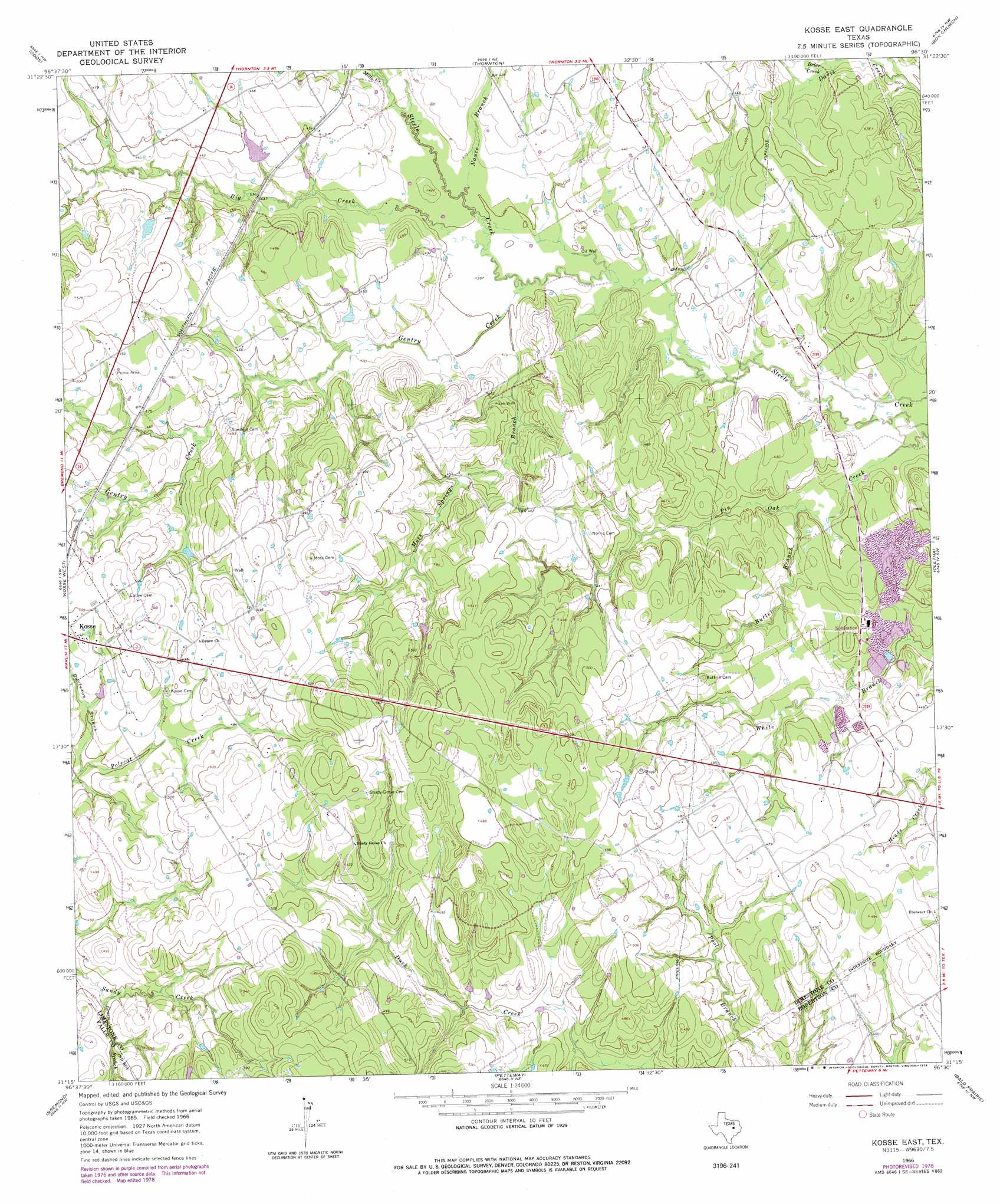
Kosse East Topo Map Texas
To zoom in, hover over the map of Kosse East
USGS Topo Quad 31096c5 - 1:24,000 scale
| Topo Map Name: | Kosse East |
| USGS Topo Quad ID: | 31096c5 |
| Print Size: | ca. 21 1/4" wide x 27" high |
| Southeast Coordinates: | 31.25° N latitude / 96.5° W longitude |
| Map Center Coordinates: | 31.3125° N latitude / 96.5625° W longitude |
| U.S. State: | TX |
| Filename: | o31096c5.jpg |
| Download Map JPG Image: | Kosse East topo map 1:24,000 scale |
| Map Type: | Topographic |
| Topo Series: | 7.5´ |
| Map Scale: | 1:24,000 |
| Source of Map Images: | United States Geological Survey (USGS) |
| Alternate Map Versions: |
Kosse East TX 1966, updated 1969 Download PDF Buy paper map Kosse East TX 1966, updated 1978 Download PDF Buy paper map Kosse East TX 2010 Download PDF Buy paper map Kosse East TX 2013 Download PDF Buy paper map Kosse East TX 2016 Download PDF Buy paper map |
1:24,000 Topo Quads surrounding Kosse East
Mart |
Ben Hur |
Groesbeck |
Fallon |
Teague South |
Otto |
Odds |
Thornton |
Box Church |
Farrar |
Mcclanahan |
Kosse West |
Kosse East |
Oletha |
Round Prairie |
Reagan |
Bremond |
Petteway |
Bald Prairie |
Marquez |
Baileyville |
Hammond |
Owensville |
Franklin |
Camp Creek Lake |
> Back to 31096a1 at 1:100,000 scale
> Back to 31096a1 at 1:250,000 scale
> Back to U.S. Topo Maps home
Kosse East topo map: Gazetteer
Kosse East: Dams
Knox Lake Dam elevation 133m 436′Kosse East: Reservoirs
Knox Lake elevation 133m 436′Kosse East: Streams
Big Creek elevation 120m 393′Brier Creek elevation 125m 410′
Burleson Branch elevation 134m 439′
Butler Branch elevation 119m 390′
Gentry Creek elevation 119m 390′
Green Branch elevation 133m 436′
Mills Creek elevation 126m 413′
Moss Springs Branch elevation 124m 406′
Nance Branch elevation 122m 400′
Kosse East digital topo map on disk
Buy this Kosse East topo map showing relief, roads, GPS coordinates and other geographical features, as a high-resolution digital map file on DVD: