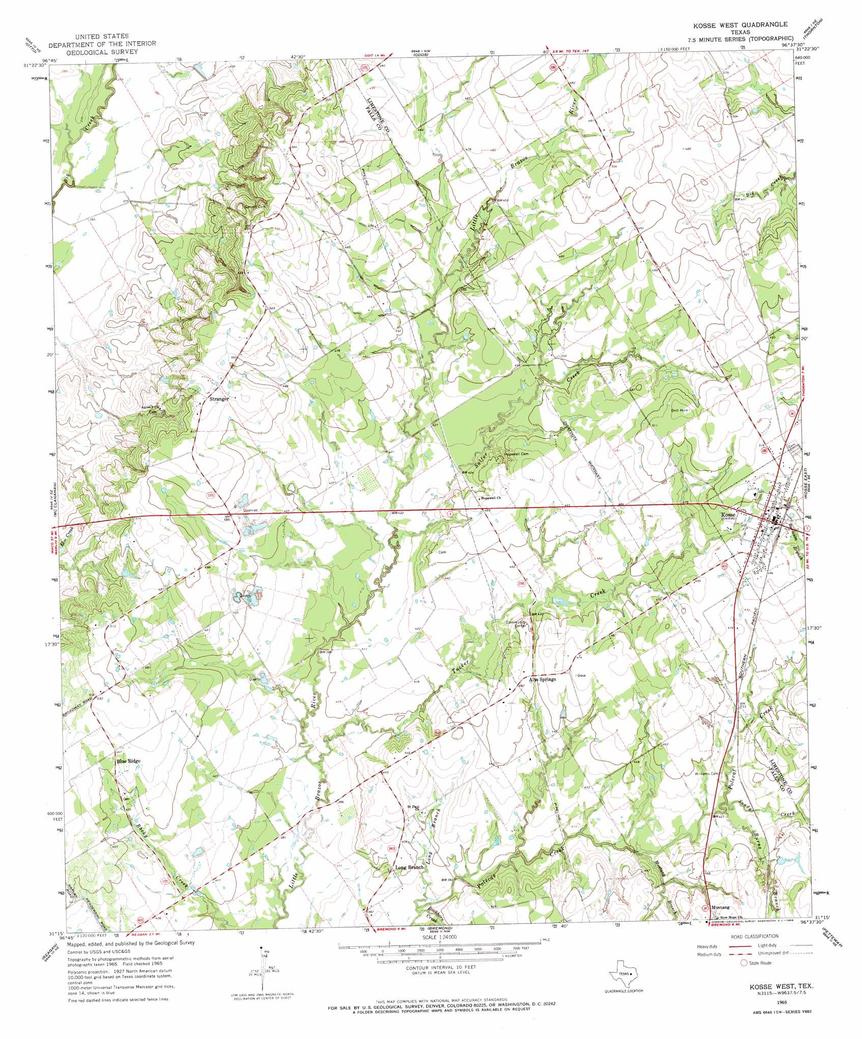
Kosse West Topo Map Texas
To zoom in, hover over the map of Kosse West
USGS Topo Quad 31096c6 - 1:24,000 scale
| Topo Map Name: | Kosse West |
| USGS Topo Quad ID: | 31096c6 |
| Print Size: | ca. 21 1/4" wide x 27" high |
| Southeast Coordinates: | 31.25° N latitude / 96.625° W longitude |
| Map Center Coordinates: | 31.3125° N latitude / 96.6875° W longitude |
| U.S. State: | TX |
| Filename: | o31096c6.jpg |
| Download Map JPG Image: | Kosse West topo map 1:24,000 scale |
| Map Type: | Topographic |
| Topo Series: | 7.5´ |
| Map Scale: | 1:24,000 |
| Source of Map Images: | United States Geological Survey (USGS) |
| Alternate Map Versions: |
Kosse West TX 1965, updated 1969 Download PDF Buy paper map Kosse West TX 2010 Download PDF Buy paper map Kosse West TX 2013 Download PDF Buy paper map Kosse West TX 2016 Download PDF Buy paper map |
1:24,000 Topo Quads surrounding Kosse West
Elk |
Mart |
Ben Hur |
Groesbeck |
Fallon |
Riesel |
Otto |
Odds |
Thornton |
Box Church |
Marlin |
Mcclanahan |
Kosse West |
Kosse East |
Oletha |
Cedar Springs |
Reagan |
Bremond |
Petteway |
Bald Prairie |
Rosebud |
Baileyville |
Hammond |
Owensville |
Franklin |
> Back to 31096a1 at 1:100,000 scale
> Back to 31096a1 at 1:250,000 scale
> Back to U.S. Topo Maps home
Kosse West topo map: Gazetteer
Kosse West: Populated Places
Alto Springs elevation 138m 452′Blue Ridge elevation 142m 465′
Kosse elevation 152m 498′
Long Branch elevation 122m 400′
Mustang elevation 142m 465′
Stranger elevation 161m 528′
Kosse West: Streams
Buckhorn Creek elevation 116m 380′Burns Branch elevation 128m 419′
Long Branch elevation 116m 380′
Mustang Branch elevation 122m 400′
Sandy Creek elevation 127m 416′
Sulfur Creek elevation 123m 403′
Tucker Creek elevation 116m 380′
Kosse West digital topo map on disk
Buy this Kosse West topo map showing relief, roads, GPS coordinates and other geographical features, as a high-resolution digital map file on DVD: