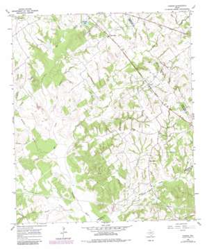
Farrar Topo Map Texas
To zoom in, hover over the map of Farrar
USGS Topo Quad 31096d3 - 1:24,000 scale
| Topo Map Name: | Farrar |
| USGS Topo Quad ID: | 31096d3 |
| Print Size: | ca. 21 1/4" wide x 27" high |
| Southeast Coordinates: | 31.375° N latitude / 96.25° W longitude |
| Map Center Coordinates: | 31.4375° N latitude / 96.3125° W longitude |
| U.S. State: | TX |
| Filename: | o31096d3.jpg |
| Download Map JPG Image: | Farrar topo map 1:24,000 scale |
| Map Type: | Topographic |
| Topo Series: | 7.5´ |
| Map Scale: | 1:24,000 |
| Source of Map Images: | United States Geological Survey (USGS) |
| Alternate Map Versions: |
Farrar TX 1966, updated 1970 Download PDF Buy paper map Farrar TX 1966, updated 1983 Download PDF Buy paper map Farrar TX 2011 Download PDF Buy paper map Farrar TX 2013 Download PDF Buy paper map Farrar TX 2016 Download PDF Buy paper map |
1:24,000 Topo Quads surrounding Farrar
> Back to 31096a1 at 1:100,000 scale
> Back to 31096a1 at 1:250,000 scale
> Back to U.S. Topo Maps home
Farrar topo map: Gazetteer
Farrar: Dams
Kennedy Dam elevation 115m 377′Sims Lake Dam elevation 111m 364′
Farrar: Populated Places
Fair Oaks elevation 132m 433′Farrar elevation 131m 429′
Lost Prairie elevation 137m 449′
New Hope elevation 133m 436′
Farrar: Reservoirs
Kennedy Lake elevation 118m 387′Sims Lake elevation 111m 364′
Farrar: Streams
Bear Branch elevation 119m 390′Big Creek elevation 107m 351′
Coots Branch elevation 110m 360′
Dooley Creek elevation 107m 351′
Dry Creek elevation 116m 380′
Ezell Branch elevation 110m 360′
Gibson Branch elevation 116m 380′
Lynn Creek elevation 113m 370′
Pear Branch elevation 107m 351′
Pinoak Creek elevation 119m 390′
Sand Branch elevation 107m 351′
Sanders Creek elevation 107m 351′
Sassafras Branch elevation 107m 351′
Farrar digital topo map on disk
Buy this Farrar topo map showing relief, roads, GPS coordinates and other geographical features, as a high-resolution digital map file on DVD:


