Ben Hur Topo Map Texas
To zoom in, hover over the map of Ben Hur
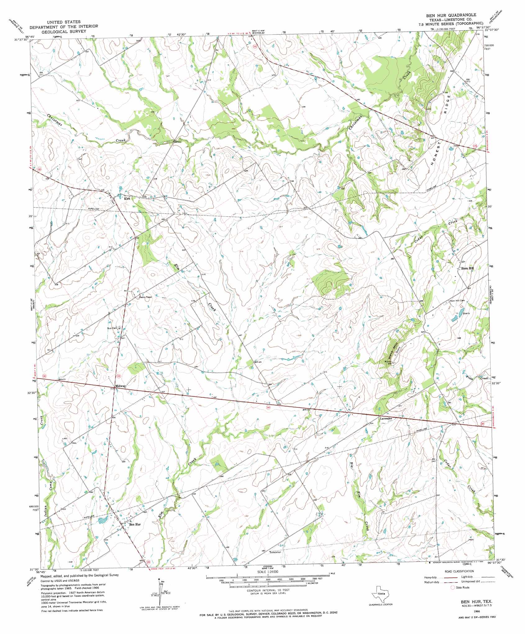
USGS Topo Quad 31096e6 - 1:24,000 scale
| Topo Map Name: | Ben Hur |
| USGS Topo Quad ID: | 31096e6 |
| Print Size: | ca. 21 1/4" wide x 27" high |
| Southeast Coordinates: | 31.5° N latitude / 96.625° W longitude |
| Map Center Coordinates: | 31.5625° N latitude / 96.6875° W longitude |
| U.S. State: | TX |
| Filename: | o31096e6.jpg |
| Download Map JPG Image: | Ben Hur topo map 1:24,000 scale |
| Map Type: | Topographic |
| Topo Series: | 7.5´ |
| Map Scale: | 1:24,000 |
| Source of Map Images: | United States Geological Survey (USGS) |
| Alternate Map Versions: |
Ben Hur TX 1966, updated 1969 Download PDF Buy paper map Ben Hur TX 2010 Download PDF Buy paper map Ben Hur TX 2013 Download PDF Buy paper map Ben Hur TX 2016 Download PDF Buy paper map |
1:24,000 Topo Quads surrounding Ben Hur
Penelope |
Hubbard |
Coolidge |
Union High |
Wortham |
Axtell |
Prairie Hill |
Echols |
Tehuacana |
Mexia |
Elk |
Mart |
Ben Hur |
Groesbeck |
Fallon |
Riesel |
Otto |
Odds |
Thornton |
Box Church |
Marlin |
Mcclanahan |
Kosse West |
Kosse East |
Oletha |
> Back to 31096e1 at 1:100,000 scale
> Back to 31096a1 at 1:250,000 scale
> Back to U.S. Topo Maps home
Ben Hur digital topo map on disk
Buy this Ben Hur topo map showing relief, roads, GPS coordinates and other geographical features, as a high-resolution digital map file on DVD: