Mexia Topo Map Texas
To zoom in, hover over the map of Mexia
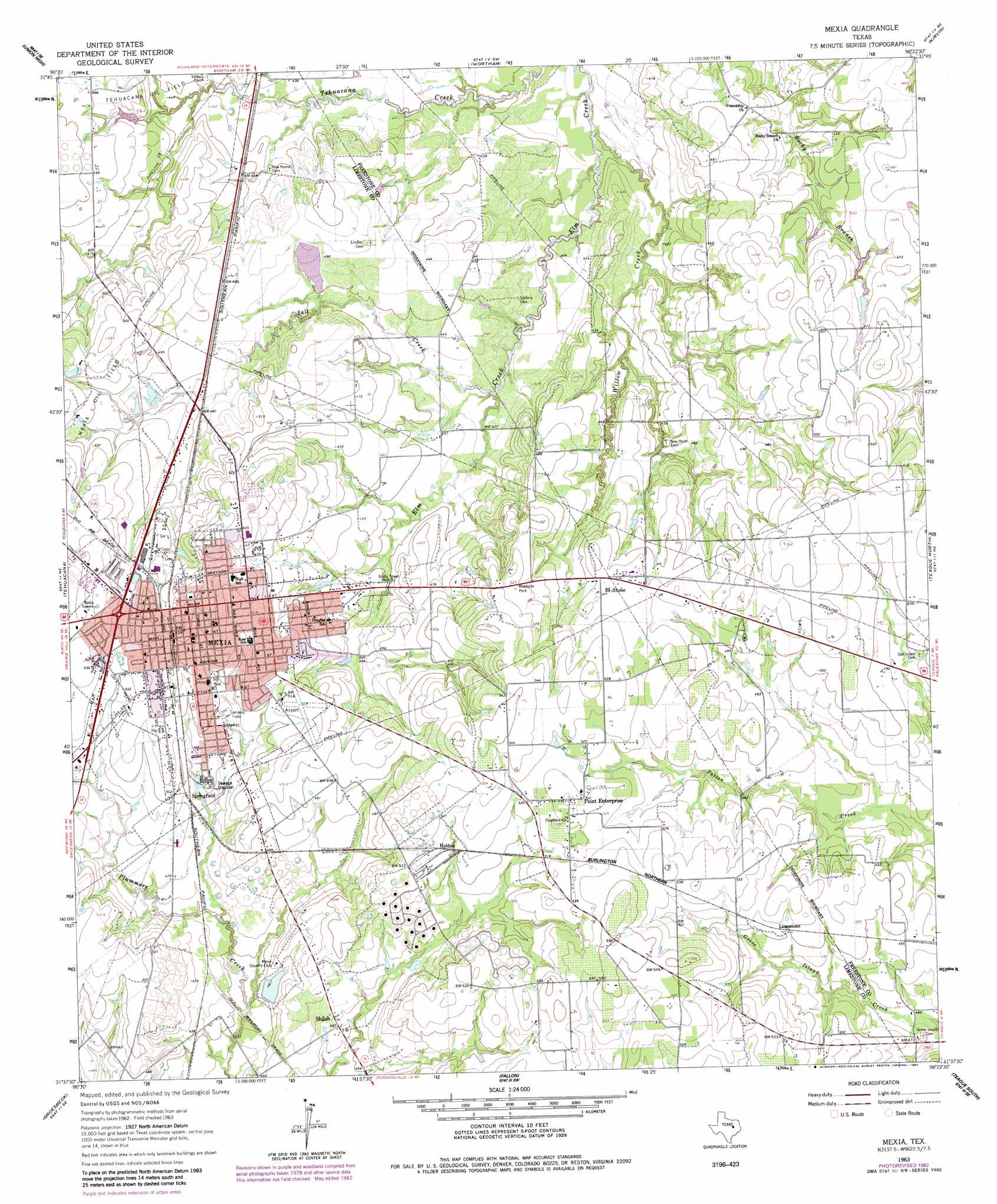
USGS Topo Quad 31096f4 - 1:24,000 scale
| Topo Map Name: | Mexia |
| USGS Topo Quad ID: | 31096f4 |
| Print Size: | ca. 21 1/4" wide x 27" high |
| Southeast Coordinates: | 31.625° N latitude / 96.375° W longitude |
| Map Center Coordinates: | 31.6875° N latitude / 96.4375° W longitude |
| U.S. State: | TX |
| Filename: | o31096f4.jpg |
| Download Map JPG Image: | Mexia topo map 1:24,000 scale |
| Map Type: | Topographic |
| Topo Series: | 7.5´ |
| Map Scale: | 1:24,000 |
| Source of Map Images: | United States Geological Survey (USGS) |
| Alternate Map Versions: |
Mexia TX 1963, updated 1966 Download PDF Buy paper map Mexia TX 1963, updated 1983 Download PDF Buy paper map Mexia TX 2010 Download PDF Buy paper map Mexia TX 2013 Download PDF Buy paper map Mexia TX 2016 Download PDF Buy paper map |
1:24,000 Topo Quads surrounding Mexia
Dawson |
Purdon |
Richland |
Streetman |
Winkler |
Coolidge |
Union High |
Wortham |
Kirvin |
Stewards Mill |
Echols |
Tehuacana |
Mexia |
Teague North |
Fairfield |
Ben Hur |
Groesbeck |
Fallon |
Teague South |
Dew |
Odds |
Thornton |
Box Church |
Farrar |
Donie |
> Back to 31096e1 at 1:100,000 scale
> Back to 31096a1 at 1:250,000 scale
> Back to U.S. Topo Maps home
Mexia topo map: Gazetteer
Mexia: Airports
Pt Enterprise D and W Ranch Airport elevation 156m 511′Mexia: Dams
Mexia Country Club Lake Dam elevation 138m 452′Mexia: Parks
Mexia City Park elevation 152m 498′Mexia: Populated Places
Bi-Stone elevation 157m 515′Holden elevation 156m 511′
Mexia elevation 159m 521′
Point Enterprise elevation 162m 531′
Springfield elevation 146m 479′
Mexia: Reservoirs
Mexia Country Club Lake elevation 138m 452′Mexia: Streams
Salt Creek elevation 125m 410′Willow Creek elevation 116m 380′
Mexia digital topo map on disk
Buy this Mexia topo map showing relief, roads, GPS coordinates and other geographical features, as a high-resolution digital map file on DVD: