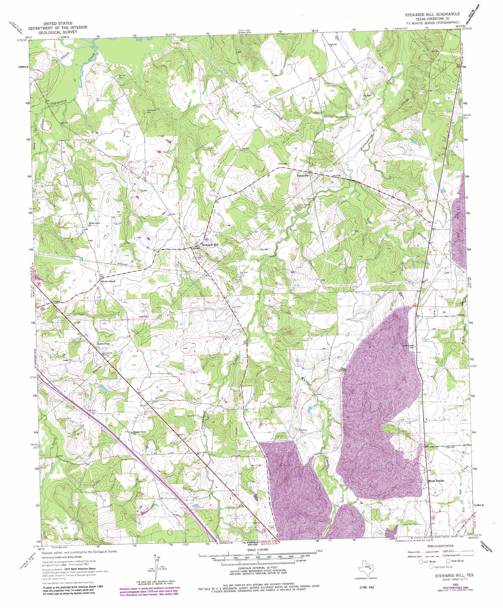
Stewards Mill Topo Map Texas
To zoom in, hover over the map of Stewards Mill
USGS Topo Quad 31096g2 - 1:24,000 scale
| Topo Map Name: | Stewards Mill |
| USGS Topo Quad ID: | 31096g2 |
| Print Size: | ca. 21 1/4" wide x 27" high |
| Southeast Coordinates: | 31.75° N latitude / 96.125° W longitude |
| Map Center Coordinates: | 31.8125° N latitude / 96.1875° W longitude |
| U.S. State: | TX |
| Filename: | o31096g2.jpg |
| Download Map JPG Image: | Stewards Mill topo map 1:24,000 scale |
| Map Type: | Topographic |
| Topo Series: | 7.5´ |
| Map Scale: | 1:24,000 |
| Source of Map Images: | United States Geological Survey (USGS) |
| Alternate Map Versions: |
Stewards Mill TX 1963, updated 1966 Download PDF Buy paper map Stewards Mill TX 1963, updated 1983 Download PDF Buy paper map Stewards Mill TX 2010 Download PDF Buy paper map Stewards Mill TX 2013 Download PDF Buy paper map Stewards Mill TX 2016 Download PDF Buy paper map |
1:24,000 Topo Quads surrounding Stewards Mill
Corsicana |
Powell |
Goodlow Park |
Creslenn Ranch |
Cross Roads |
Richland |
Streetman |
Winkler |
Roustabout Camp |
Cayuga |
Wortham |
Kirvin |
Stewards Mill |
Young |
Yard |
Mexia |
Teague North |
Fairfield |
Turlington |
Butler |
Fallon |
Teague South |
Dew |
Lanely |
Keechi |
> Back to 31096e1 at 1:100,000 scale
> Back to 31096a1 at 1:250,000 scale
> Back to U.S. Topo Maps home
Stewards Mill topo map: Gazetteer
Stewards Mill: Airports
Pyramid Ranch Airport elevation 108m 354′Stewards Mill: Populated Places
Bonnerville elevation 110m 360′Rhode Island elevation 119m 390′
Stewards Mill elevation 117m 383′
Ward Prairie elevation 137m 449′
Stewards Mill: Streams
Caney Creek elevation 88m 288′Cox Creek elevation 92m 301′
Grindstone Creek elevation 98m 321′
Joe Creek elevation 86m 282′
Walnut Creek elevation 97m 318′
Stewards Mill digital topo map on disk
Buy this Stewards Mill topo map showing relief, roads, GPS coordinates and other geographical features, as a high-resolution digital map file on DVD: