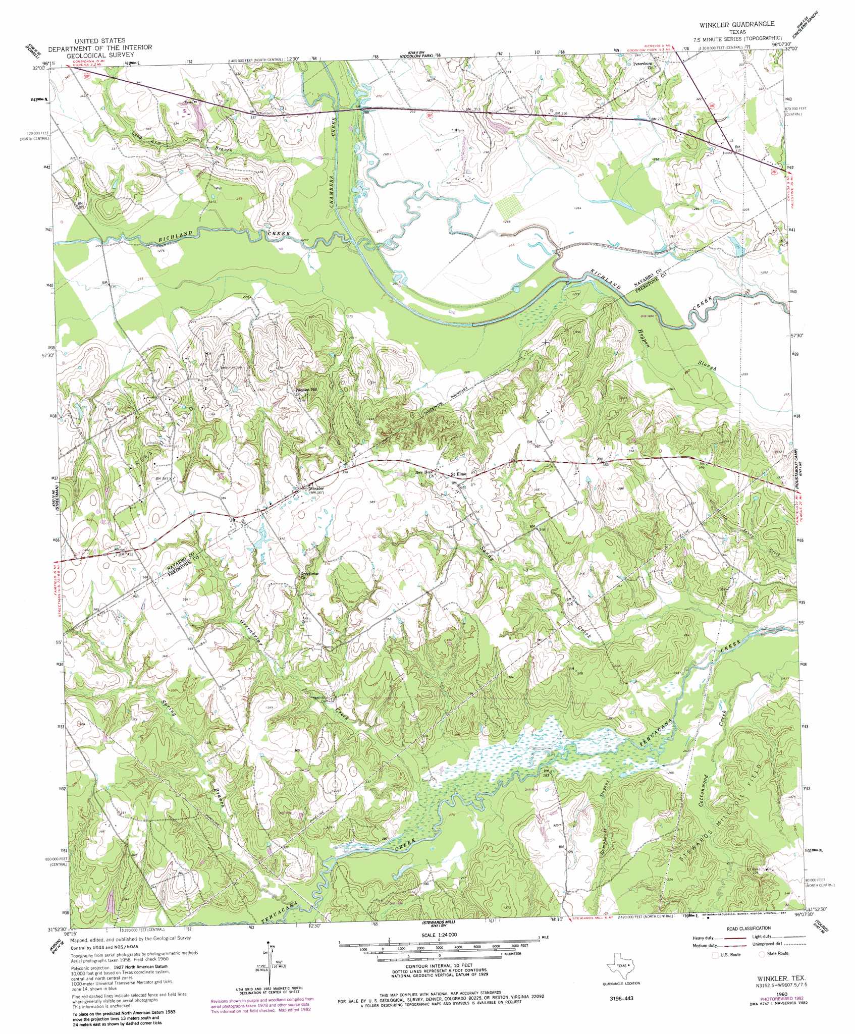
Winkler Topo Map Texas
To zoom in, hover over the map of Winkler
USGS Topo Quad 31096h2 - 1:24,000 scale
| Topo Map Name: | Winkler |
| USGS Topo Quad ID: | 31096h2 |
| Print Size: | ca. 21 1/4" wide x 27" high |
| Southeast Coordinates: | 31.875° N latitude / 96.125° W longitude |
| Map Center Coordinates: | 31.9375° N latitude / 96.1875° W longitude |
| U.S. State: | TX |
| Filename: | o31096h2.jpg |
| Download Map JPG Image: | Winkler topo map 1:24,000 scale |
| Map Type: | Topographic |
| Topo Series: | 7.5´ |
| Map Scale: | 1:24,000 |
| Source of Map Images: | United States Geological Survey (USGS) |
| Alternate Map Versions: |
Winkler TX 1960, updated 1961 Download PDF Buy paper map Winkler TX 1960, updated 1975 Download PDF Buy paper map Winkler TX 1960, updated 1983 Download PDF Buy paper map Winkler TX 1960, updated 1983 Download PDF Buy paper map Winkler TX 2010 Download PDF Buy paper map Winkler TX 2013 Download PDF Buy paper map Winkler TX 2016 Download PDF Buy paper map |
1:24,000 Topo Quads surrounding Winkler
Chatfield |
Bazette |
Kerens |
Malakoff |
Mallard Hill |
Corsicana |
Powell |
Goodlow Park |
Creslenn Ranch |
Cross Roads |
Richland |
Streetman |
Winkler |
Roustabout Camp |
Cayuga |
Wortham |
Kirvin |
Stewards Mill |
Young |
Yard |
Mexia |
Teague North |
Fairfield |
Turlington |
Butler |
> Back to 31096e1 at 1:100,000 scale
> Back to 31096a1 at 1:250,000 scale
> Back to U.S. Topo Maps home
Winkler topo map: Gazetteer
Winkler: Guts
Hogpen Slough elevation 79m 259′Winkler: Oilfields
Reka Oil Field elevation 107m 351′Stewards Mill Oil Field elevation 99m 324′
Winkler: Populated Places
Saint Elmo elevation 110m 360′Winkler elevation 117m 383′
Winkler: Streams
Camphouse Dugout elevation 80m 262′Chambers Creek elevation 82m 269′
Greenbriar Creek elevation 82m 269′
Long Arm Branch elevation 84m 275′
Sandy Creek elevation 79m 259′
Spring Branch elevation 85m 278′
Winkler digital topo map on disk
Buy this Winkler topo map showing relief, roads, GPS coordinates and other geographical features, as a high-resolution digital map file on DVD: