Westphalia Topo Map Texas
To zoom in, hover over the map of Westphalia
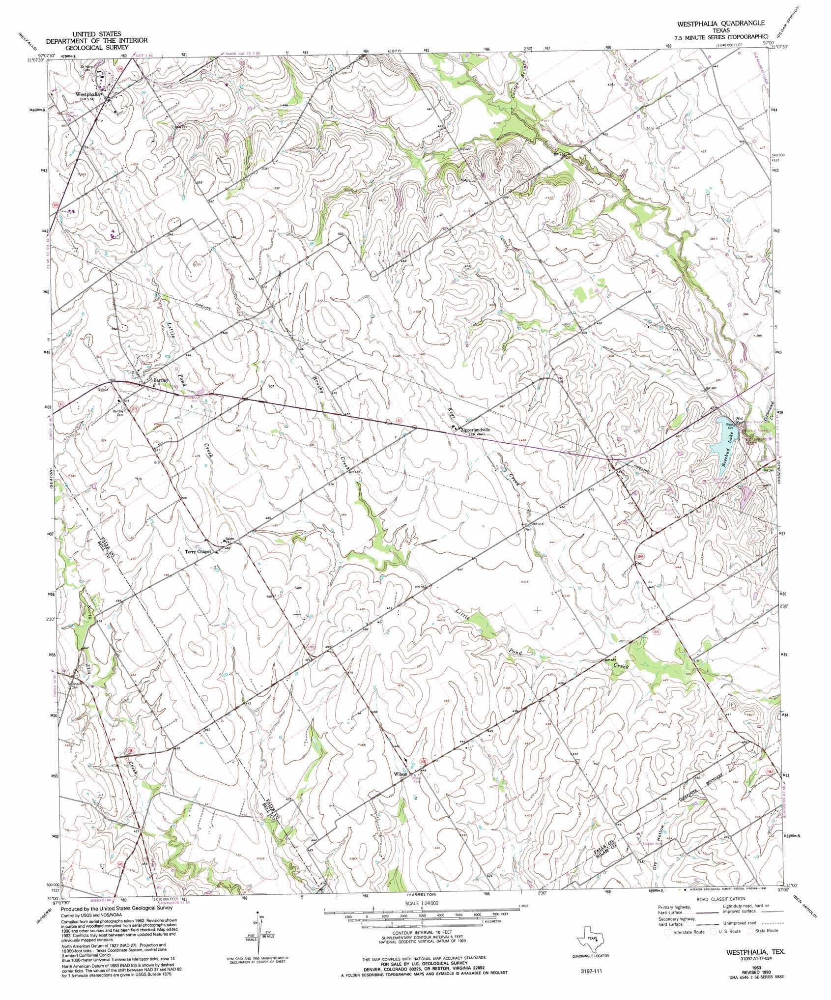
USGS Topo Quad 31097a1 - 1:24,000 scale
| Topo Map Name: | Westphalia |
| USGS Topo Quad ID: | 31097a1 |
| Print Size: | ca. 21 1/4" wide x 27" high |
| Southeast Coordinates: | 31° N latitude / 97° W longitude |
| Map Center Coordinates: | 31.0625° N latitude / 97.0625° W longitude |
| U.S. State: | TX |
| Filename: | o31097a1.jpg |
| Download Map JPG Image: | Westphalia topo map 1:24,000 scale |
| Map Type: | Topographic |
| Topo Series: | 7.5´ |
| Map Scale: | 1:24,000 |
| Source of Map Images: | United States Geological Survey (USGS) |
| Alternate Map Versions: |
Westphalia TX 1963, updated 1965 Download PDF Buy paper map Westphalia TX 1963, updated 1993 Download PDF Buy paper map Westphalia TX 2010 Download PDF Buy paper map Westphalia TX 2012 Download PDF Buy paper map Westphalia TX 2016 Download PDF Buy paper map |
1:24,000 Topo Quads surrounding Westphalia
Moody |
Bruceville |
Chilton |
Marlin |
Mcclanahan |
Troy |
Belfalls |
Lott |
Cedar Springs |
Reagan |
Temple |
Seaton |
Westphalia |
Rosebud |
Baileyville |
Little River |
Rogers |
Yarrelton |
Ben Arnold |
Maysfield |
Davilla |
Sharp |
Pettibone |
Cameron |
Hanover |
> Back to 31097a1 at 1:100,000 scale
> Back to 31096a1 at 1:250,000 scale
> Back to U.S. Topo Maps home
Westphalia topo map: Gazetteer
Westphalia: Dams
City of Rosebud Dam elevation 123m 403′Krause Lake Dam elevation 158m 518′
Smith Lake Dam elevation 120m 393′
Westphalia: Parks
McLennans Bluff Historical Marker elevation 129m 423′Westphalia: Populated Places
Barclay elevation 159m 521′Terry Chapel elevation 144m 472′
Westphalia elevation 175m 574′
Wilson elevation 135m 442′
Wilson elevation 136m 446′
Zipperlandville elevation 143m 469′
Westphalia: Reservoirs
Krause Lake elevation 158m 518′Rosebud Lake elevation 123m 403′
Smith Lake elevation 120m 393′
Westphalia: Streams
Brushy Creek elevation 134m 439′Cactus Branch elevation 122m 400′
Keys Creek elevation 127m 416′
Westphalia digital topo map on disk
Buy this Westphalia topo map showing relief, roads, GPS coordinates and other geographical features, as a high-resolution digital map file on DVD: