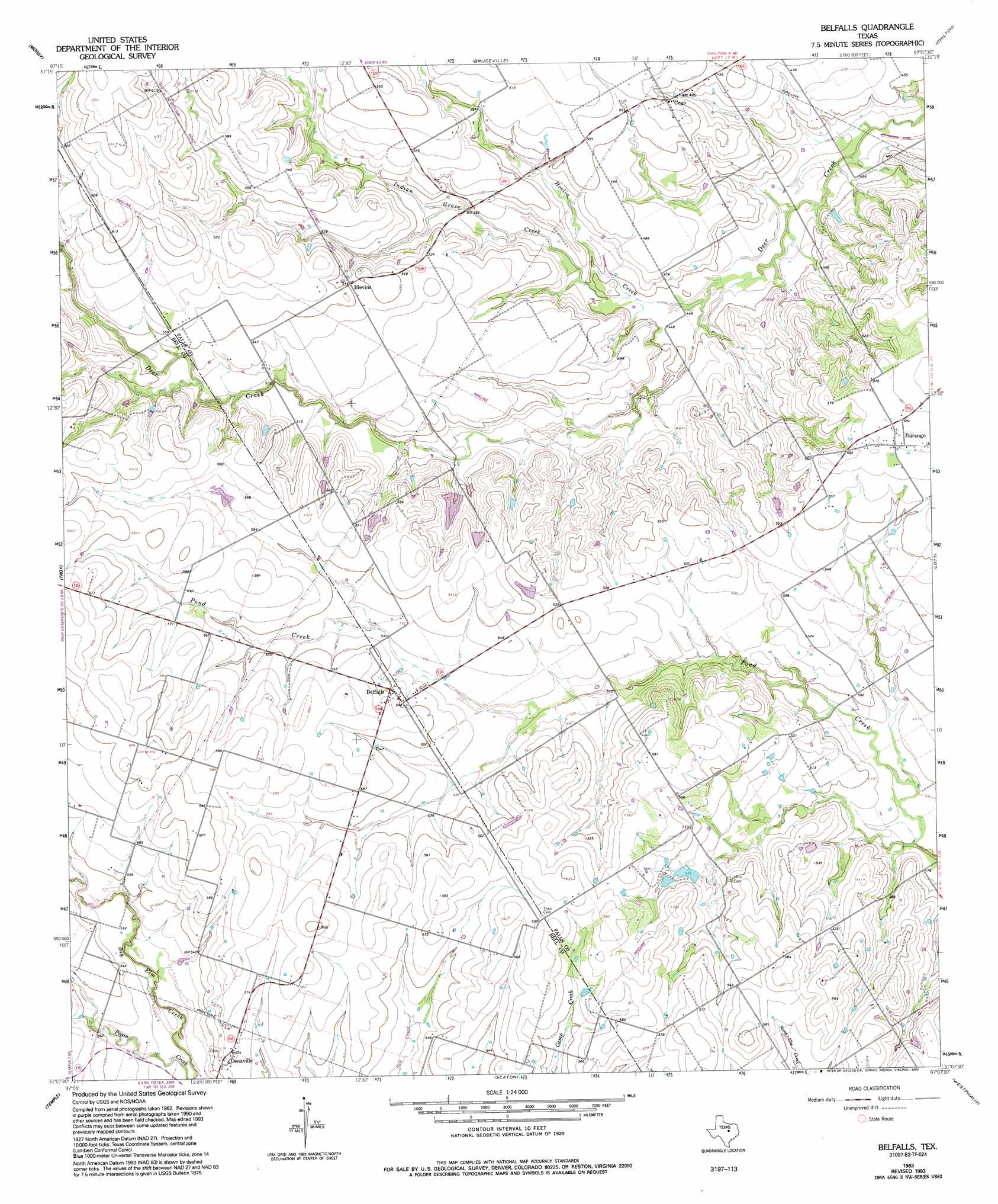
Belfalls Topo Map Texas
To zoom in, hover over the map of Belfalls
USGS Topo Quad 31097b2 - 1:24,000 scale
| Topo Map Name: | Belfalls |
| USGS Topo Quad ID: | 31097b2 |
| Print Size: | ca. 21 1/4" wide x 27" high |
| Southeast Coordinates: | 31.125° N latitude / 97.125° W longitude |
| Map Center Coordinates: | 31.1875° N latitude / 97.1875° W longitude |
| U.S. State: | TX |
| Filename: | o31097b2.jpg |
| Download Map JPG Image: | Belfalls topo map 1:24,000 scale |
| Map Type: | Topographic |
| Topo Series: | 7.5´ |
| Map Scale: | 1:24,000 |
| Source of Map Images: | United States Geological Survey (USGS) |
| Alternate Map Versions: |
Belfalls TX 1963, updated 1993 Download PDF Buy paper map Belfalls TX 2010 Download PDF Buy paper map Belfalls TX 2012 Download PDF Buy paper map Belfalls TX 2016 Download PDF Buy paper map |
1:24,000 Topo Quads surrounding Belfalls
Mcgregor |
South Bosque |
Lorena |
Robinson |
Riesel |
Eagle Springs |
Moody |
Bruceville |
Chilton |
Marlin |
Moffat |
Troy |
Belfalls |
Lott |
Cedar Springs |
Belton |
Temple |
Seaton |
Westphalia |
Rosebud |
Holland |
Little River |
Rogers |
Yarrelton |
Ben Arnold |
> Back to 31097a1 at 1:100,000 scale
> Back to 31096a1 at 1:250,000 scale
> Back to U.S. Topo Maps home
Belfalls topo map: Gazetteer
Belfalls: Dams
Steakley Lake Dam elevation 157m 515′Zaleski Lake Dam elevation 171m 561′
Belfalls: Populated Places
Belfalls elevation 167m 547′Blevins elevation 167m 547′
Cego elevation 154m 505′
Durango elevation 178m 583′
Oenaville elevation 174m 570′
Belfalls: Reservoirs
Steakley Dam elevation 157m 515′Zaleski Lake elevation 171m 561′
Belfalls: Streams
Hoolia Creek elevation 134m 439′Indian Grave Creek elevation 135m 442′
Belfalls digital topo map on disk
Buy this Belfalls topo map showing relief, roads, GPS coordinates and other geographical features, as a high-resolution digital map file on DVD: