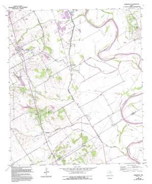
Robinson Topo Map Texas
To zoom in, hover over the map of Robinson
USGS Topo Quad 31097d1 - 1:24,000 scale
| Topo Map Name: | Robinson |
| USGS Topo Quad ID: | 31097d1 |
| Print Size: | ca. 21 1/4" wide x 27" high |
| Southeast Coordinates: | 31.375° N latitude / 97° W longitude |
| Map Center Coordinates: | 31.4375° N latitude / 97.0625° W longitude |
| U.S. State: | TX |
| Filename: | o31097d1.jpg |
| Download Map JPG Image: | Robinson topo map 1:24,000 scale |
| Map Type: | Topographic |
| Topo Series: | 7.5´ |
| Map Scale: | 1:24,000 |
| Source of Map Images: | United States Geological Survey (USGS) |
| Alternate Map Versions: |
Robinson TX 1957, updated 1958 Download PDF Buy paper map Robinson TX 1957, updated 1971 Download PDF Buy paper map Robinson TX 1957, updated 1977 Download PDF Buy paper map Robinson TX 1957, updated 1993 Download PDF Buy paper map Robinson TX 2010 Download PDF Buy paper map Robinson TX 2012 Download PDF Buy paper map Robinson TX 2016 Download PDF Buy paper map |
1:24,000 Topo Quads surrounding Robinson
> Back to 31097a1 at 1:100,000 scale
> Back to 31096a1 at 1:250,000 scale
> Back to U.S. Topo Maps home
Robinson topo map: Gazetteer
Robinson: Dams
Soil Conservation Service Site 3 Dam elevation 134m 439′Soil Conservation Service Site 4 Dam elevation 139m 456′
Soil Conservation Service Site 6 Dam elevation 132m 433′
Soil Conservation Service Site 7 Dam elevation 129m 423′
Robinson: Populated Places
Asa elevation 119m 390′Downs elevation 121m 396′
Downsville elevation 120m 393′
Golinda elevation 147m 482′
Levi elevation 143m 469′
Robinson elevation 151m 495′
Rosenthal elevation 151m 495′
Robinson: Reservoirs
Soil Conservation Service Site 3 Reservoir elevation 134m 439′Soil Conservation Service Site 4 Reservoir elevation 139m 456′
Soil Conservation Service Site 6 Reservoir elevation 132m 433′
Soil Conservation Service Site 7 Reservoir elevation 129m 423′
Robinson: Streams
Bull Hide Creek elevation 104m 341′Castleman Creek elevation 106m 347′
Crow Creek elevation 128m 419′
Dry Creek elevation 110m 360′
Flat Creek elevation 110m 360′
Old Castleman Creek elevation 106m 347′
Shaw Creek elevation 106m 347′
Robinson digital topo map on disk
Buy this Robinson topo map showing relief, roads, GPS coordinates and other geographical features, as a high-resolution digital map file on DVD:


