Ater Topo Map Texas
To zoom in, hover over the map of Ater
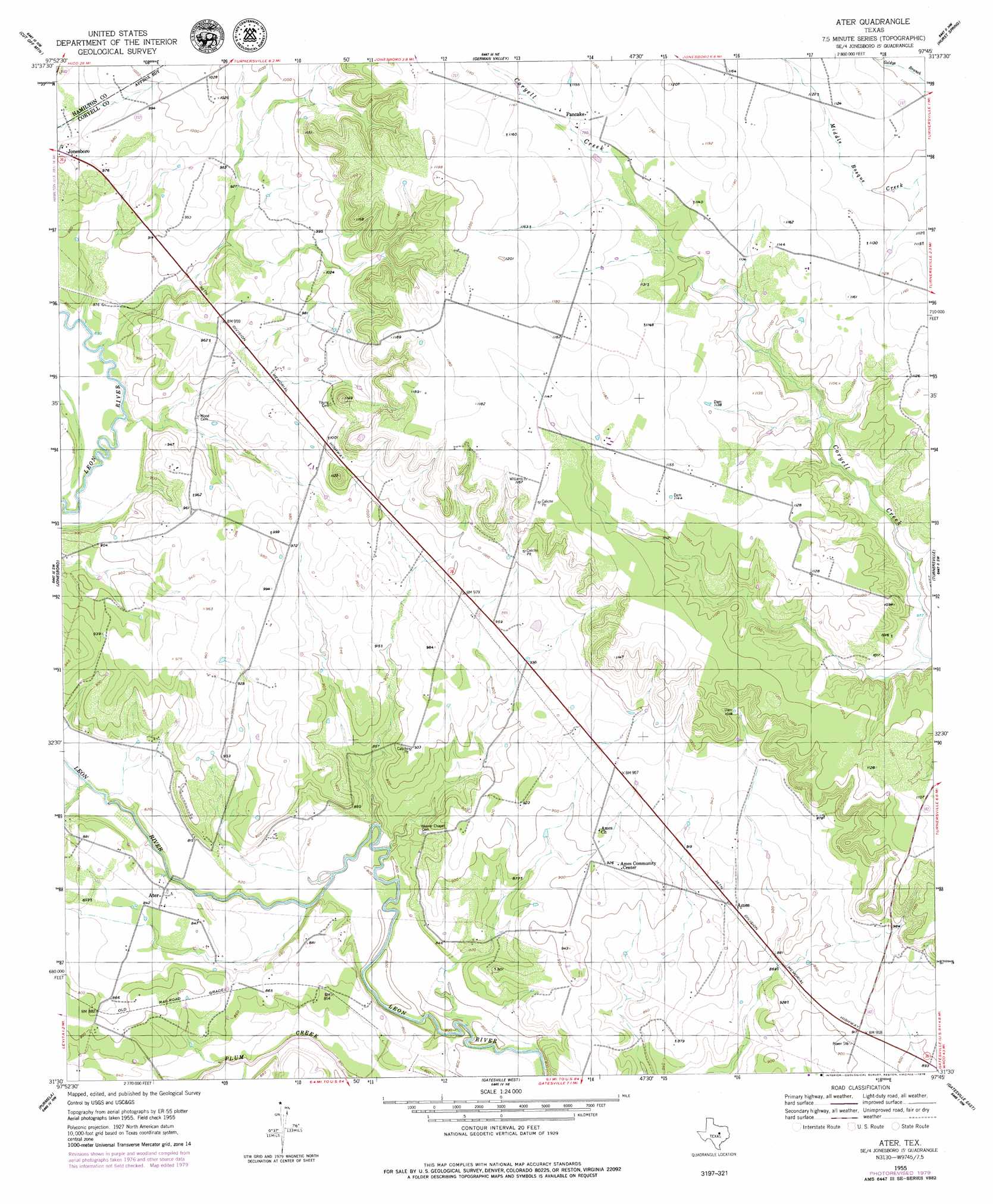
USGS Topo Quad 31097e7 - 1:24,000 scale
| Topo Map Name: | Ater |
| USGS Topo Quad ID: | 31097e7 |
| Print Size: | ca. 21 1/4" wide x 27" high |
| Southeast Coordinates: | 31.5° N latitude / 97.75° W longitude |
| Map Center Coordinates: | 31.5625° N latitude / 97.8125° W longitude |
| U.S. State: | TX |
| Filename: | o31097e7.jpg |
| Download Map JPG Image: | Ater topo map 1:24,000 scale |
| Map Type: | Topographic |
| Topo Series: | 7.5´ |
| Map Scale: | 1:24,000 |
| Source of Map Images: | United States Geological Survey (USGS) |
| Alternate Map Versions: |
Ater TX 1955, updated 1956 Download PDF Buy paper map Ater TX 1955, updated 1979 Download PDF Buy paper map Ater TX 2010 Download PDF Buy paper map Ater TX 2013 Download PDF Buy paper map Ater TX 2016 Download PDF Buy paper map |
1:24,000 Topo Quads surrounding Ater
Eidson Lake |
Fairy |
Cranfills Gap |
Sugarloaf Mountain |
Clifton |
Hamilton East |
Cutoff Mountain |
German Valley |
Hurst Spring |
Mosheim |
Ohio |
Jonesboro |
Ater |
Turnersville |
Coryell |
Pearl |
Purmela |
Gatesville West |
Gatesville East |
Oglesby |
Izoro |
Pidcoke |
Shell Mountains |
North Fort Hood |
Leon Junction |
> Back to 31097e1 at 1:100,000 scale
> Back to 31096a1 at 1:250,000 scale
> Back to U.S. Topo Maps home
Ater topo map: Gazetteer
Ater: Dams
M D M Grazing Association Dam elevation 299m 980′Ater: Populated Places
Ames elevation 281m 921′Ater elevation 257m 843′
Pancake elevation 350m 1148′
Ater: Reservoirs
Mom Grazing Association Lake elevation 299m 980′Ater: Streams
Kelly Branch elevation 252m 826′Ater digital topo map on disk
Buy this Ater topo map showing relief, roads, GPS coordinates and other geographical features, as a high-resolution digital map file on DVD: