Gholson Topo Map Texas
To zoom in, hover over the map of Gholson
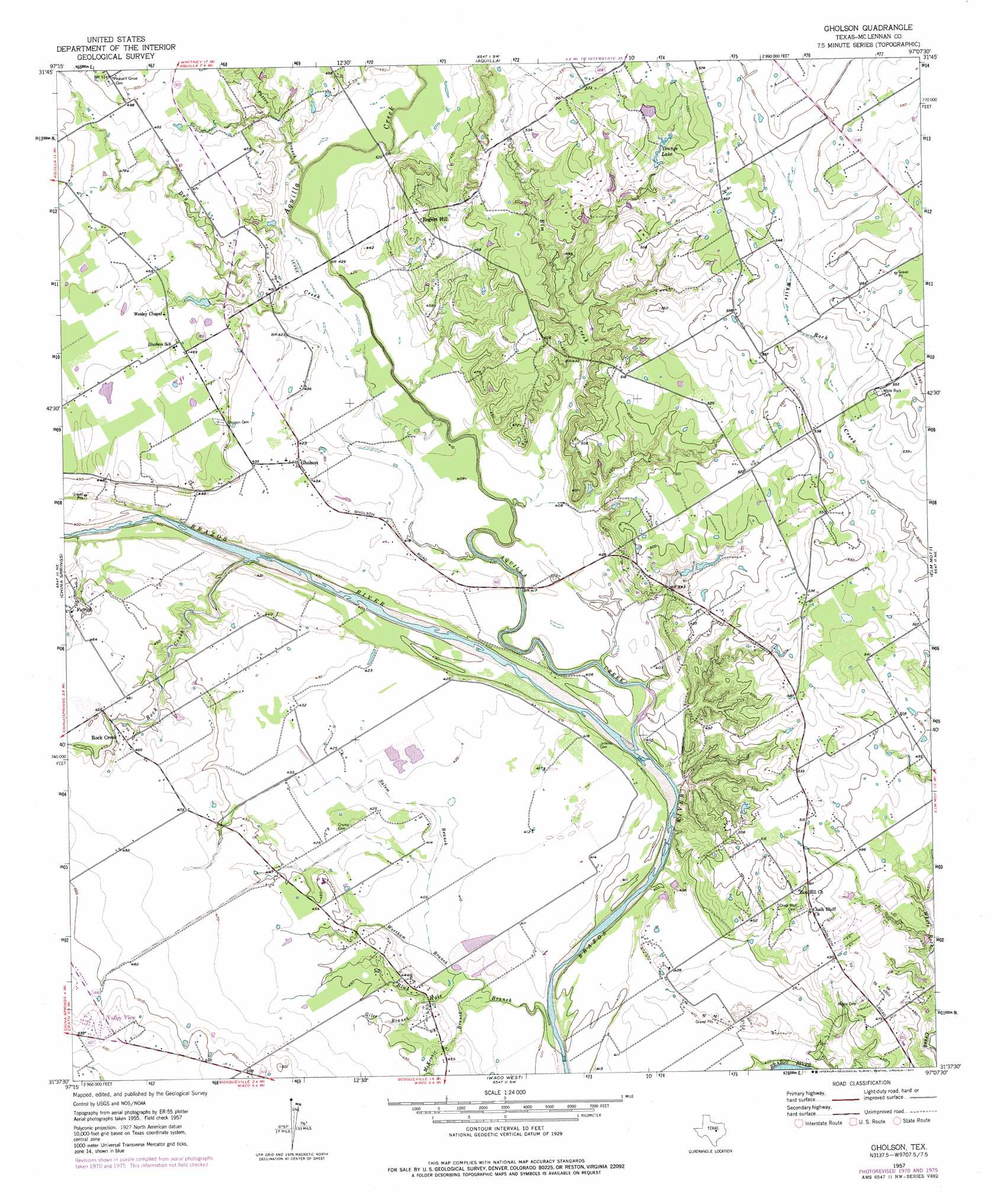
USGS Topo Quad 31097f2 - 1:24,000 scale
| Topo Map Name: | Gholson |
| USGS Topo Quad ID: | 31097f2 |
| Print Size: | ca. 21 1/4" wide x 27" high |
| Southeast Coordinates: | 31.625° N latitude / 97.125° W longitude |
| Map Center Coordinates: | 31.6875° N latitude / 97.1875° W longitude |
| U.S. State: | TX |
| Filename: | o31097f2.jpg |
| Download Map JPG Image: | Gholson topo map 1:24,000 scale |
| Map Type: | Topographic |
| Topo Series: | 7.5´ |
| Map Scale: | 1:24,000 |
| Source of Map Images: | United States Geological Survey (USGS) |
| Alternate Map Versions: |
Gholson TX 1957, updated 1958 Download PDF Buy paper map Gholson TX 1957, updated 1971 Download PDF Buy paper map Gholson TX 1957, updated 1977 Download PDF Buy paper map Gholson TX 2010 Download PDF Buy paper map Gholson TX 2012 Download PDF Buy paper map Gholson TX 2016 Download PDF Buy paper map |
1:24,000 Topo Quads surrounding Gholson
Allen Bend |
Whitney |
Peoria |
Abbott |
Malone |
Laguna Park |
Smiths Bend |
Aquilla |
West |
Penelope |
Valley Mills |
China Springs |
Gholson |
Elm Mott |
Axtell |
Crawford |
Speegleville |
Waco West |
Waco East |
Elk |
Mcgregor |
South Bosque |
Lorena |
Robinson |
Riesel |
> Back to 31097e1 at 1:100,000 scale
> Back to 31096a1 at 1:250,000 scale
> Back to U.S. Topo Maps home
Gholson topo map: Gazetteer
Gholson: Airports
Circle H Airport elevation 167m 547′Hess Airport elevation 165m 541′
Tigerbird Field elevation 139m 456′
Womack Farm Airport elevation 150m 492′
Gholson: Populated Places
Gholson elevation 131m 429′Patrick elevation 137m 449′
Rock Creek elevation 140m 459′
Rogers Hill elevation 158m 518′
Valley View elevation 162m 531′
Gholson: Reservoirs
Youngs Lake elevation 156m 511′Gholson: Streams
Aquilla Creek elevation 116m 380′Blue Hole Branch elevation 115m 377′
Dry Creek elevation 123m 403′
Elm Creek elevation 119m 390′
Giles Branch elevation 128m 419′
McKenzie Branch elevation 124m 406′
Patten Branch elevation 127m 416′
Rock Creek elevation 120m 393′
Salem Branch elevation 124m 406′
Wortham Branch elevation 124m 406′
Gholson digital topo map on disk
Buy this Gholson topo map showing relief, roads, GPS coordinates and other geographical features, as a high-resolution digital map file on DVD: