Mosheim Topo Map Texas
To zoom in, hover over the map of Mosheim
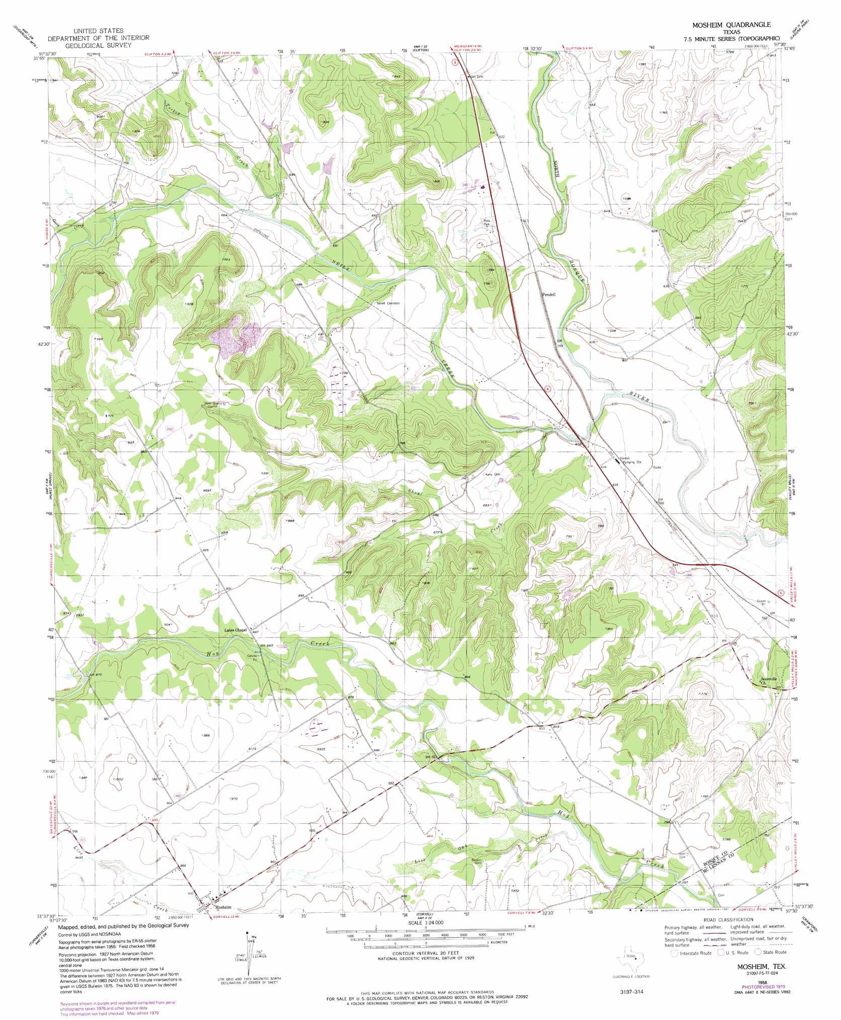
USGS Topo Quad 31097f5 - 1:24,000 scale
| Topo Map Name: | Mosheim |
| USGS Topo Quad ID: | 31097f5 |
| Print Size: | ca. 21 1/4" wide x 27" high |
| Southeast Coordinates: | 31.625° N latitude / 97.5° W longitude |
| Map Center Coordinates: | 31.6875° N latitude / 97.5625° W longitude |
| U.S. State: | TX |
| Filename: | o31097f5.jpg |
| Download Map JPG Image: | Mosheim topo map 1:24,000 scale |
| Map Type: | Topographic |
| Topo Series: | 7.5´ |
| Map Scale: | 1:24,000 |
| Source of Map Images: | United States Geological Survey (USGS) |
| Alternate Map Versions: |
Mosheim TX 1956, updated 1957 Download PDF Buy paper map Mosheim TX 1956, updated 1991 Download PDF Buy paper map Mosheim TX 2010 Download PDF Buy paper map Mosheim TX 2012 Download PDF Buy paper map Mosheim TX 2016 Download PDF Buy paper map |
1:24,000 Topo Quads surrounding Mosheim
Iredell |
Meridian |
Pilot Knob |
Allen Bend |
Whitney |
Cranfills Gap |
Sugarloaf Mountain |
Clifton |
Laguna Park |
Smiths Bend |
German Valley |
Hurst Spring |
Mosheim |
Valley Mills |
China Springs |
Ater |
Turnersville |
Coryell |
Crawford |
Speegleville |
Gatesville West |
Gatesville East |
Oglesby |
Mcgregor |
South Bosque |
> Back to 31097e1 at 1:100,000 scale
> Back to 31096a1 at 1:250,000 scale
> Back to U.S. Topo Maps home
Mosheim topo map: Gazetteer
Mosheim: Dams
Soil Conservation Service Site 2 Dam elevation 246m 807′Mosheim: Populated Places
Mosheim elevation 281m 921′Pendell elevation 183m 600′
Mosheim: Reservoirs
Soil Conservation Service Site 2 Reservoir elevation 246m 807′Mosheim: Streams
Gary Creek elevation 207m 679′Live Oak Creek elevation 233m 764′
Neils Creek elevation 172m 564′
Shoal Creek elevation 176m 577′
Turkey Creek elevation 195m 639′
Mosheim digital topo map on disk
Buy this Mosheim topo map showing relief, roads, GPS coordinates and other geographical features, as a high-resolution digital map file on DVD: