Cutoff Mountain Topo Map Texas
To zoom in, hover over the map of Cutoff Mountain
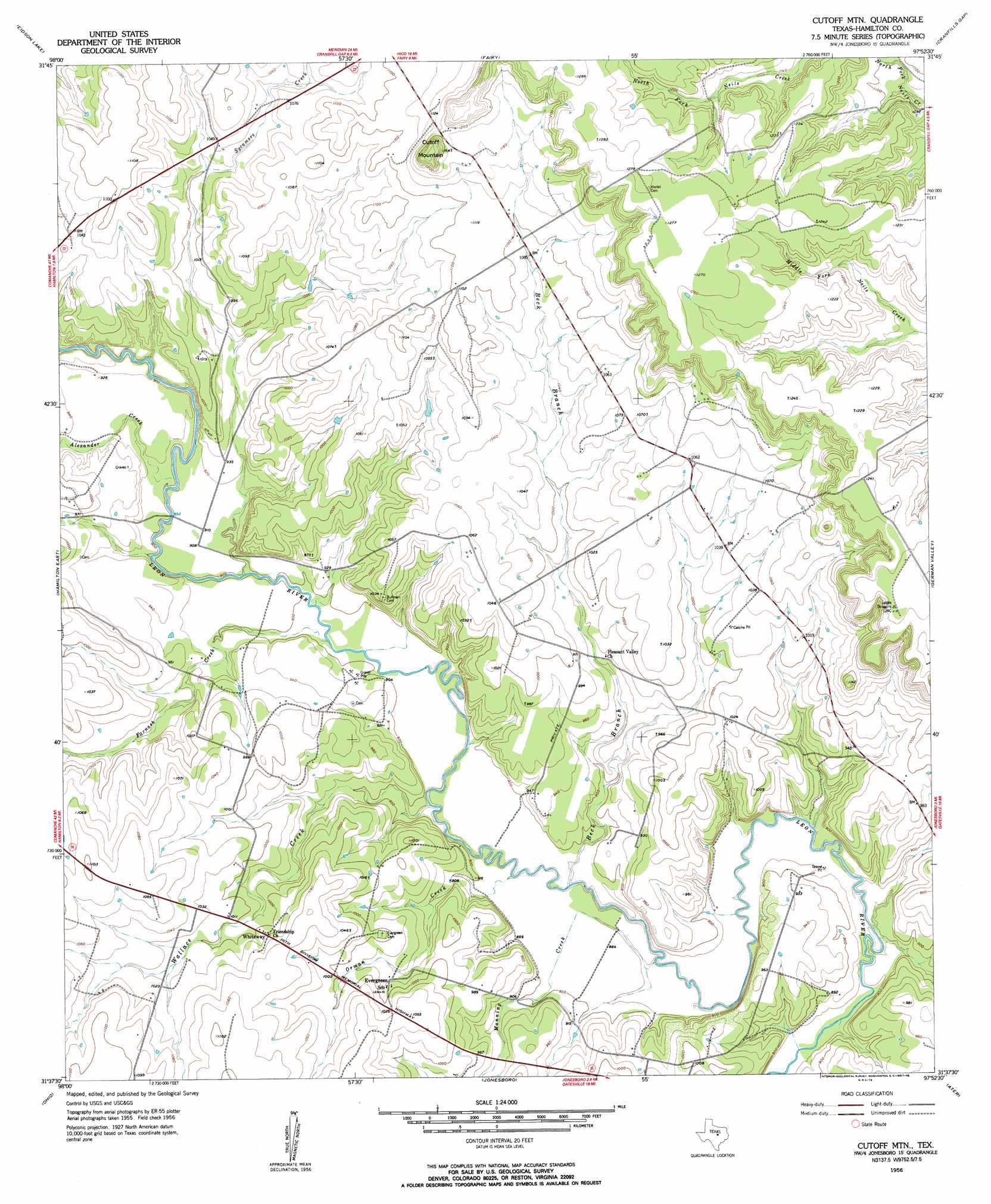
USGS Topo Quad 31097f8 - 1:24,000 scale
| Topo Map Name: | Cutoff Mountain |
| USGS Topo Quad ID: | 31097f8 |
| Print Size: | ca. 21 1/4" wide x 27" high |
| Southeast Coordinates: | 31.625° N latitude / 97.875° W longitude |
| Map Center Coordinates: | 31.6875° N latitude / 97.9375° W longitude |
| U.S. State: | TX |
| Filename: | o31097f8.jpg |
| Download Map JPG Image: | Cutoff Mountain topo map 1:24,000 scale |
| Map Type: | Topographic |
| Topo Series: | 7.5´ |
| Map Scale: | 1:24,000 |
| Source of Map Images: | United States Geological Survey (USGS) |
| Alternate Map Versions: |
Cutoff Mtn TX 1956, updated 1957 Download PDF Buy paper map Cutoff Mtn TX 1956, updated 1957 Download PDF Buy paper map Cutoff Mountain TX 2010 Download PDF Buy paper map Cutoff Mountain TX 2012 Download PDF Buy paper map Cutoff Mountain TX 2016 Download PDF Buy paper map |
1:24,000 Topo Quads surrounding Cutoff Mountain
Carlton |
Hico |
Spring Creek Gap |
Iredell |
Meridian |
Gentrys Mill |
Eidson Lake |
Fairy |
Cranfills Gap |
Sugarloaf Mountain |
Hamilton West |
Hamilton East |
Cutoff Mountain |
German Valley |
Hurst Spring |
Shive |
Ohio |
Jonesboro |
Ater |
Turnersville |
Evant |
Pearl |
Purmela |
Gatesville West |
Gatesville East |
> Back to 31097e1 at 1:100,000 scale
> Back to 31096a1 at 1:250,000 scale
> Back to U.S. Topo Maps home
Cutoff Mountain topo map: Gazetteer
Cutoff Mountain: Populated Places
Whiteway elevation 309m 1013′Cutoff Mountain: Streams
Alexander Creek elevation 272m 892′Beck Branch elevation 264m 866′
Farnash Creek elevation 269m 882′
Manning Creek elevation 262m 859′
Orman Creek elevation 268m 879′
Sycamore Creek elevation 271m 889′
Wallace Creek elevation 268m 879′
Cutoff Mountain: Summits
Cutoff Mountain elevation 391m 1282′Cutoff Mountain digital topo map on disk
Buy this Cutoff Mountain topo map showing relief, roads, GPS coordinates and other geographical features, as a high-resolution digital map file on DVD: