West Topo Map Texas
To zoom in, hover over the map of West
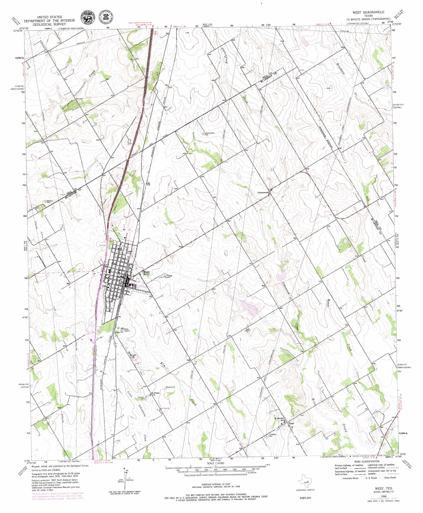
USGS Topo Quad 31097g1 - 1:24,000 scale
| Topo Map Name: | West |
| USGS Topo Quad ID: | 31097g1 |
| Print Size: | ca. 21 1/4" wide x 27" high |
| Southeast Coordinates: | 31.75° N latitude / 97° W longitude |
| Map Center Coordinates: | 31.8125° N latitude / 97.0625° W longitude |
| U.S. State: | TX |
| Filename: | o31097g1.jpg |
| Download Map JPG Image: | West topo map 1:24,000 scale |
| Map Type: | Topographic |
| Topo Series: | 7.5´ |
| Map Scale: | 1:24,000 |
| Source of Map Images: | United States Geological Survey (USGS) |
| Alternate Map Versions: |
West TX 1956, updated 1957 Download PDF Buy paper map West TX 1956, updated 1971 Download PDF Buy paper map West TX 2010 Download PDF Buy paper map West TX 2012 Download PDF Buy paper map West TX 2016 Download PDF Buy paper map |
1:24,000 Topo Quads surrounding West
Blanton |
Hillsboro West |
Hillsboro East |
Mertens |
Frost |
Whitney |
Peoria |
Abbott |
Malone |
Irene |
Smiths Bend |
Aquilla |
West |
Penelope |
Hubbard |
China Springs |
Gholson |
Elm Mott |
Axtell |
Prairie Hill |
Speegleville |
Waco West |
Waco East |
Elk |
Mart |
> Back to 31097e1 at 1:100,000 scale
> Back to 31096a1 at 1:250,000 scale
> Back to U.S. Topo Maps home
West topo map: Gazetteer
West: Airports
West Airpark elevation 168m 551′West: Dams
Galbraith Lake Dam elevation 178m 583′Soil Conservation Service Grade Stabilization Structure 103 elevation 154m 505′
Soil Conservation Service Site 10 Dam elevation 159m 521′
Soil Conservation Service Site 9 Dam elevation 156m 511′
West: Populated Places
Cottonwood elevation 168m 551′Tours elevation 170m 557′
West elevation 198m 649′
West: Reservoirs
Galbraith Lake elevation 178m 583′Grade Stabilization Structure 103 Reservoir elevation 154m 505′
Soil Conservation Service Site 10 Reservoir elevation 159m 521′
Soil Conservation Service Site 9 Reservoir elevation 156m 511′
West: Streams
Cottonwood Creek elevation 150m 492′West digital topo map on disk
Buy this West topo map showing relief, roads, GPS coordinates and other geographical features, as a high-resolution digital map file on DVD: